
MyTopo
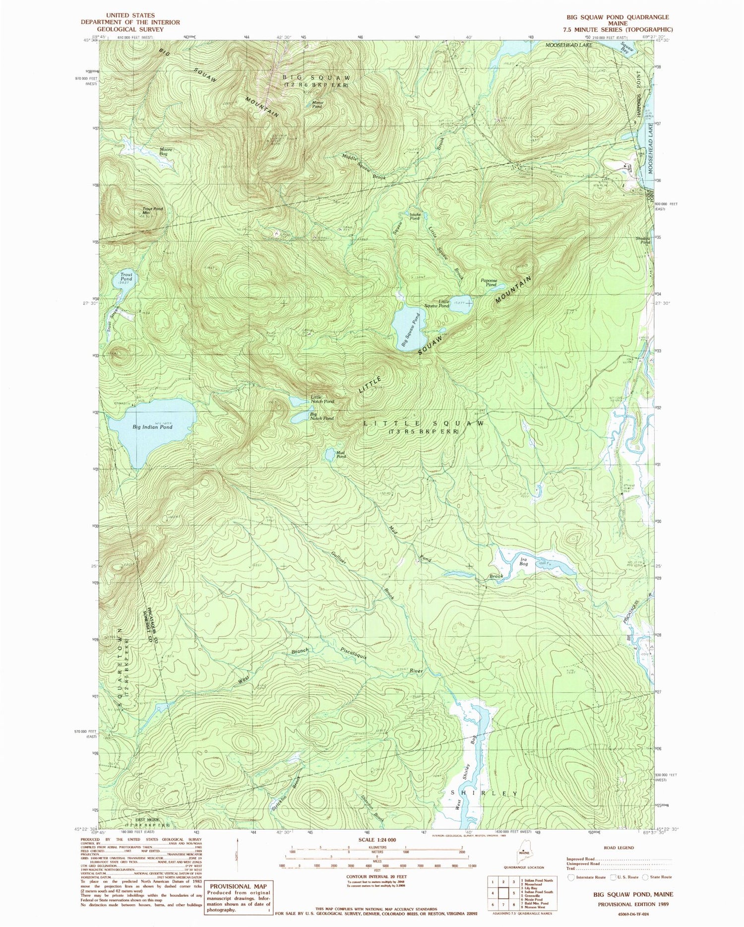
Classic USGS Big Moose Pond Maine 7.5'x7.5' Topo Map
Couldn't load pickup availability
Historical USGS topographic quad map of Big Moose Pond in the state of Maine. Typical map scale is 1:24,000, but may vary for certain years, if available. Print size: 24" x 27"
This quadrangle is in the following counties: Piscataquis, Somerset.
The map contains contour lines, roads, rivers, towns, and lakes. Printed on high-quality waterproof paper with UV fade-resistant inks, and shipped rolled.
Contains the following named places: Big Indian Pond, Big Notch Pond, Big Moose Mountain, Big Moose Pond, Gulliver Brook, Intake Pond, Intake Trail, Ira Bog, Little Notch Pond, Little Moose Brook, Little Moose Mountain, Little Moose Pond, Mansell Brook, Middle Moose Brook, Mirror Pond, Moore Bog, Mud Pond, Mud Pond Brook, Papoose Pond, Moose Brook, Trout Pond, Trout Pond Mountain, Big Moose Mountain Lookout Tower, Big Moose Mountain Trail, Moosehead Junction Township


