
MyTopo
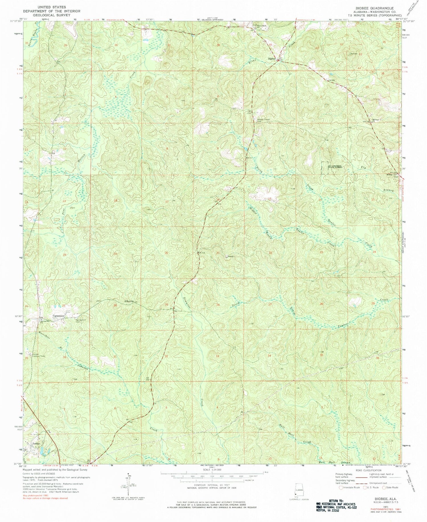
Classic USGS Bigbee Alabama 7.5'x7.5' Topo Map
Couldn't load pickup availability
Historical USGS topographic quad map of Bigbee in the state of Alabama. Map scale may vary for some years, but is generally around 1:24,000. Print size is approximately 24" x 27"
This quadrangle is in the following counties: Washington.
The map contains contour lines, roads, rivers, towns, and lakes. Printed on high-quality waterproof paper with UV fade-resistant inks, and shipped rolled.
Contains the following named places: Bigbee, Bigbee Post Office, Carpenter, Chatom Division, Ellisville, Jordan, Jordan Lookout Tower, Lucyville School, Middle Prong Tauler Creek, Midway Church, Midway Methodist Church Cemetery, Midway United Methodist Church, Moseley Church, Saint Stephens State Forest, Spring Hill Baptist Church, Spring Hill Cemetery, Springhill School, Three Fork Church, Three Forks Cemetery, Waterhole Branch, Wesley Chapel Cemetery, Wesley Chapel Church


