MyTopo
Classic USGS Billingsley Alabama 7.5'x7.5' Topo Map
Couldn't load pickup availability
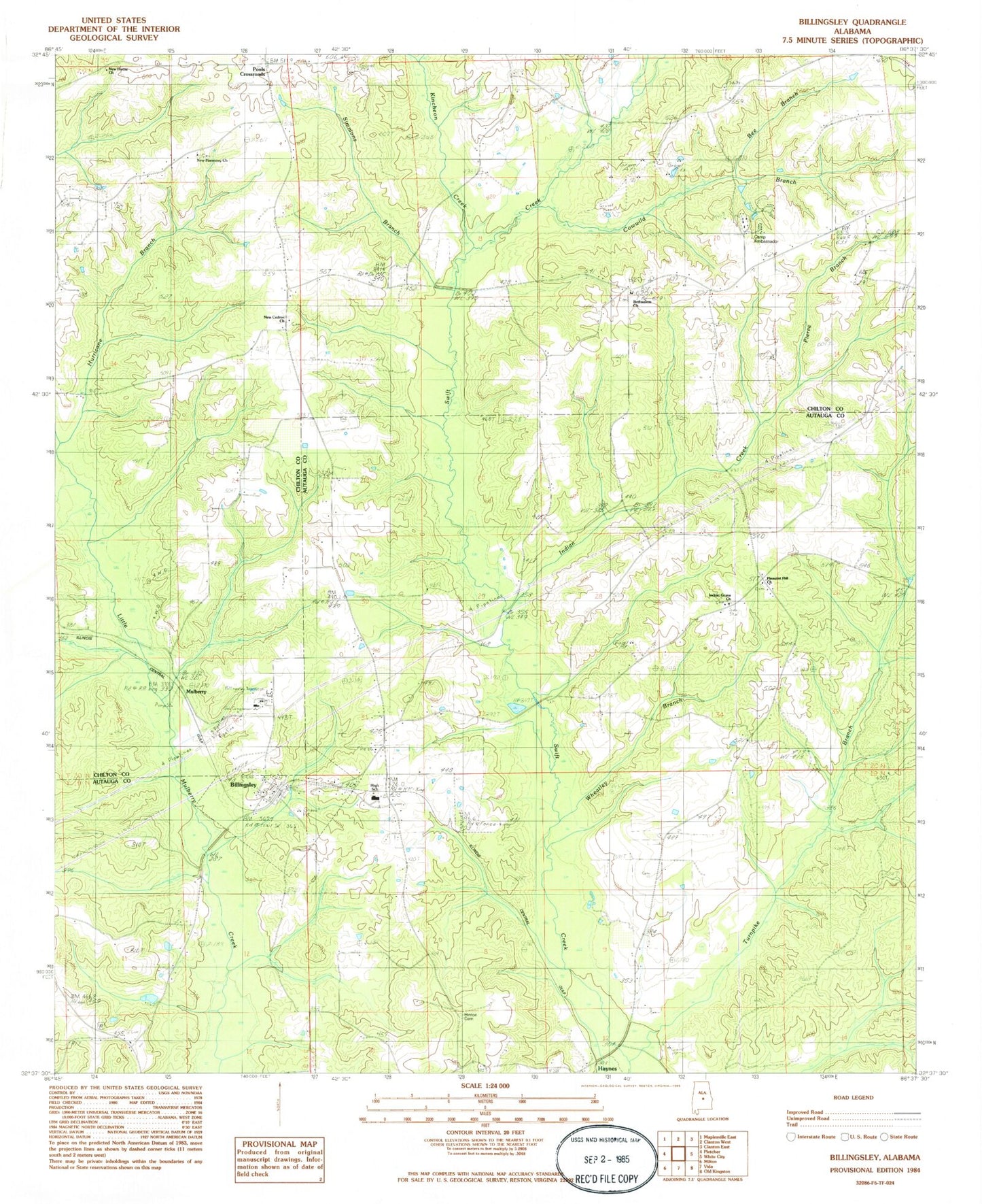
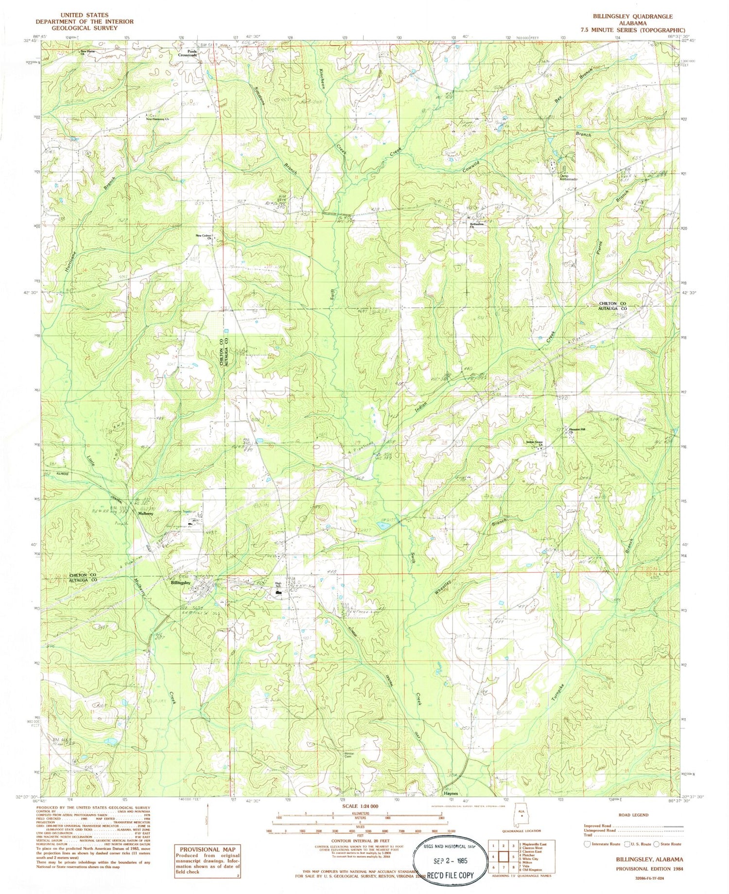
Historical USGS topographic quad map of Billingsley in the state of Alabama. Map scale may vary for some years, but is generally around 1:24,000. Print size is approximately 24" x 27"
This quadrangle is in the following counties: Autauga, Chilton.
The map contains contour lines, roads, rivers, towns, and lakes. Printed on high-quality waterproof paper with UV fade-resistant inks, and shipped rolled.
Contains the following named places: Antioch Cemetery, Bee Branch, Bethsalem Baptist Church, Bethsalem Cemetery, Billingsley, Billingsley Cemetery, Billingsley Church, Billingsley High School, Billingsley Post Office, Billingsley Volunteer Fire Department, Carter Cemetery, Cowwild Branch, Fall Line Hills, Haynes, Hinton Cemetery, Hurricane Branch, Indian Creek, Indian Grave Church, Kincheon Creek, Moores Mill, Mount Zion Church, Mulberry, New Cedron Baptist Church, New Cedron Cemetery, New Harmony Cemetery, New Harmony Holiness Church, New Home Church, New Mount Zion Church, Old Cedron Church, Pierce Branch, Pleasant Hill Church, Pools Crossroads, Simmons Branch, Talley Branch, Town of Billingsley, Wheatley Branch, White Water Lake, ZIP Code: 36006