MyTopo
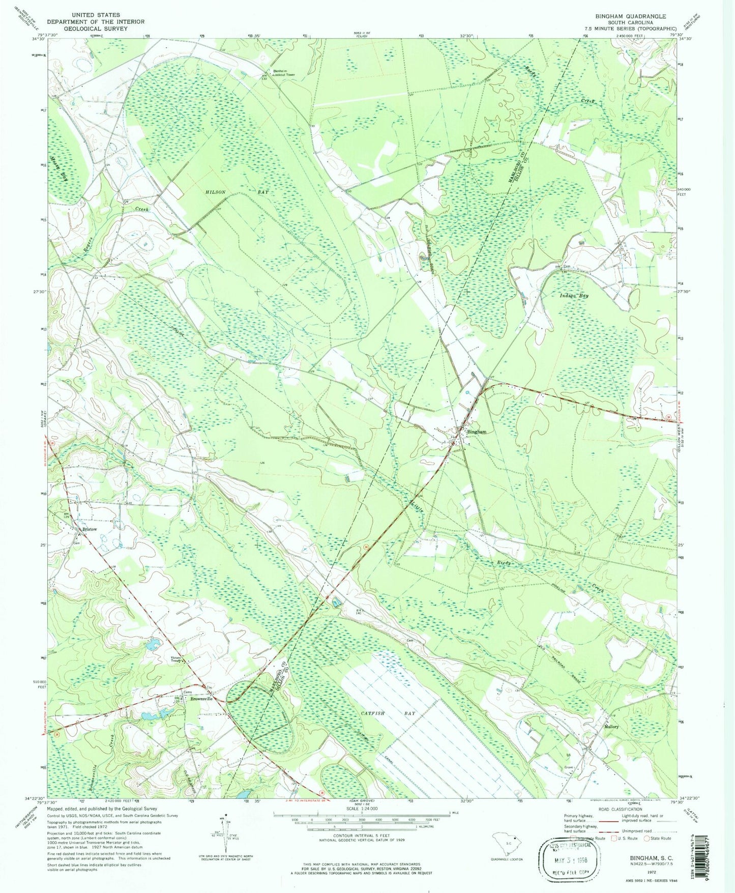
Classic USGS Bingham South Carolina 7.5'x7.5' Topo Map
Couldn't load pickup availability
Historical USGS topographic quad map of Bingham in the state of South Carolina. Map scale may vary for some years, but is generally around 1:24,000. Print size is approximately 24" x 27"
This quadrangle is in the following counties: Dillon, Marlboro.
The map contains contour lines, roads, rivers, towns, and lakes. Printed on high-quality waterproof paper with UV fade-resistant inks, and shipped rolled.
Contains the following named places: Bethea Cross Roads, Bethlehem Church, Bingham, Bingham Church, Bingham School, Blenheim Fire Department Brownsville Station, Blenheim Lookout Tower, Bristow, Bristow Freewill Church, Brownsville, Brownsville Church, Brownsville School, Canal Industries Pond Dam, Canal Industries Pond Dam D-2950, Catfish Bay, Grey Pond, Grey Pond Dam D-3460, Hilson Bay, Indigo Bay, Key School, Mallory, Mallory Church of God, Mallory Cross Roads, Manning Church, Pine Bay, Reedy Creek Springs, Sandhill School, Victory Temple