MyTopo
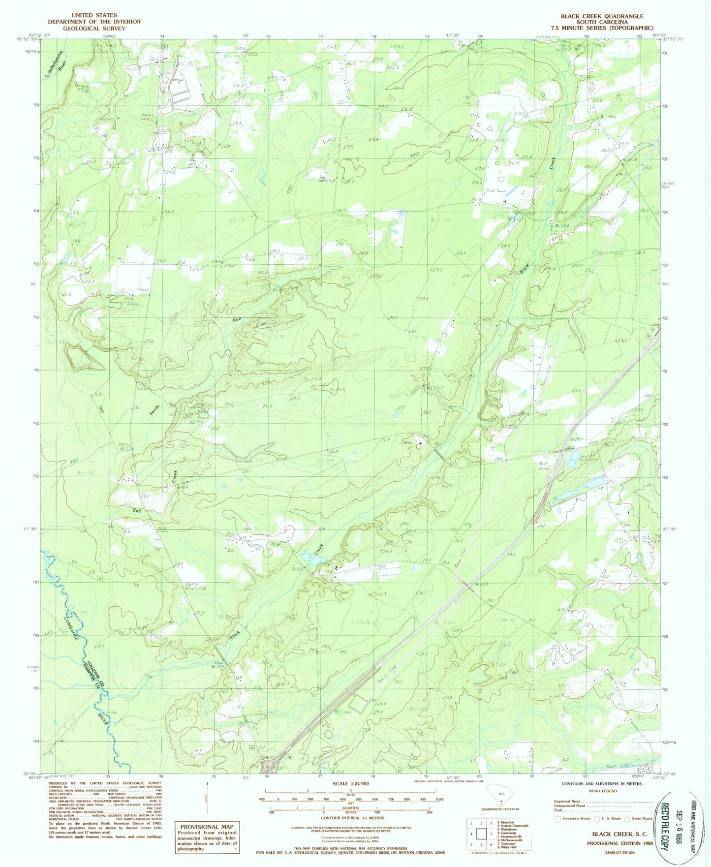
Classic USGS Black Creek South Carolina 7.5'x7.5' Topo Map
Couldn't load pickup availability
Historical USGS topographic quad map of Black Creek in the state of South Carolina. Map scale may vary for some years, but is generally around 1:24,000. Print size is approximately 24" x 27"
This quadrangle is in the following counties: Colleton, Hampton.
The map contains contour lines, roads, rivers, towns, and lakes. Printed on high-quality waterproof paper with UV fade-resistant inks, and shipped rolled.
Contains the following named places: Bertha School, Big Gate School, Big Survey Lake, Big Survey Lake Dam D-2547, Black Creek, Black Creek Church, Bull Creek, Cane Branch Lookout Tower, Cane Branch School, Caney Branch School, Cavern Branch School, Colleton Fire Department Station 29, Colleton Fire Department Station 8, Crosbys Pond, Crosbys Pond Dam D-2546, Fire Hill School, Hendersonville Division, Heyward Church, Heyward School, Marys Church, New Hope School, Newville School, Polly Bottom School, Sandy Run, Shiloh Cemetery, Shiloh Church