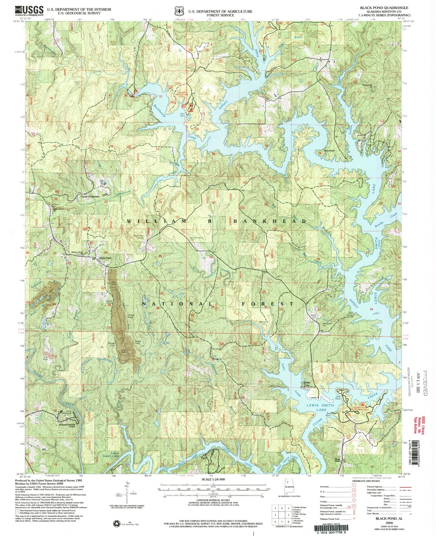
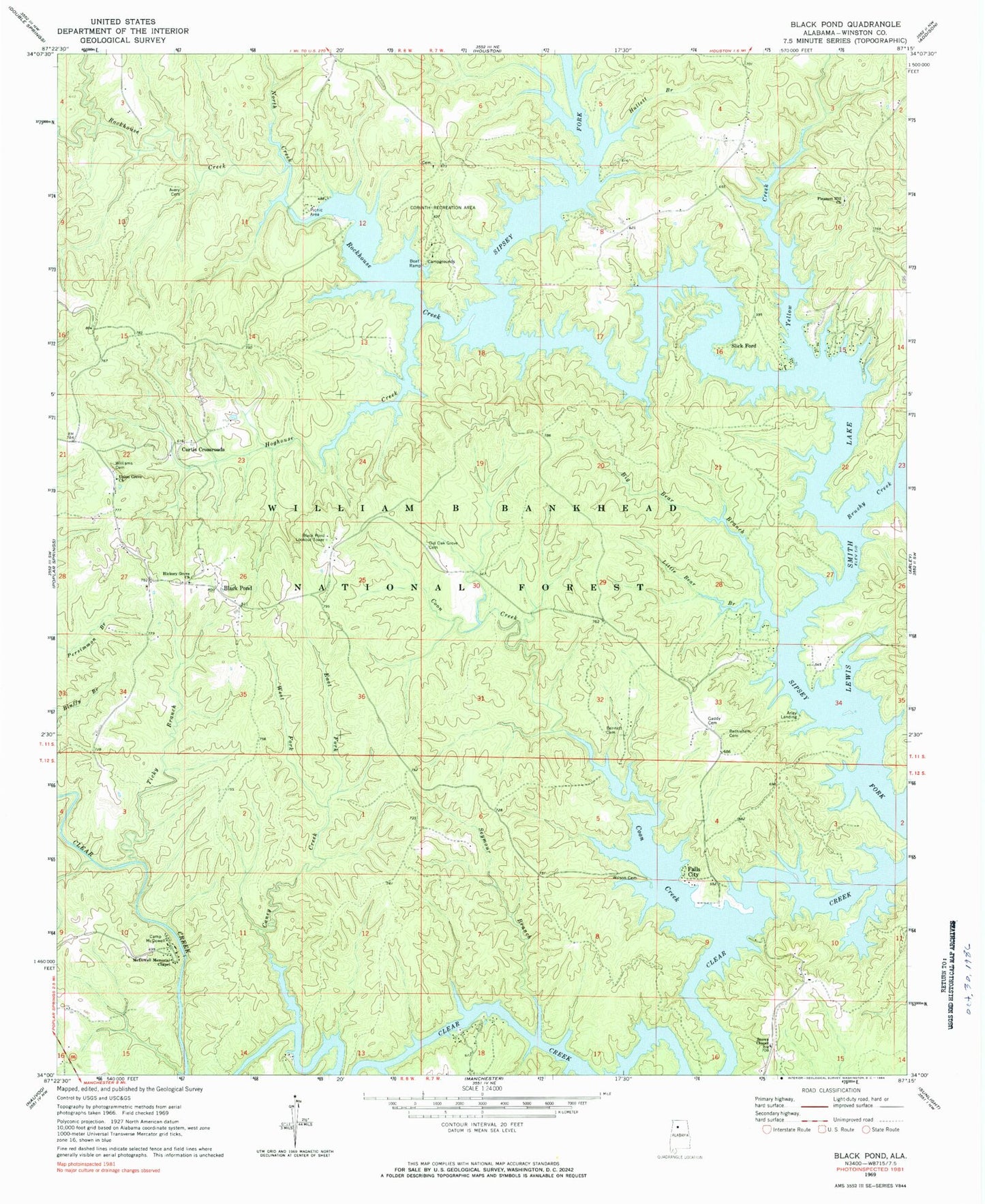
MyTopo
Classic USGS Black Pond Alabama 7.5'x7.5' Topo Map
Couldn't load pickup availability
Historical USGS topographic quad map of Black Pond in the state of Alabama. Map scale is 1:24000. Print size is approximately 24" x 27"
This quadrangle is in the following counties: Winston.
The map contains contour lines, roads, rivers, towns, and lakes. Printed on high-quality waterproof paper with UV fade-resistant inks, and shipped rolled.
Contains the following named places: Alford Spring Branch, Arley Landing, Avery Cemetery, Beltone School (historical), Bennett Cemetery, Bethlehem Baptist Church Cemetery, Bethlehem Cemetery, Bethlehem Church, Big Bear Branch, Big Oak (historical), Black Pond, Black Pond Fire Department, Black Pond Lookout Tower, Black Pond Mine, Black Pond School (historical), Brushy Creek, Camp McDowell, Caney Creek, Centerdale School (historical), Cilicia Post Office (historical), Clear Creek Marina, Clear Creek Recreation Area, Coon Creek, Corinth (historical), Corinth Church, Corinth Church Cemetery, Corinth Recreation Area, Curtis Crossroads, East Fork Caney Creek, Falls City, Falls City Post Office (historical), Falls City Schools 1 and 2 (historical), Fowler Post Office (historical), Gaddy Cemetery, Hickory Grove Church, Hoghouse Creek, Houston Recreation Site, Hullett Branch, Indian Gap (historical), Island Ford, J A Bennett Cemetery, Lane Cemetery, Lanes Mills Post Office (historical), Little Bear Branch, Lovelady Bridge (historical), Lovelady Mill (historical), Malta Post Office (historical), McClinton Cemetery, McDowell Memorial Chapel, Montgomery Cemetery, Nolan Gap (historical), North Creek, Old Oak Grove Cemetery, Partridges Mill (historical), Pinetucky Church (historical), Pinetucky School (historical), Pleasant Hill Church, Pleasant Hill Number 1 Community Church Cemetery, Pleasant Hill School (historical), Poplar Springs Mine, Rock House School (historical), Rockhouse Creek, Sachs Bottoms (historical), Seymour Branch, Slick Ford, Snows Chapel, Ticky Branch, Union Grove Church, West Fork Caney Creek, Williams Cemetery, Wilson-Tubbs Cemetery, Yellow Creek