MyTopo
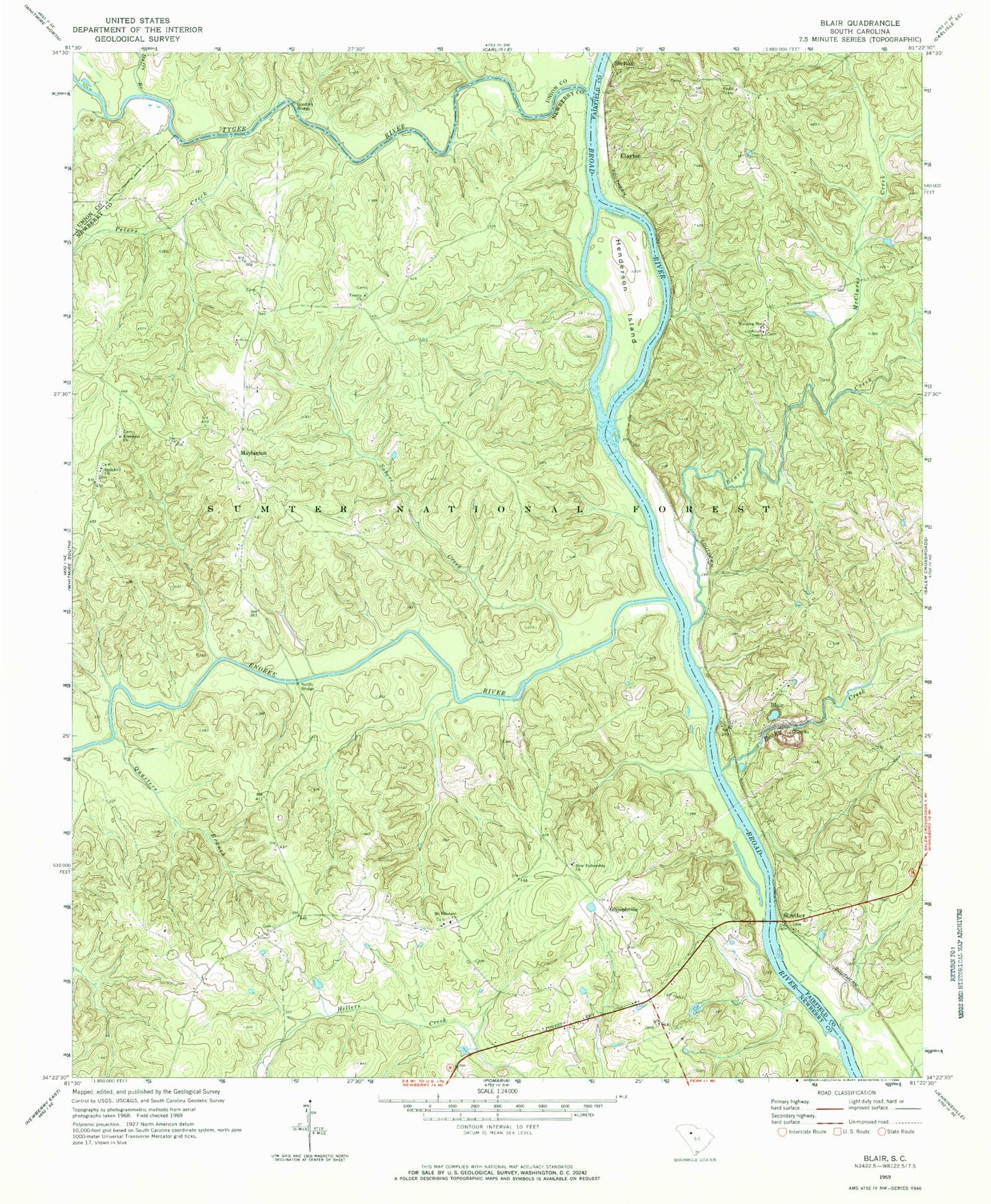
Classic USGS Blair South Carolina 7.5'x7.5' Topo Map
Couldn't load pickup availability
Historical USGS topographic quad map of Blair in the state of South Carolina. Map scale may vary for some years, but is generally around 1:24,000. Print size is approximately 24" x 27"
This quadrangle is in the following counties: Fairfield, Newberry, Union.
The map contains contour lines, roads, rivers, towns, and lakes. Printed on high-quality waterproof paper with UV fade-resistant inks, and shipped rolled.
Contains the following named places: Ashford Ferry, Beaver Creek, Big Dryer Creek, Blair, Blair Quarry, Blairs Ferry, Broad River Scenic Area, Broad River School, Cane Creek, Clayton, Clayton Ferry, David Sims Ferry, Duffs Branch, Ebenezer Cemetery, Ebenezer Church, Elizabeth Church, Elizabeth School, Enoree River, Gilliam Spring, Glymphville, Gordons Bridge, Greenshaws Ford, Henderson Ferry, Henderson Island, Hendersons Bridge, James Ashford Cemetery, Keitts Bridge, Keitts River, Kellys Creek, Lyles Ford, Lylesford, Maybinton, Maybinton Fire Department Sub Station, McClures Creek, Mount Pleasant Church, Mount Pleasant School, New Fellowship Church, Old Ridge Branch, Peters Creek, Pleasant Hill School, Quarters Branch, Rennicks Branch, Rocky Creek, Scenic Area Hunt Camp, Seekwell Cemetery, Seekwell Church, Seekwell School, Shelton, Shelton - Shivar Cemetery, Shelton Lookout Tower, Strother, Subers Creek, Trinity Church, Trinity School, Tyger River, Weeping Mary Cemetery, Weeping Mary Church