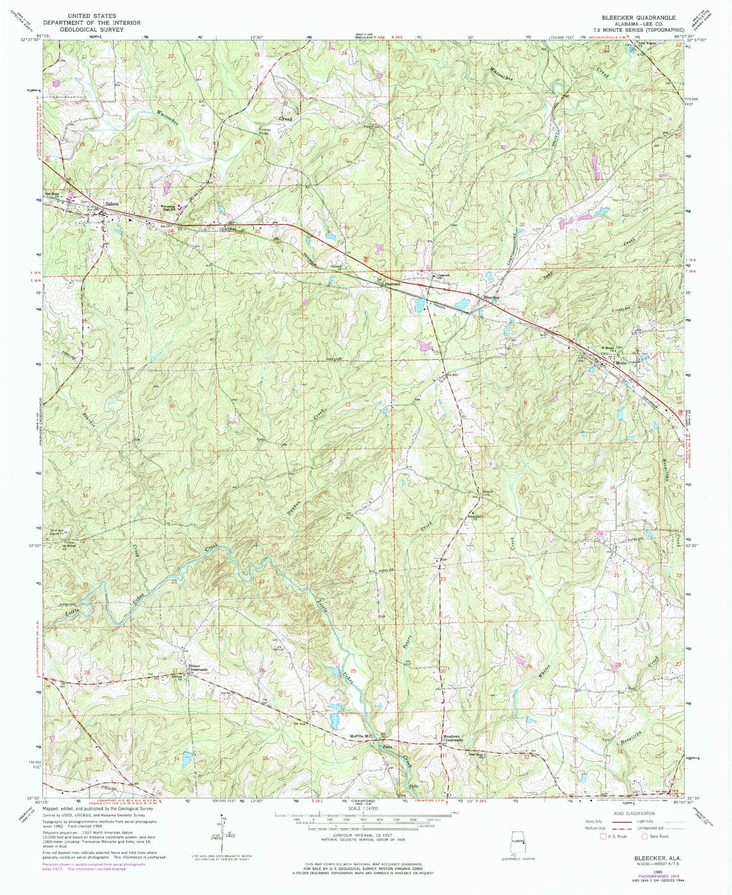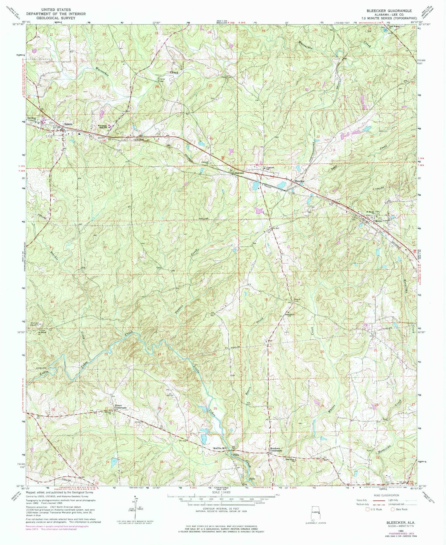
MyTopo
Classic USGS Bleecker Alabama 7.5'x7.5' Topo Map
Couldn't load pickup availability
Historical USGS topographic quad map of Bleecker in the state of Alabama. Typical map scale is 1:24,000, but may vary for certain years, if available. Print size: 24" x 27"
This quadrangle is in the following counties: Lee.
The map contains contour lines, roads, rivers, towns, and lakes. Printed on high-quality waterproof paper with UV fade-resistant inks, and shipped rolled.
Contains the following named places: Antioch Methodist Church, Bethelpore Church, Concord Baptist Church, Concord Church, Dunken Creek, Good Hope Church, New Hope Church, Peters Creek, Saint Marks Church, Saint Peters Church, Salem, Stroud Cemetery, Self Dam, Gullatte Dam, Hubbard Dam, Hubbard Lake, Alnoname Two Dam, W B Cogdell Dam, Bonita Farms Lake, Antioch Cemetery, Church of Christ, Concord Cemetery, Goodhope School (historical), Great Falls, Jerusalem Church, Pleasant View Church, Saint Peter School (historical), Salem Cemetery, Salem United Methodist Church, Salem-Shotwell Covered Bridge, Strouds Cross Road, Meadows Cemetery, Shotwell, Sturkie Creek, Wetumpka Council House (historical), Bleecker, Motts, Meadows Crossroads, Moffits Mill, Prince Crossroads, Mount Gilead Church (historical), Salem Church, Salem School, Wacoochee High School, Salem Church, Smiths Station Division, Salem Post Office, Smiths Station Fire and Rescue Station 1, Salem Volunteer Fire Department