MyTopo
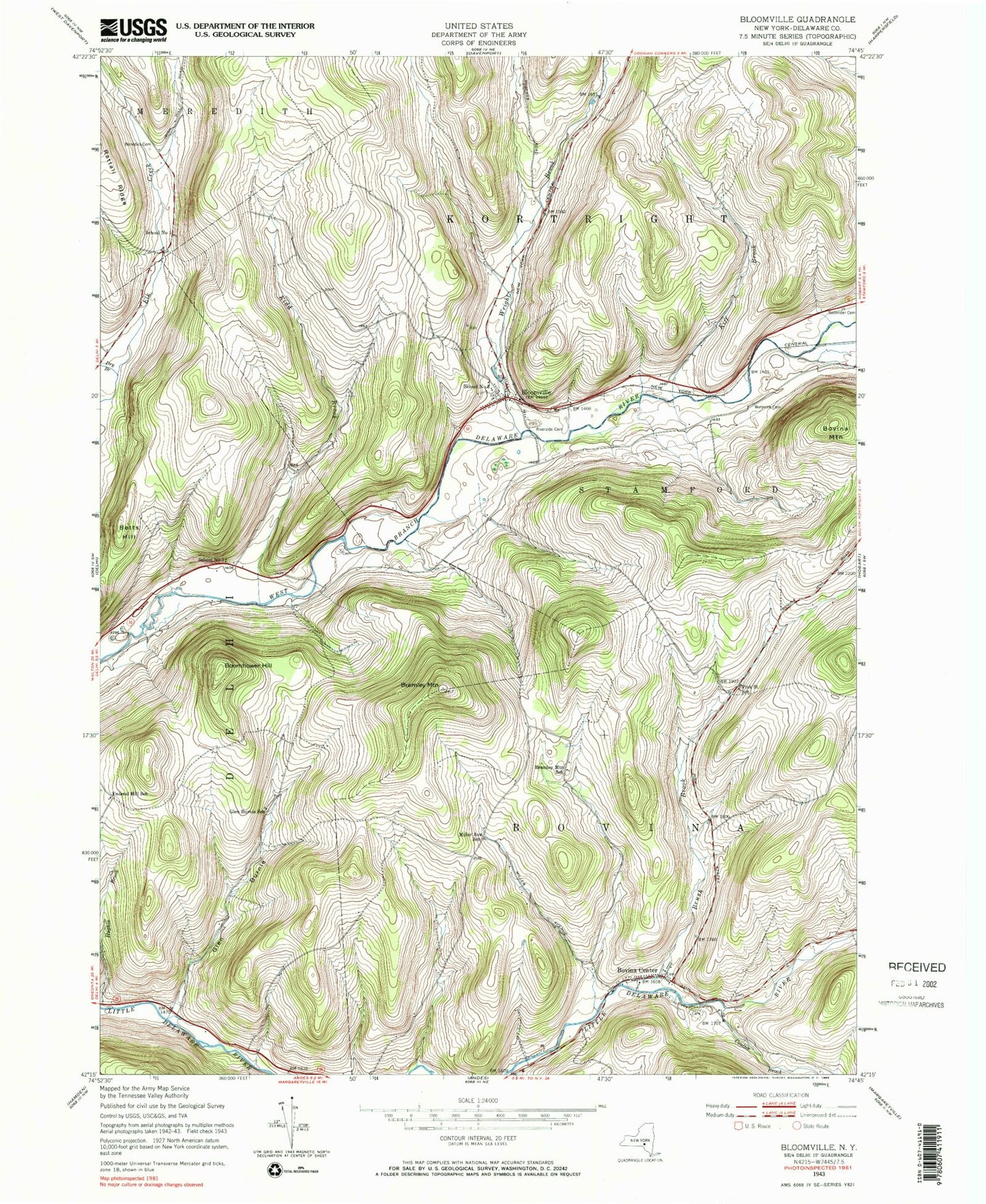
Classic USGS Bloomville New York 7.5'x7.5' Topo Map
Couldn't load pickup availability
Historical USGS topographic quad map of Bloomville in the state of New York. Map scale may vary for some years, but is generally around 1:24,000. Print size is approximately 24" x 27"
This quadrangle is in the following counties: Delaware.
The map contains contour lines, roads, rivers, towns, and lakes. Printed on high-quality waterproof paper with UV fade-resistant inks, and shipped rolled.
Contains the following named places: Betts Hill, Bloomville, Bloomville Census Designated Place, Bloomville Post Office, Bloomville United Methodist Church, Bloomville Volunteer Fire Department Station 1, Boomhower Hill, Bovina Cemetery, Bovina Center, Bovina Center CPO, Bovina Public Library, Bovina United Presbyterian Church, Bovina Volunteer Fire Department, Bramley Mountain, Bramley Mountain Farm, Bramley Mountain School, Brush Brook, Brush Cemetery, Byebrook Farm, Coulter Brook, Dry Brook, Elk Creek Cemetery, Federal Hill School, Glen Burnie, Glen Burnie School, Grace's Landing, High Meadows Farm, Kidd Brook, Kiff Brook, Maple Shade Farm, Miller Avenue School, Old United Presbyterian Church Cemetery, Pink Street School, Riverside Cemetery, Rose Brook, Sackrider Cemetery, School Number 1, School Number 2, Town of Bovina, Wetmore Cemetery, Wright Brook, ZIP Codes: 13739, 13740