MyTopo
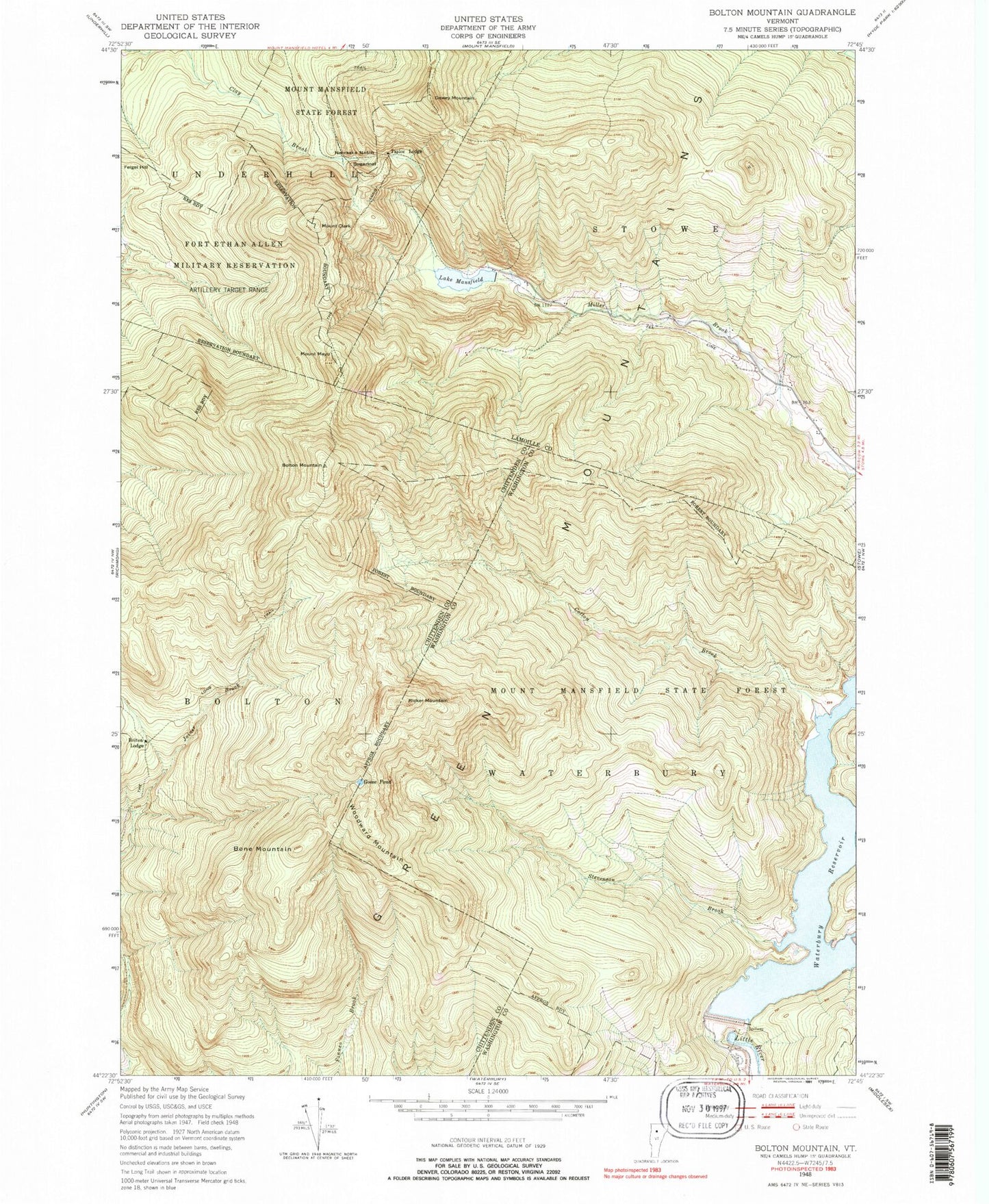
USGS Classic Bolton Mountain Vermont 7.5'x7.5' Topo Map
Couldn't load pickup availability
Historical USGS topographic quad map of Bolton Mountain in the state of Vermont. Scale: 1:24000. Print size: 24" x 27"
This quadrangle is in the following counties: Chittenden, Lamoille, Washington.
The map contains contour lines, roads, rivers, towns, lakes, and grids including latitude / longitude and UTM / MGRS. Printed on high-quality waterproof paper with UV fade-resistant inks.
Contains the following named places: Bolton Lodge, Bolton Mountain, Bone Mountain, Cotton Brook, Dewey Mountain, Feigel Hill, Goose Pond, Lake Mansfield, Mount Clark, Mount Mayo, Nebraska Notch, Ricker Mountain, Stevenson Brook, Sugarloaf, Taylor Lodge, Waterbury Reservoir, Woodward Mountain, WNCS-FM (Montpelier), Waterbury Dam, Lake Mansfield Dam, Bolton Valley Ski Area, Bryant Lodge, Dalley Loop Trail, Hedgehop Hill Loop Trail, Kenyon Sawmill (historical), Little River State Park, Sawmill Loop Trail, Schoolhouse District 10 School (historical), Stevenson Brook Trail, Waterbury Last Block Sawmill, Bolton Valley, Bolton Valley Census Designated Place