MyTopo
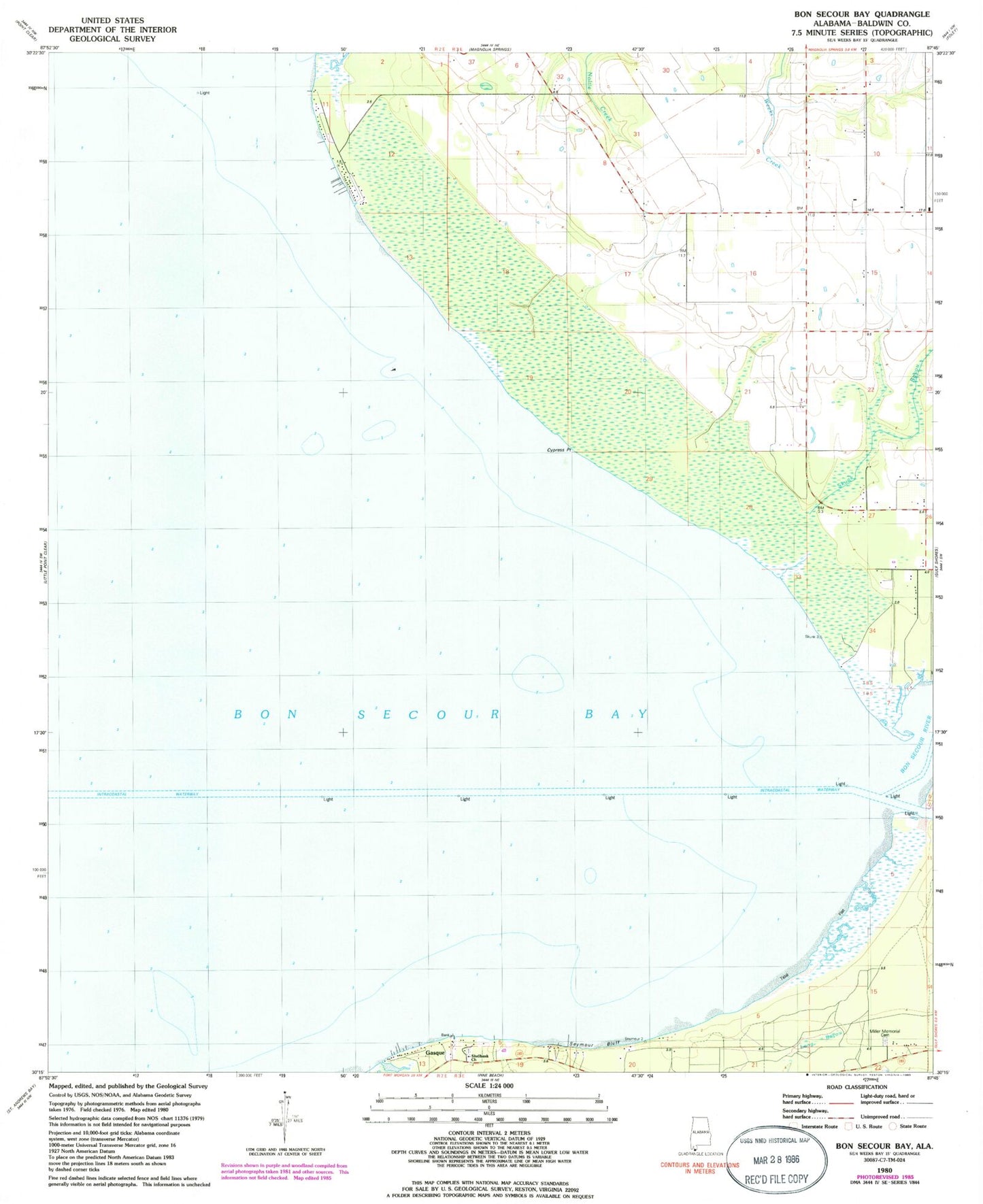
Classic USGS Bon Secour Bay Alabama 7.5'x7.5' Topo Map
Couldn't load pickup availability
Historical USGS topographic quad map of Bon Secour Bay in the state of Alabama. Map scale may vary for some years, but is generally around 1:24,000. Print size is approximately 24" x 27"
This quadrangle is in the following counties: Baldwin.
The map contains contour lines, roads, rivers, towns, and lakes. Printed on high-quality waterproof paper with UV fade-resistant inks, and shipped rolled.
Contains the following named places: Bass Field, Boggy Branch, Bon Secour Bay, Bon Secour River, Cypress Point, Cypress Point Gas Field, Dorgans Lodge, Foley Division, Fort Morgan Volunteer Fire Department, Frosts Landing, Gasque, Long Bayou, Miller Memorial Cemetery, Peninsula Golf and Racquet Club, Sand Bayou, Seymour Bluff, Shell Banks Baptist Church, Shell Banks Cemetery, Shellbank Bayou, Skunk Bayou, Skunk Bayou Gas Field, South Weeks Bay Gas Field, ZIP Code: 36542