MyTopo
Classic USGS Boonville New York 7.5'x7.5' Topo Map
Couldn't load pickup availability
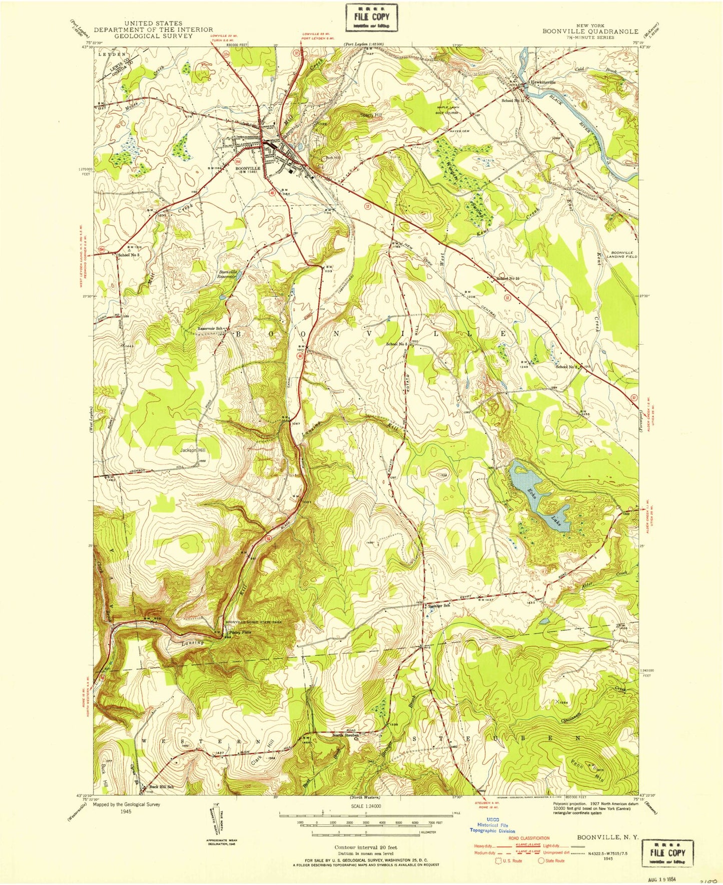
Historical USGS topographic quad map of Boonville in the state of New York. Map scale may vary for some years, but is generally around 1:24,000. Print size is approximately 24" x 27"
This quadrangle is in the following counties: Lewis, Oneida.
The map contains contour lines, roads, rivers, towns, and lakes. Printed on high-quality waterproof paper with UV fade-resistant inks, and shipped rolled.
Contains the following named places: Abundant Life Fellowship Church, Adirondack High School, Bamber School, Big Branch, Black River Canal, Boonville, Boonville Airpark, Boonville Cemetery, Boonville Fire Company, Boonville Fire Department, Boonville Gorge State Park, Boonville Post Office, Boonville Quarry, Boonville Reservoir, Boonville School, Boonville United Methodist Church, Boonville Wastewater Treatment Plant, Buck Hill School, Christian Missionary Church, Clark Brook, Clark Hill, Cold Brook, Crystal Creek, Cummings Creek, East Kent Creek, Echo Lake, Egypt Cemetery, Erwin Library and Institute, Erwin Park, Hawkinsville, Hayes Cemetery, Hurlbutville, Jackson Hill, Kingdom Hall of Jehovahs Witnesses, North Steuben Cemetery, North Steuben Church, Park Hill, Penn Mountain, Pixley Falls, Potato Hill, Reservoir School, Saint Joseph's Church, School Number 11, School Number 16, School Number 2, School Number 3, School Number 5, Sperry Hill, Sunset Nursing Home, Town of Boonville, Trinity Episcopal Church, Village of Boonville, WBRV-FM (Boonville), West Kent Creek, Wingate Swamp, Woodgate Pines Golf Club, ZIP Code: 13309