MyTopo
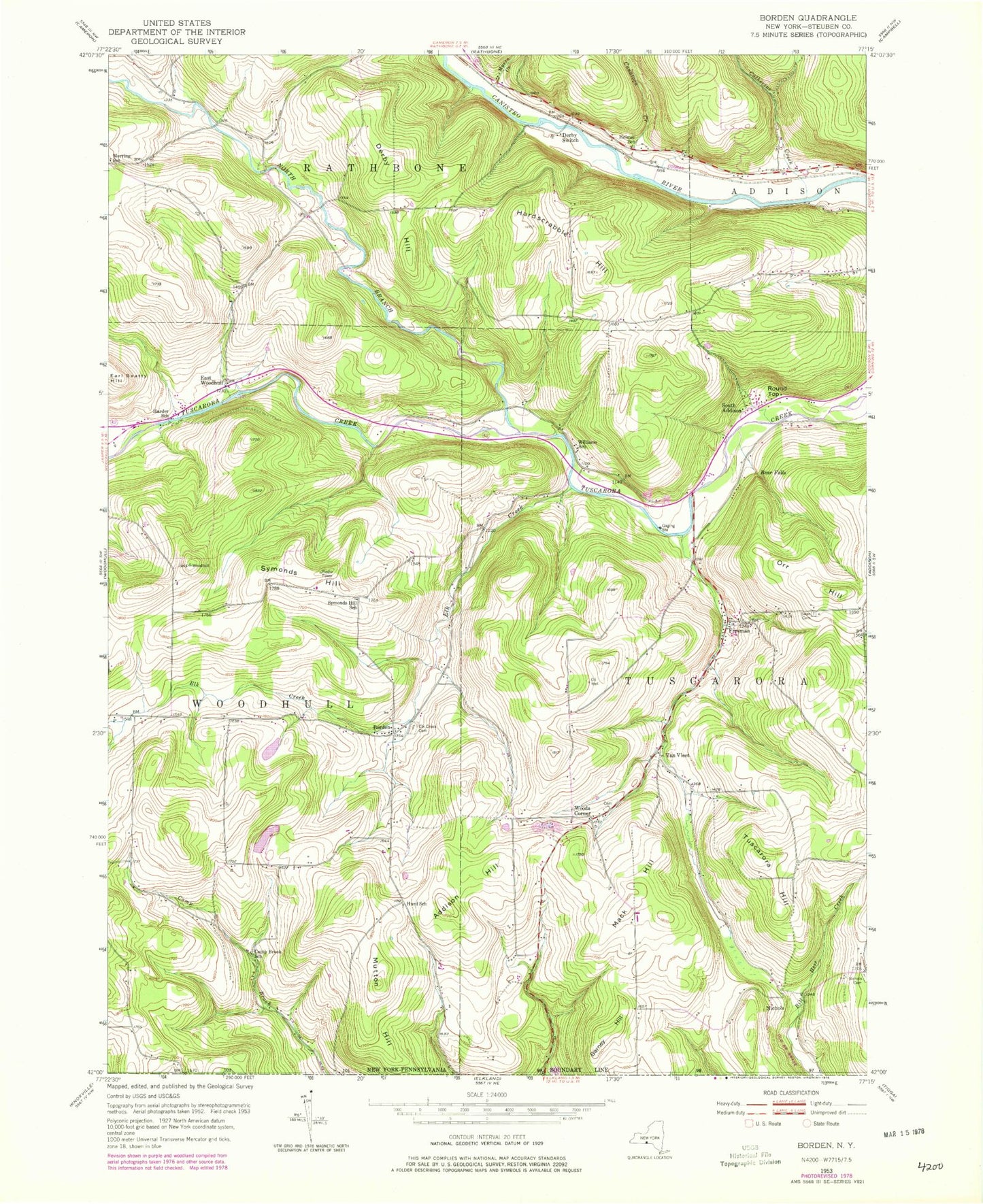
Classic USGS Borden New York 7.5'x7.5' Topo Map
Couldn't load pickup availability
Historical USGS topographic quad map of Borden in the state of New York. Map scale may vary for some years, but is generally around 1:24,000. Print size is approximately 24" x 27"
This quadrangle is in the following counties: Steuben.
The map contains contour lines, roads, rivers, towns, and lakes. Printed on high-quality waterproof paper with UV fade-resistant inks, and shipped rolled.
Contains the following named places: Addison Hill, Addison Hill Cemetery, Barney Hill, Bear Falls, Borden, Camp Brook School, Canatoga Creek, Catherine Creek, Derby Hill, Derby School, Derby Switch, East Woodhull, Elk Creek, Elk Creek Airport, Elk Creek Cemetery, Fairview School, Freeman, Grace Bible Fellowship, Harder School, Hardscrabble Hill, Helmer School, Hillsprings Farm, Hurd School, Mack Hill, Mack Hill School, Merring School, Mutton Hill, Myers Creek, Nichols, Nichols School, North Branch Tuscarora Creek, Round Top, South Addison, Swan Cemetery, Symonds Hill, Symonds Hill School, Town of Tuscarora, Tuscarora Fire Department, Tuscarora Hill, Van Vleet, Wagon Wheel Mobile Home Park, Williams School, Woods Corner, WYDC-TV (Corning), ZIP Code: 14801