MyTopo
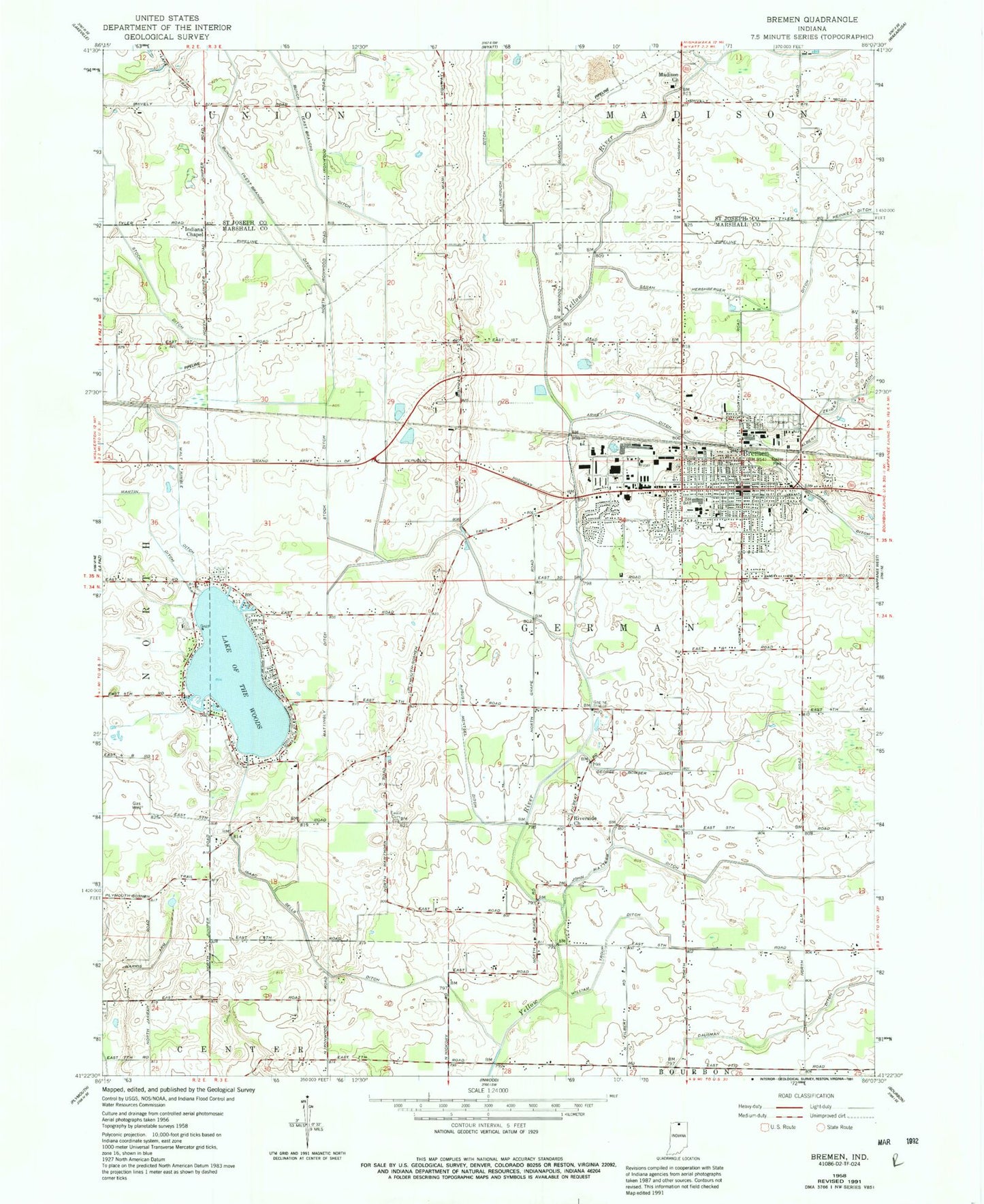
Classic USGS Bremen Indiana 7.5'x7.5' Topo Map
Couldn't load pickup availability
Historical USGS topographic quad map of Bremen in the state of Indiana. Map scale may vary for some years, but is generally around 1:24,000. Print size is approximately 24" x 27"
This quadrangle is in the following counties: Marshall, St. Joseph.
The map contains contour lines, roads, rivers, towns, and lakes. Printed on high-quality waterproof paper with UV fade-resistant inks, and shipped rolled.
Contains the following named places: August Mentsel Ditch, Berger Farms, Bremen, Bremen Elementary/Middle School, Bremen Fire Department, Bremen Police Department, Bremen Post Office, Bremen Public Library, Bremen Senior High School, Bules Farms, Community Hospital of Bremen, Creighton Airport, Doctors NeuroPsychiatric Hospital, East Branch Bunch Ditch, Eby Farms, George Bowser Ditch, Hackbarth Airport, Indiana Chapel, Indiana State Police Department District 24, Isaac Sells Ditch, John Mattern Ditch, Klotz Tree Farm, Kuhn Farm, Lake of the Wood, Madison Church, Mattingly Ditch, Miami Hill Farms, Middle Fork Yellow River, Monhaut Farm, Riverside Church, Sarah Hershberger Ditch, Stock Ditch, Town of Bremen, Township of German, Unsicker Airport, Walker Farm, Walt Kimble Ditch, West Branch Bunch Ditch, William Troup Ditch, ZIP Code: 46506