
MyTopo
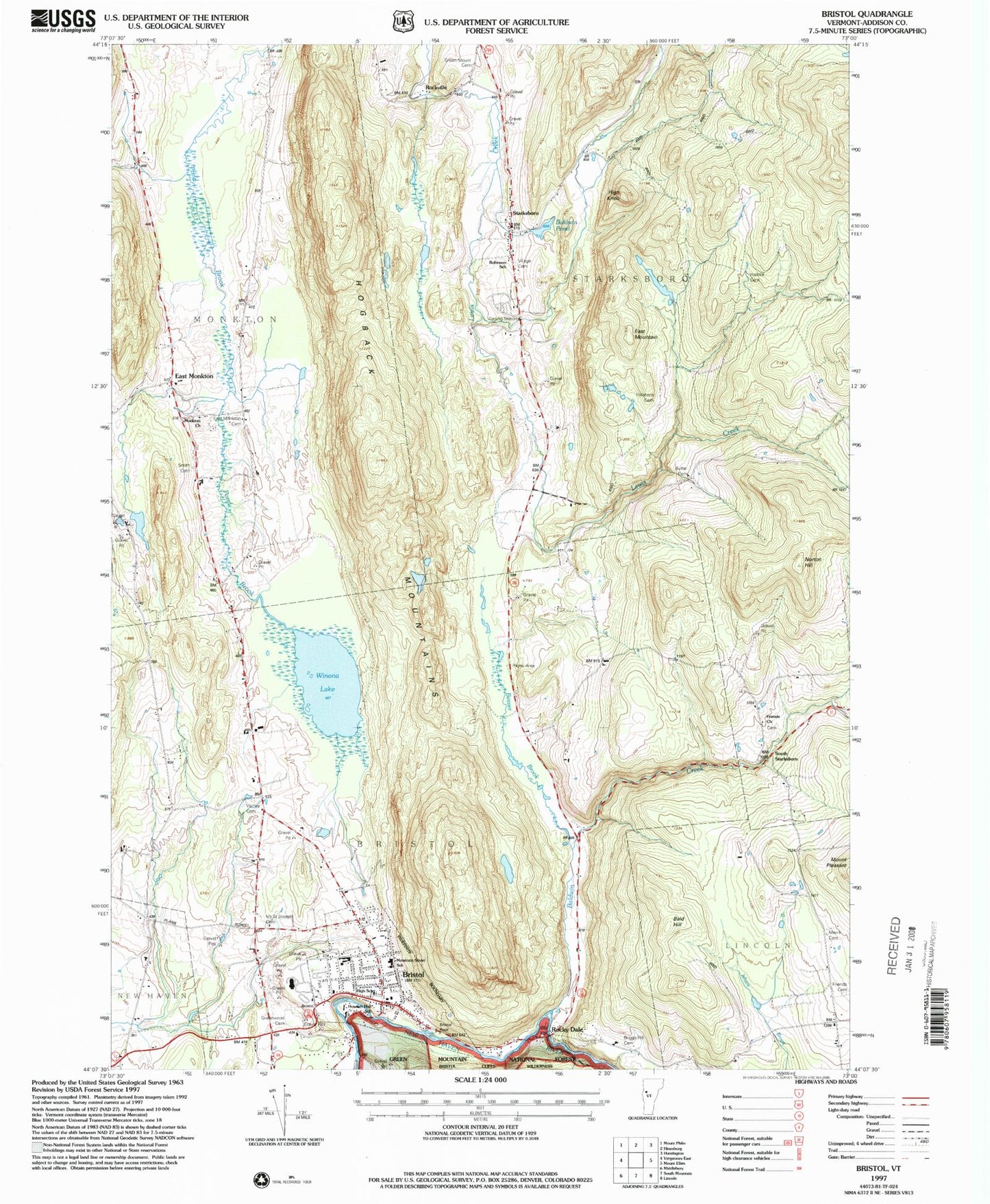
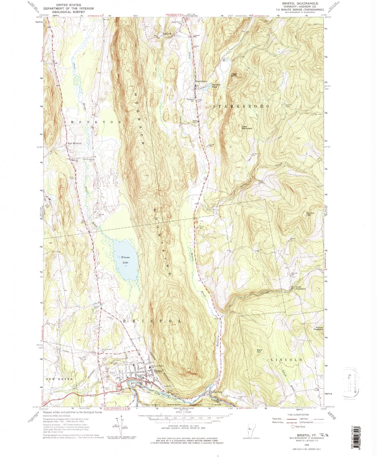
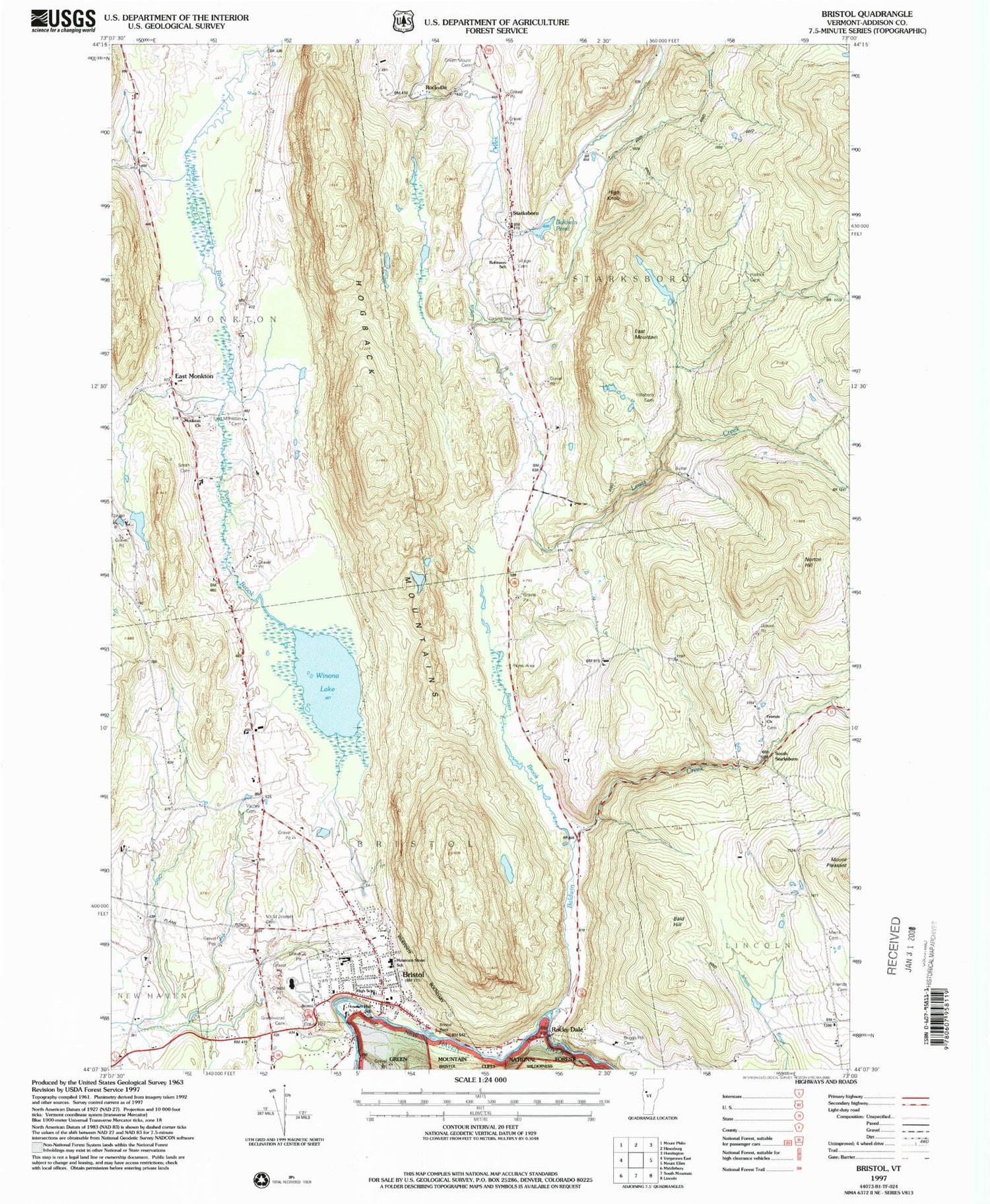
Classic USGS Bristol Vermont 7.5'x7.5' Topo Map
Couldn't load pickup availability
Historical USGS topographic quad map of Bristol in the state of Vermont. Typical map scale is 1:24,000, but may vary for certain years, if available. Print size: 24" x 27"
This quadrangle is in the following counties: Addison.
The map contains contour lines, roads, rivers, towns, and lakes. Printed on high-quality waterproof paper with UV fade-resistant inks, and shipped rolled.
Contains the following named places: Bald Hill, Baldwin Creek, Baldwin Pond, Beaver Brook, Briggs Hill Cemetery, Bristol, Bristol Rock, Norton Cemetery, East Monkton, East Monkton Cemetery, East Mountain, Friends Cemetery, Friends Church, Green Mount Cemetery, Greenwood Cemetery, Hallock Cemetery, High Knob, Hillsboro Cemetery, Hogback Mountains, Howden Hall School, Merrill Cemetery, Monkton Church, Mount Saint Joseph Cemetery, Bristol Elementary School, Norton Hill, Robinson Elementary School, Rockville, Rocky Dale, Smith Cemetery, South Starksboro, Starksboro, Varney Cemetery, Village Cemetery, Bristol Pond, Bristol Airport (historical), Town of Starksboro, Bristol Baptist Church, Bristol Downtown Historic District, Bristol Federated Church, Bristol Pond, Bristol Post Office, Bristol Town Hall, Horan Cemetery, Lincoln Library, Lincoln Municipal Forest, Mount Abraham Union High School, Saint Ambrose Parish Hall, South Starksboro Friends Cemetery, Starksboro Post Office, Starksboro Village Meeting House, Winona Recreation Area, Taft Cemetery, Starksboro Volunteer Fire Department Station 1, Bristol Fire Station, Bristol Census Designated Place, Red Cedar School, Addison Northeast Supervisory Union, Bristol Rescue Squad, Clover Set Farm, Bristol Police Department