MyTopo
Classic USGS Bristow Indiana 7.5'x7.5' Topo Map
Couldn't load pickup availability
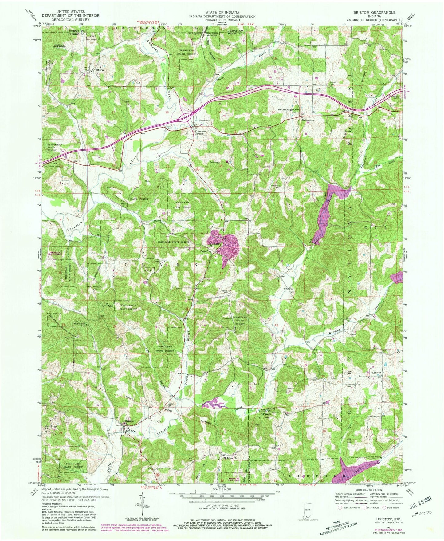
Historical USGS topographic quad map of Bristow in the state of Indiana. Typical map scale is 1:24,000, but may vary for certain years, if available. Print size: 24" x 27"
This quadrangle is in the following counties: Dubois, Perry.
The map contains contour lines, roads, rivers, towns, and lakes. Printed on high-quality waterproof paper with UV fade-resistant inks, and shipped rolled.
Contains the following named places: Apalona, Beard Cemetery, Bristow, Comstock Cemetery, Coon Branch, Dry Branch, Enlow Cemetery, Fosters Ridge Church, Fox Ridge Cemetery, Hobbs Cemetery, Kitterman Corners, Lanman Cemetery, Lasher Cemetery, Maggity Branch, Massey Creek, Miller Cemetery, Mount Sinai Church, Oak Ridge Church, Saint Johns Church, Sassafras, Siberia, Sigler Creek, Snake Branch, Tige Creek, Underhill Cemetery, Uniontown, Winding Branch, Indian Lake, Tipsaw Lake, Middle Fork Number 7 Dam, Middle Fork Dam Number 5, Middle Fork Number 6 Dam, Mount Pleasant Cemetery, Indian Lake Recreation Area, Fosters Ridge, Township of Clark, Anderson Township Fire Department Station 2, Anderson Fire Department, Bristow Post Office