MyTopo
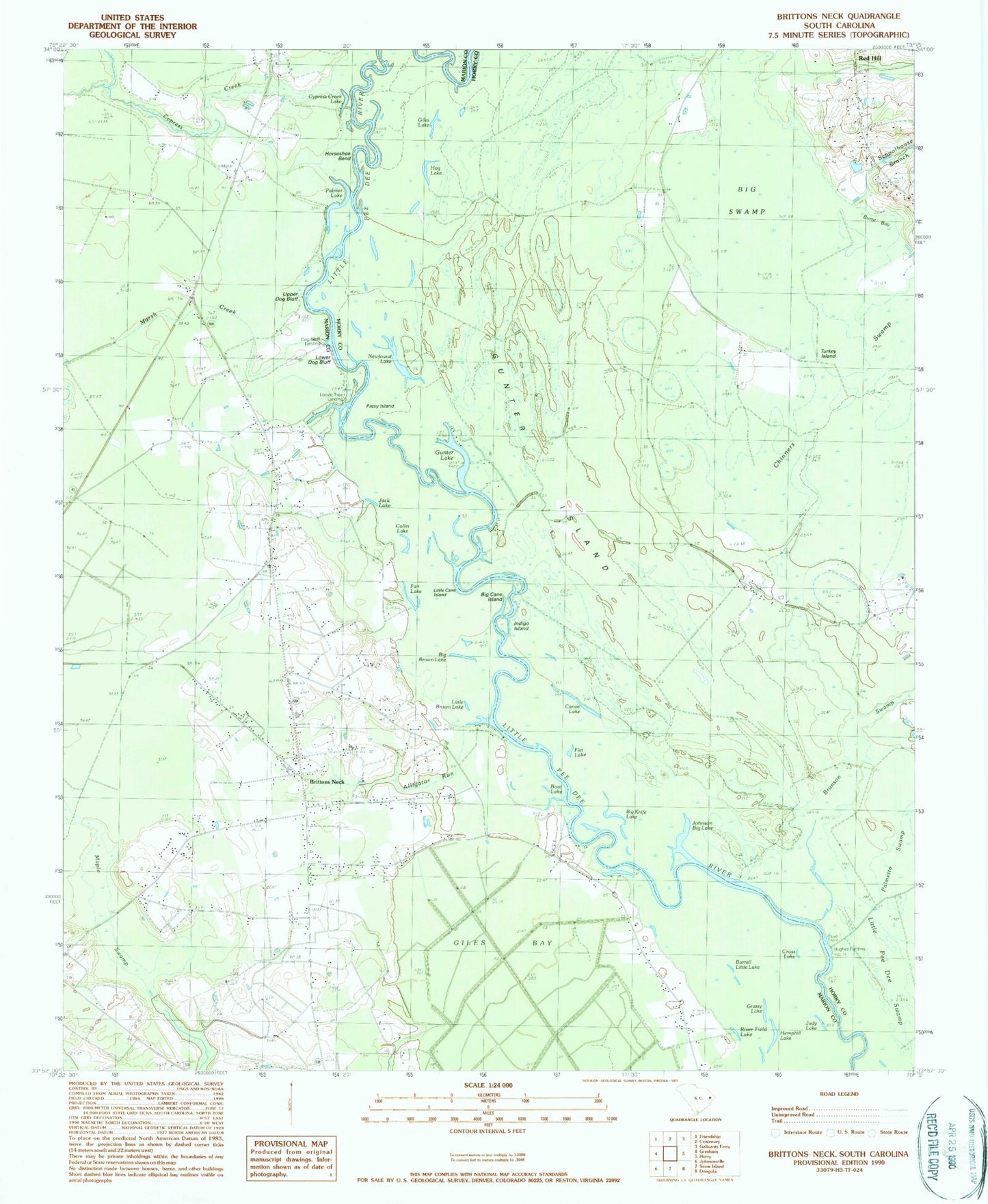
Classic USGS Brittons Neck South Carolina 7.5'x7.5' Topo Map
Couldn't load pickup availability
Historical USGS topographic quad map of Brittons Neck in the state of South Carolina. Map scale may vary for some years, but is generally around 1:24,000. Print size is approximately 24" x 27"
This quadrangle is in the following counties: Horry, Marion.
The map contains contour lines, roads, rivers, towns, and lakes. Printed on high-quality waterproof paper with UV fade-resistant inks, and shipped rolled.
Contains the following named places: Alligator Run, Bethel African Methodist Episcopal Church, Bethel Church, Bethel School, Big Brown Lake, Big Cane Island, Big Knife Lake, Big Swamp, Boat Lake, Britton Neck High School, Brittons Neck, Britton's Neck - Gresham Fire Department, Brittons Neck Elementary School, Brittons Neck Gresham Fire Department, Burnt Bay, Burrell Little Lake, Buzzard Skull Church, Canoe Lake, Central Church, Chinners Swamp, Collin Lake, Cross Lake, Cypress Creek, Cypress Creek Lake, Daviston Census Designated Place, Daviston Church of God, Dog Bluff Landing, Evans Branch, Fair Lake, Flat Lake, Gethsemane Church, Giles Bay, Giles Lake, Grassy Lake, Gresham Post Office, Gunter Island, Gunter Island School, Gunter Lake, Hemphill Lake, Hog Lake, Horseshoe Bend, Hughes Landing, Indigo Island, Jack Lake, Johnson Big Lake, Johnson Ferry, Judy Lake, Little Brown Lake, Little Cane Island, Locust Tree Landing, Lower Dog Bluff, Lower Dog Bluff Landing, Marsh Creek, Nebo Church, Nebo School, Newfound Lake, Palmer Lake, Patsy Island, Peters Ferry Landing, Red Hill, Red Hill Church, Red Hill School, River Field Lake, Schoolhouse Branch, Turkey Island, Upper Dog Bluff, Upper Dog Bluff Landing, White Church, White Oak Landing, ZIP Codes: 29544, 29546