MyTopo
Classic USGS Brookgreen South Carolina 7.5'x7.5' Topo Map
Couldn't load pickup availability
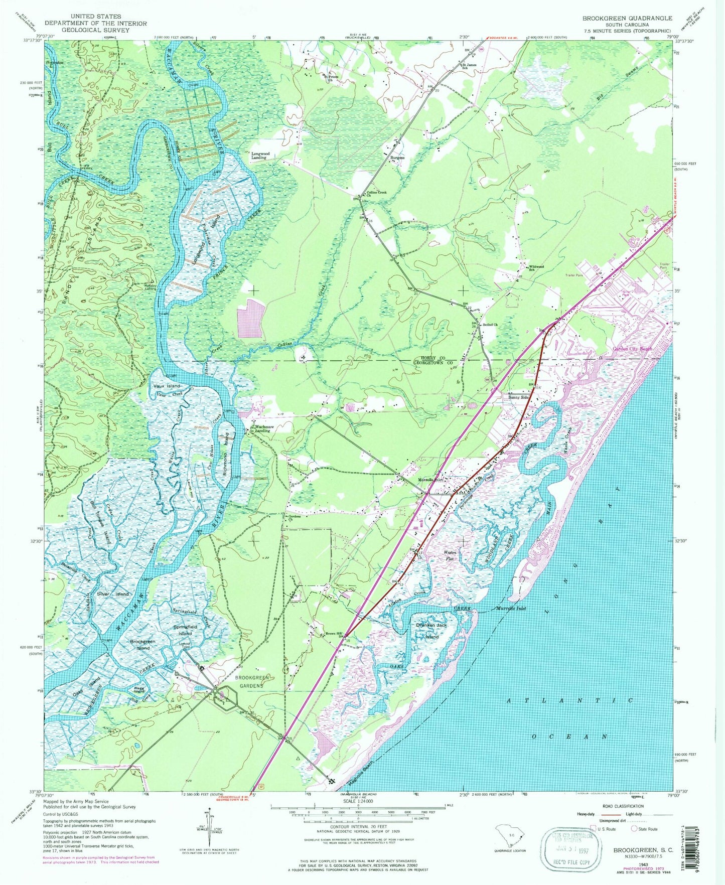
Historical USGS topographic quad map of Brookgreen in the state of South Carolina. Typical map scale is 1:24,000, but may vary for certain years, if available. Print size: 24" x 27"
This quadrangle is in the following counties: Georgetown, Horry.
The map contains contour lines, roads, rivers, towns, and lakes. Printed on high-quality waterproof paper with UV fade-resistant inks, and shipped rolled.
Contains the following named places: Allston Creek, Bethel Church, Black Creek, Brookgreen Creek, Brookgreen Gardens, Brookgreen Island, Bull Creek, Bull Tongue Island, Burgess, Cow House Creek, Crane Creek, Drunken Jack Island, Fisherman Creek, Flagg Island, Little Bull Creek, Main Creek, Murrells Inlet, Oaks Creek, Oaks Island, Parsonage Creek, Prince Creek, Ruinsville Creek, Saint James Elementary School, Saint Peters Church, Sandhole Creek, Sandy Island, Silver Creek, Silver Island, Silvers Creek, Springfield Creek, Springfield Island, Still Creek, Sunny Side, Vaux Creek, Vaux Island, Whale Creek, White Creek, Wildwood School, Longwood Landing, Laurel Hill Island, Mulberry Landing, Atalaya Mansion, Belin Memorial Methodist Church, Blue Heron, Brookgreen Plantation (historical), Browns Church, Captains Cove, Carriage Run, Crystal Oaks, Eagle Crest, Huntington Beach State Park, Huntington Estate, Huntington Marsh, Inlet Crossing Shopping Center, Inlet Harbor, Inlet Oaks Village, Jerusalem Church, Jessamine Pond, Laurel Hill Church (historical), Laurel Hill School (historical), Live Oaks, Moss Creek, Murrells Inlet Historic District, Murrells Inlet Park, Oak Hill, Richmond Hill, Richmond Hill Plantation, Robin Hood, Springfield Plantation (historical), Waccawache Marina, Wachasaw Plantation, Wachesaw Place, Wayside Forest, Jamestown, Jensens, Mount Gilead, Ocean Pines, Pirate Cove, Seabreeze, Thompson (historical), Windjammer Village, Gordons Church, Longwood Island, Brown School, Collins Creek, Collins Creek Church, Garden City Beach, Richmond Island, Wachesaw Landing, Weston Flat, Woodland Creek, WYAK-AM (Surfside Beach-Garden City Beach), WYAV-FM (Conway), WBPR-FM (Georgetown), WYAK-FM (Surfside Beach), WYAK-FM (Surfside Beach), WCRD-TV (Myrtle Beach), Murrells Inlet, Garden City, Garden City Beach Post Office (historical), Murrells Inlet Fire Department Station 76, Garden City Census Designated Place, Murrells Inlet Census Designated Place, Seaside Elementary School, Saint James Middle School, Saint James High School, Murrells Inlet Post Office, Murrells Inlet Community Center, Murrells Inlet Church of God, Surfside Christian Church, Trinity Presbyterian Church, Marlin Quay Marina, Ragtops and Roadsters Auto Museum, Murrells Inlet Wastewater Treatment Plant, Waccamaw Community Hospital, Atlantic Surgery Center, Murrells Inlet School District (historical), Murrells Inlet Fire Department Station 78