MyTopo
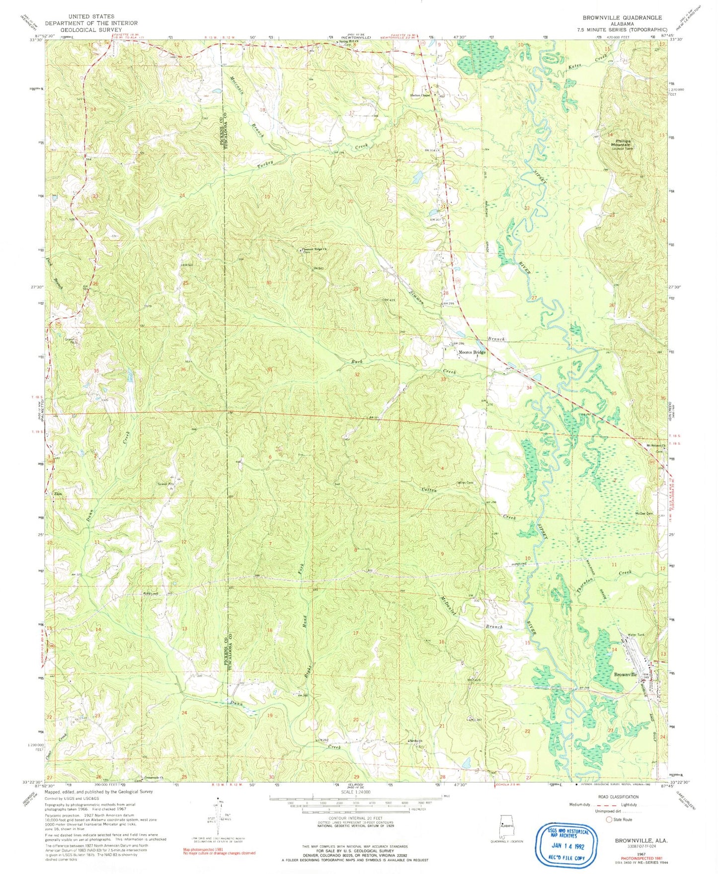
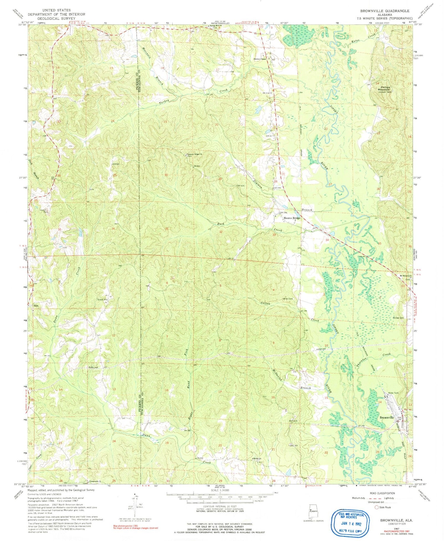
Classic USGS Brownville Alabama 7.5'x7.5' Topo Map
Couldn't load pickup availability
Historical USGS topographic quad map of Brownville in the state of Alabama. Map scale may vary for some years, but is generally around 1:24,000. Print size is approximately 24" x 27"
This quadrangle is in the following counties: Pickens, Tuscaloosa.
The map contains contour lines, roads, rivers, towns, and lakes. Printed on high-quality waterproof paper with UV fade-resistant inks, and shipped rolled.
Contains the following named places: Arbor Springs School, Brownville, Buck Creek, Cotton Creek, Crossroads Cemetery, Crossroads Church, Double Branch Church, Dunn Creek Gas Field, Festus, Kates Creek, Little Hill School, Lubbub, Mayfield Cemetery, Mayfield Church, Mayfield Community Center, Mayfield Volunteer Fire Department, McDaniel Branch, McGee Cemetery, Moccasin Branch, Moores Bridge, Moores Bridge Cemetery, Moores Bridge Missionary Baptist Church, Mount Hebron Baptist Church, Mount Hebron Baptist Church Cemetery, New Doublebranches Cemetery, Phillips Mountain, Pleasant Ridge Baptist Church, Pleasant Ridge Cemetery, Pleasant Ridge Church, Right Hand Fork Dunn Creek, Sardis Cemetery, Sardis Freewill Baptist Church, Shelton Chapel, Simmon Branch, Spring Hill Baptist Church, Spring Hill Cemetery, Sullivan Jersey Farm, Thornton Creek, Turkey Creek, Winn Cemetery, Zion School, ZIP Code: 35458