MyTopo
Classic USGS Bull Pond South Carolina 7.5'x7.5' Topo Map
Couldn't load pickup availability
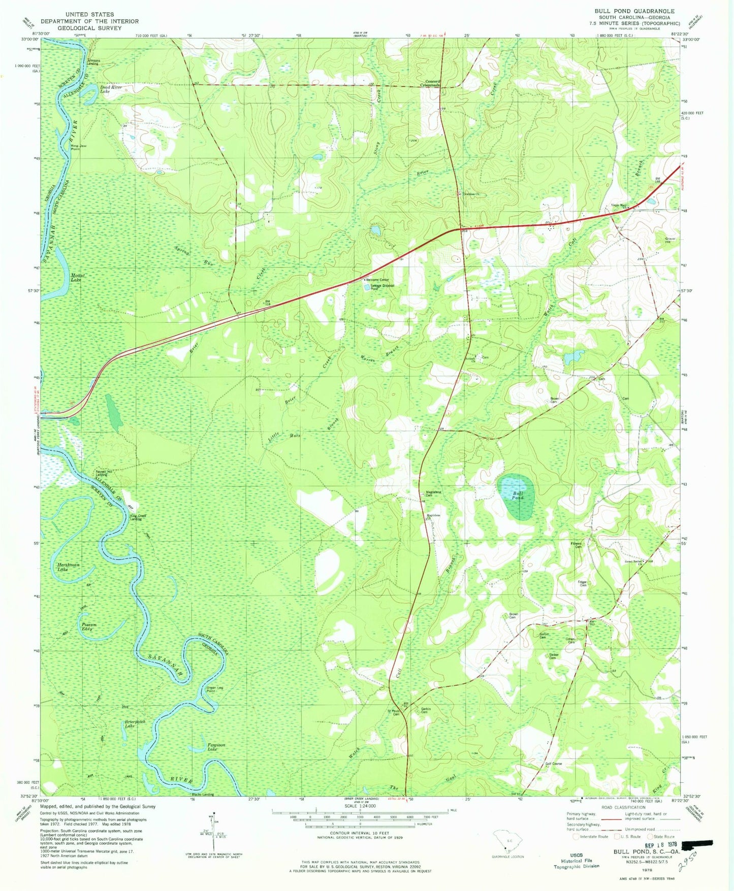
Historical USGS topographic quad map of Bull Pond in the states of South Carolina, Georgia. Map scale is 1:24000. Print size is approximately 24" x 27"
This quadrangle is in the following counties: Allendale, Screven.
The map contains contour lines, roads, rivers, towns, and lakes. Printed on high-quality waterproof paper with UV fade-resistant inks, and shipped rolled.
Contains the following named places: Antioch Cemetery, Antioch Church, Beaufort Island, Blacks Landing, Blue Spring, Box Store (historical), Brier Creek, Brierpatch Lake, Brooks School (historical), Brown Cemetery, Brown Cemetery, Bull Pond, Bull Pond School (historical), Cane Creek Church (historical), Cohen Cemetery, Concord Cemetery, Concord Church (historical), Concord Crossroads, Cooks Chapel School (historical), Crooked Cut, Dead River Lake, Erwinton Church, Erwinton Plantation, Fennell Hill Landing, Ferguson Lake, Flowers Cemetery, Folger Cemetery, Garvin Cemetery, Garvin Cemetery, Gravel Hill, Gravel Hill (historical), Gravel Hill Plantation, Green Log Point, Horsepen Gut, Johnsons Landing, King Creek Landing, Little Brier Creek, Magdalene Cemetery, Magdalene Church, Mars Branch, Martin Spring Run, McLean School (historical), Milbury, Mount Lake, Possum Eddy, Rices Pond Dam D-2573, Ring Jaw Point, Saint Paul Church (historical), Saint Pauls Cemetery, Spring Run, Spring Run, Stony Creek, Striker Cemetery, Sweet Bethel Church, Trinity School (historical), Virgin Mary Church, Warren Branch, Watchcaw Creek, Willingham Plantation