MyTopo
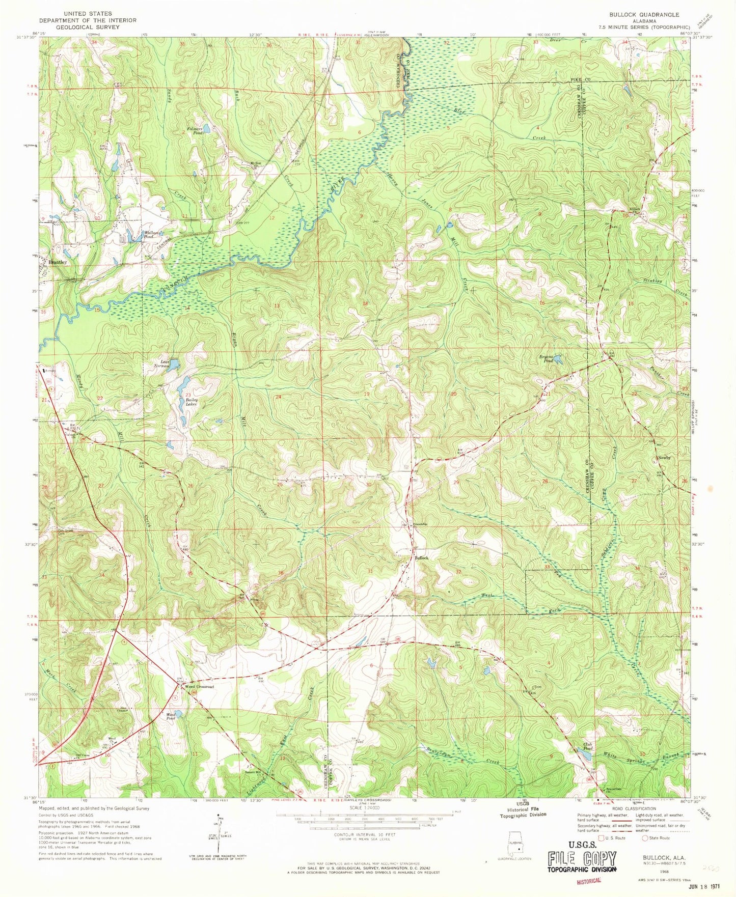
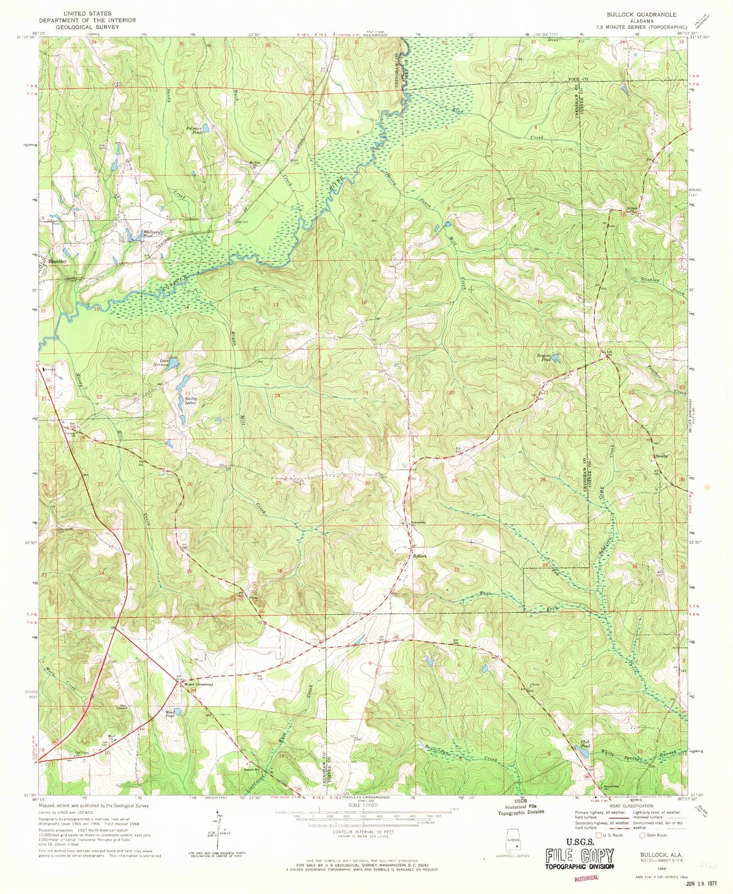
Classic USGS Bullock Alabama 7.5'x7.5' Topo Map
Couldn't load pickup availability
Historical USGS topographic quad map of Bullock in the state of Alabama. Map scale may vary for some years, but is generally around 1:24,000. Print size is approximately 24" x 27"
This quadrangle is in the following counties: Coffee, Crenshaw, Pike.
The map contains contour lines, roads, rivers, towns, and lakes. Printed on high-quality waterproof paper with UV fade-resistant inks, and shipped rolled.
Contains the following named places: Aiken, Antioch Cemetery, Antioch Primitive Baptist Church, Bailey Lakes, Beaver Dam Cemetery, Beaverdam Primitive Baptist Church, Beulah Church, Blue Creek, Bryan Mill Creek, Bryans Pond, Buck Creek, Bullock, Bullock Volunteer Fire Department, Calvary Church, Club Pond, Coffee Corner Post Office, Driskell Family Cemetery, Ellis School, Folmars Pond, Friendship Church, Honey Jones Mill Creek, Jones Branch, Jones Mill, Lake Norman, Lowery Cemetery, Moody Mill Creek, Mount Zion Church, Newbia Baptist Church, Newby, Newby School, Oak Grove Cemetery, Old Union Church, Peacock, Rainer School, Sandy Creek, Sasser Store, Sassers Mill Church, Soldiers Camp Creek, Wallaces Pond, Weed Church, Weed Crossroad, Weed Pond, West Fork Pea Creek, Zion Chapel