MyTopo
Classic USGS Burke Mountain Vermont 7.5'x7.5' Topo Map
Couldn't load pickup availability
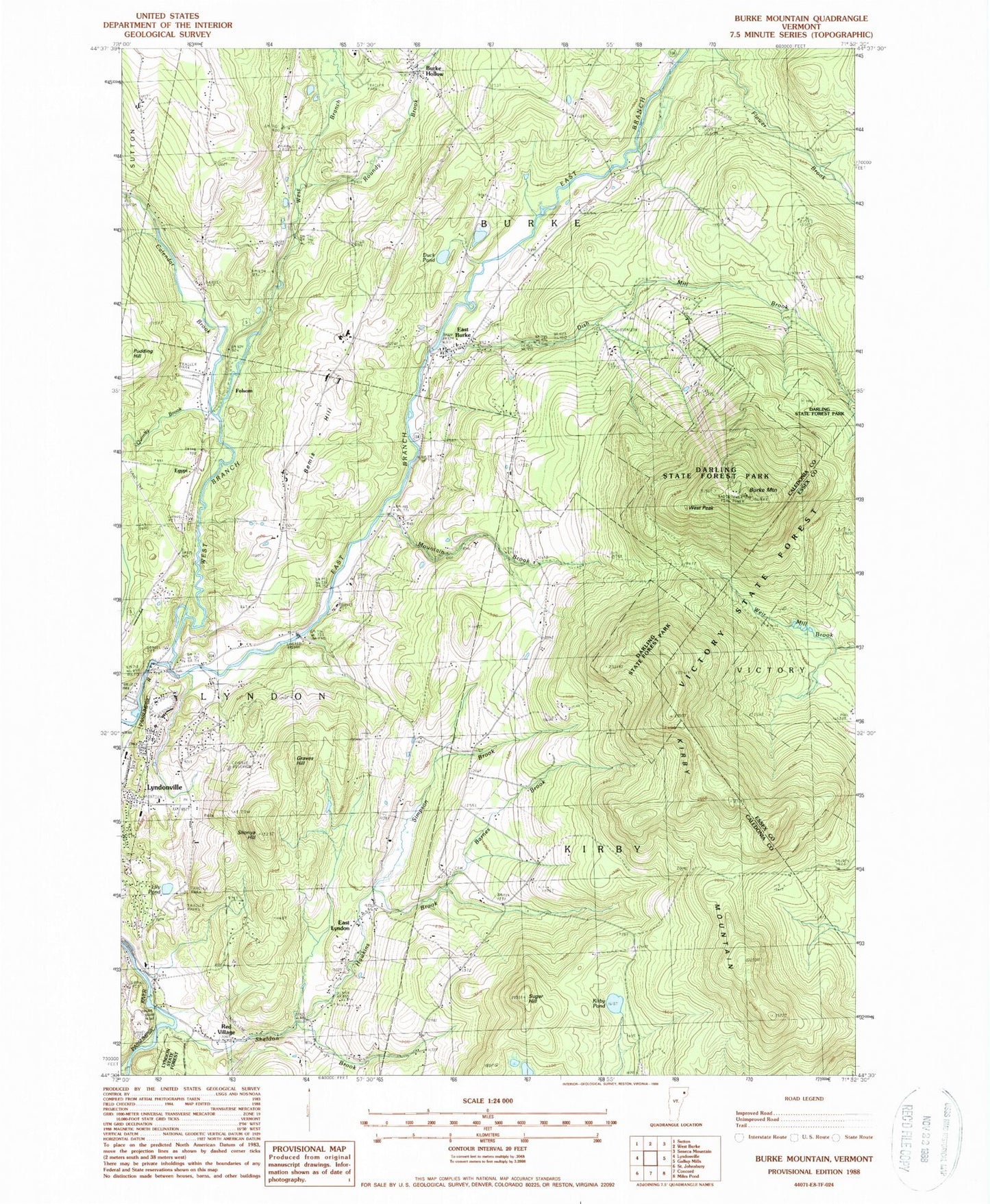
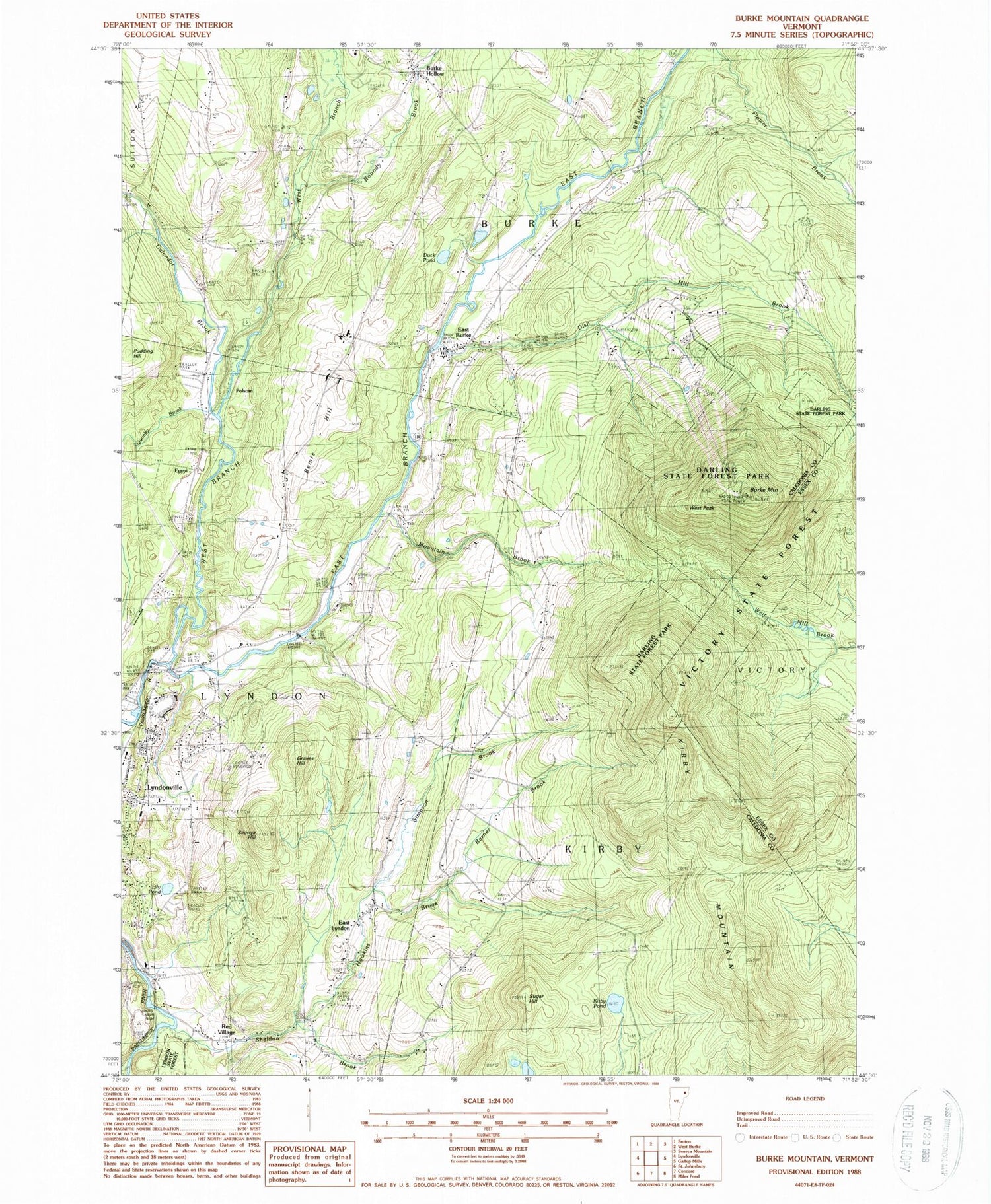
Historical USGS topographic quad map of Burke Mountain in the state of Vermont. Typical map scale is 1:24,000, but may vary for certain years, if available. Print size: 24" x 27"
This quadrangle is in the following counties: Caledonia, Essex.
The map contains contour lines, roads, rivers, towns, and lakes. Printed on high-quality waterproof paper with UV fade-resistant inks, and shipped rolled.
Contains the following named places: Calendar Brook, West Branch Passumpsic River, Barnes Brook, Bear Den Trail, Bemis Hill, Brookside School, Burke Green Cemetery, Burke Hollow, Burke Mountain, Darling State Forest, Dish Mill Brook, Duck Pond, East Branch Passumpsic River, East Burke, East Lyndon, Graves Hill, Hawkins Brook, Howland Cemetery, Kirby Mountain, Kirby Pond, Lily Pond, Mount Hunger School, Mountain Brook, North Kirby School, Pudding Hill, Quimby Brook, Red Village School, Roundy Brook, Sheldon Brook, Shonya Hill, Simpson Brook, Sugar Hill, Ward School, West Peak Burke Mountain, White School, Woodmont Cemetery, Egypt, Folsom, West Burke Aerodrome, WGMT-FM (Lyndon), WVTB-TV (Saint Johnsbury), Town of Burke, Town of Kirby, Great Falls Dam, Vail Dam, Burke Mountain Academy, Burke Mountain Campground, Burke Mountain Ski Area, Burke Mountain Ski Touring Center, Burke Town School, Burrington Covered Bridge, Caledonia County Fairgrounds, East Burke Community Library, East Burke Congregational Church, East Burke Post Office, Lyndon Town School, Lyndon Outing Club Ski Area, North Kirby, North Kirby - Brookside Cemetery, Vermont Childrens Theater, East Burke Volunteer Fire Department, Riverside School, East Burke School, East Burke Census Designated Place