MyTopo
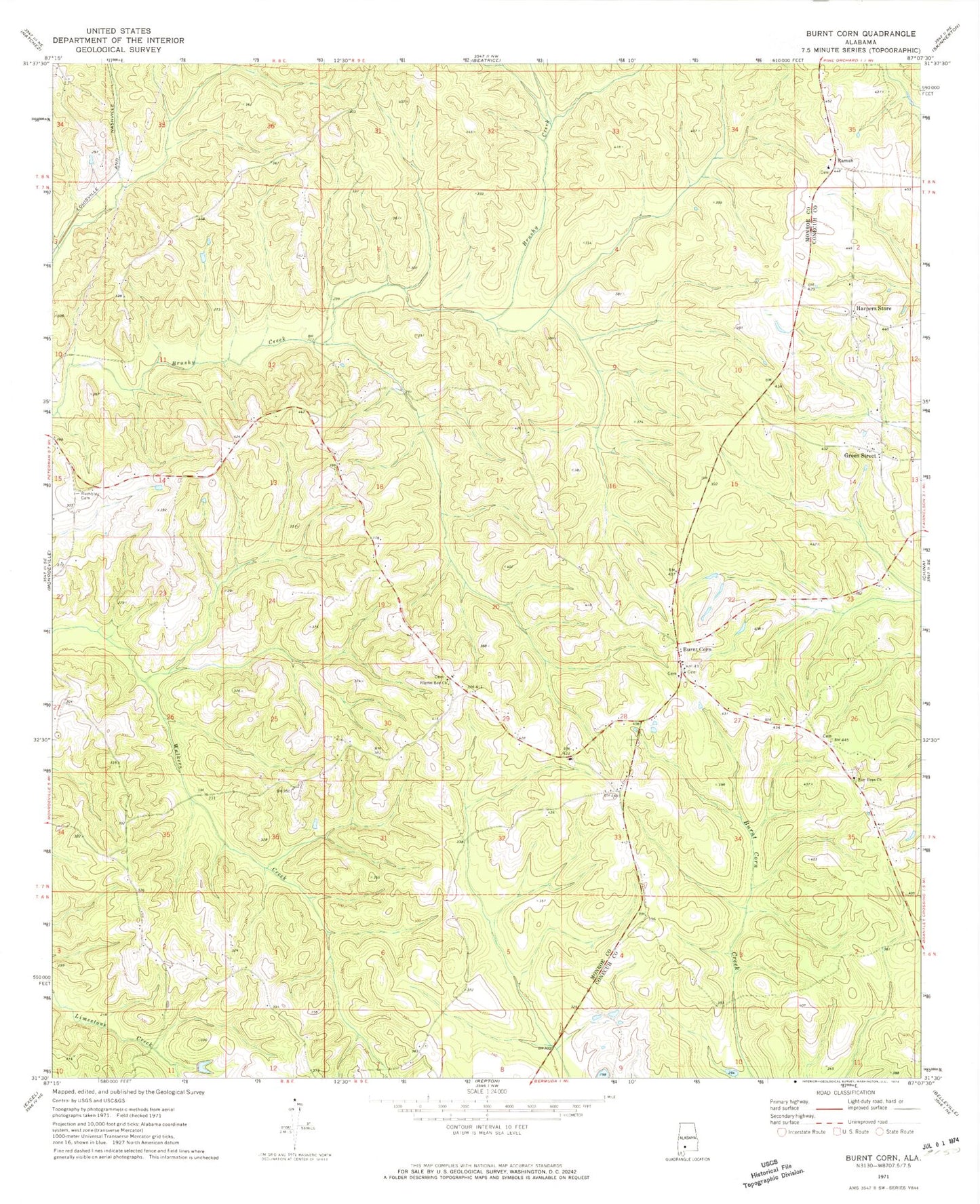
Classic USGS Burnt Corn Alabama 7.5'x7.5' Topo Map
Couldn't load pickup availability
Historical USGS topographic quad map of Burnt Corn in the state of Alabama. Map scale may vary for some years, but is generally around 1:24,000. Print size is approximately 24" x 27"
This quadrangle is in the following counties: Conecuh, Monroe.
The map contains contour lines, roads, rivers, towns, and lakes. Printed on high-quality waterproof paper with UV fade-resistant inks, and shipped rolled.
Contains the following named places: Academy Spring, Bethany Baptist Church, Bethany Cemetery, Bethel Church, Booker School, Burnt Corn, Burnt Corn Academy, Burnt Corn Community Church, Burnt Corn Methodist Church, Burnt Corn Volunteer Fire Department, Glendale Church, Green Street, Green Street Church, Greenfield School, Greys Store, Harpers Store, John Green Cemetery, Lee Cemetery, McKinney Branch, New Hope African Methodist Episcopal Church, New Hope Cemetery, Pilgrim Rest Church, Puryearville, Puryearville Cemetery, Puryearville Methodist Church, Ramah, Ramah Baptist Church, Ramah Cemetery, Rumbley Cemetery, Salem Baptist Church, Zion Church, ZIP Code: 36471