MyTopo
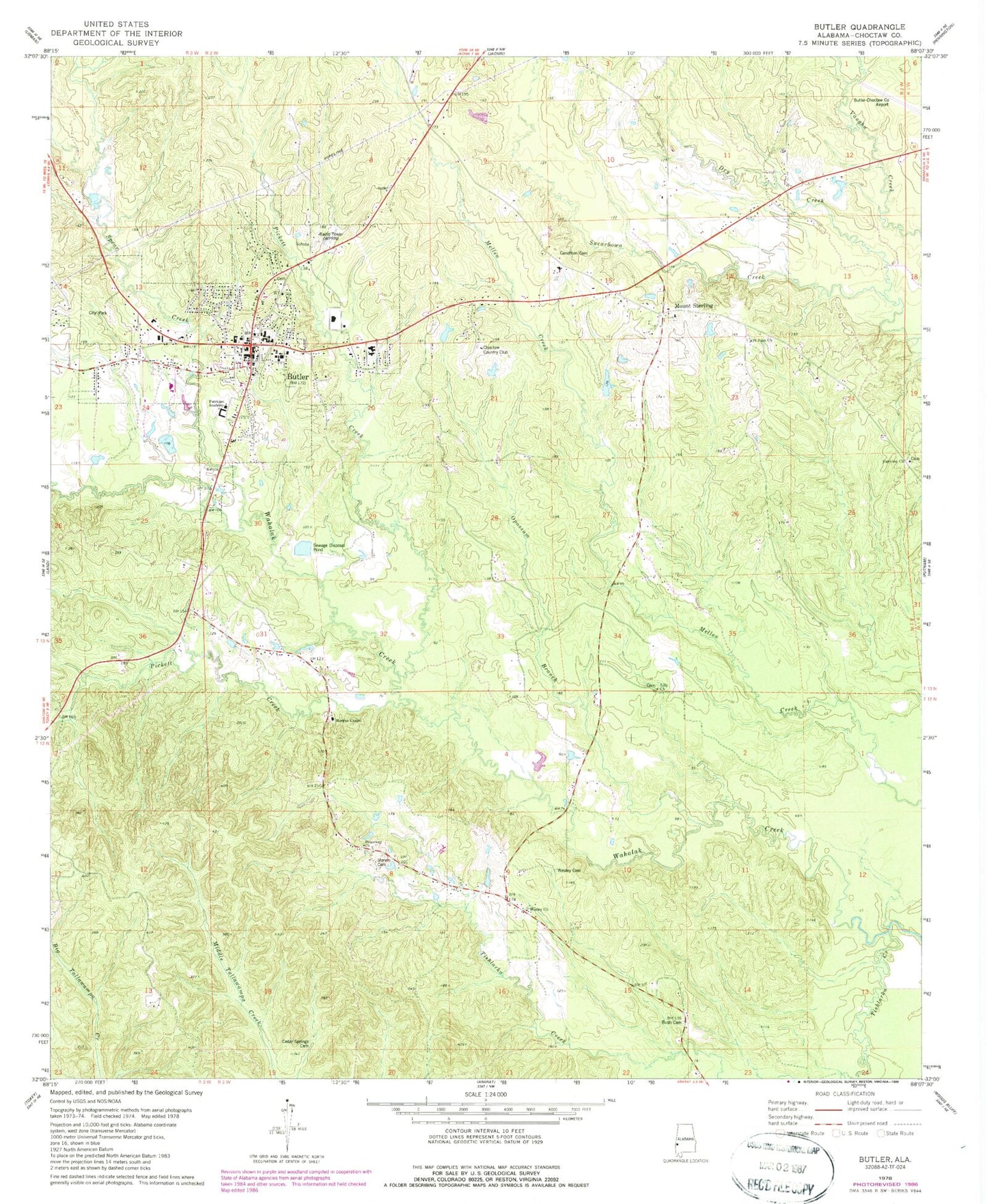
Classic USGS Butler Alabama 7.5'x7.5' Topo Map
Couldn't load pickup availability
Historical USGS topographic quad map of Butler in the state of Alabama. Map scale may vary for some years, but is generally around 1:24,000. Print size is approximately 24" x 27"
This quadrangle is in the following counties: Choctaw.
The map contains contour lines, roads, rivers, towns, and lakes. Printed on high-quality waterproof paper with UV fade-resistant inks, and shipped rolled.
Contains the following named places: Bush Cemetery, Butler, Butler City Cemetery, Butler City Hall, Butler Division, Butler Elementary School, Butler First United Methodist Church, Butler Police Department, Butler Post Office, Butler Volunteer Fire Department, Canathan Cemetery, Carnathan Mill, Cedar Spring School, Cedar Springs Cemetery, Choctaw Country Club, Choctaw County Courthouse, Choctaw County High School, Choctaw County Hospital, Choctaw County Public Library, Choctaw County Sheriff's Office, City of Butler Sewage Lagoon, City of Butler Sewage Lagoon Dam, Dry Creek, Fairview Baptist Church, Green Acres, Lily Baptist Church, Lily Cemetery, Marvin Cemetery, Mission School, Morgan Chapel, Morgan Chapel Baptist Church, Mount Sterling, Mount Sterling Baptist Church, Mount Sterling Community Center, Mount Sterling Methodist Church, Opossum Branch, Patrician Academy, Peaceway Assembly of God Church, Pickett Creek, Saint John Christian Methodist Episcopal Church, Salem Baptist Church, Skelton School, Spear Creek, Sykes Cemetery, Tishlarka Creek, Town of Butler, Wesley Cemetery, Wesley Chapel United Methodist Church, West Alabama Emergency Response Team, WPRN-AM (Butler), WQGL-FM (Butler)