MyTopo
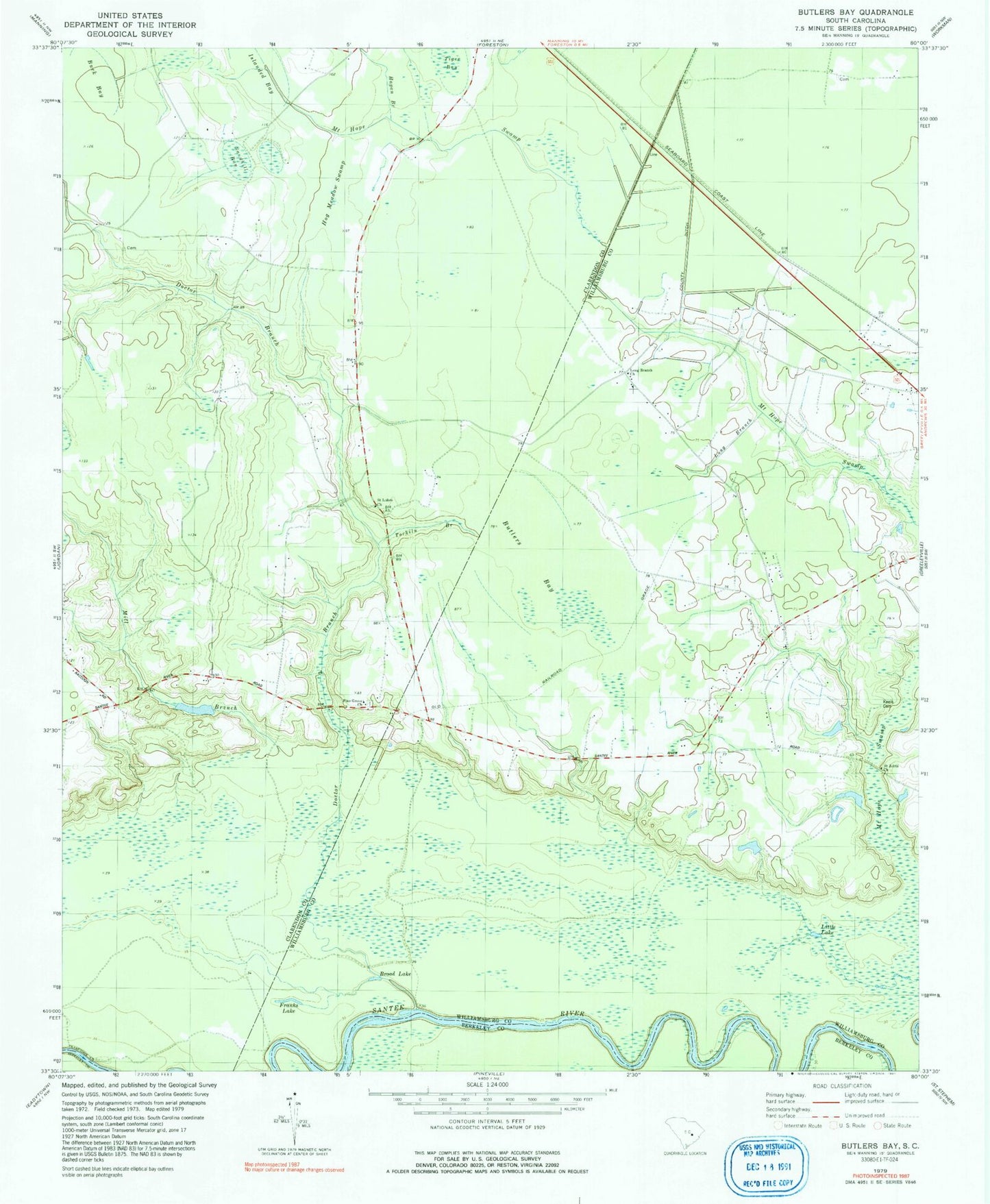
Classic USGS Butlers Bay South Carolina 7.5'x7.5' Topo Map
Couldn't load pickup availability
Historical USGS topographic quad map of Butlers Bay in the state of South Carolina. Map scale may vary for some years, but is generally around 1:24,000. Print size is approximately 24" x 27"
This quadrangle is in the following counties: Berkeley, Clarendon, Williamsburg.
The map contains contour lines, roads, rivers, towns, and lakes. Printed on high-quality waterproof paper with UV fade-resistant inks, and shipped rolled.
Contains the following named places: Broad Lake, Buck Bay, Butlers Bay, Doctor Branch, Doctor Hole, Franks Lake, Green Hill Church, Highland Creek, Hog Meadow Swamp, Hunter School, Islanded Bay, Keels Cemetery, Little Lake, Little Solomon Lake, Long Branch, Long Branch Church, Mill Branch, Mount Hope Swamp, Oak Grove Church, Pine Grove Church, Riggs Pond, Riggs Pond Dam D-3507, Saint Johns School, Saint Lukes Church, Sandhill Bay, Santee Rosenwald School, Tarkiln Branch, Tiger Bay, Torkiln Branch, ZIP Code: 29056