MyTopo
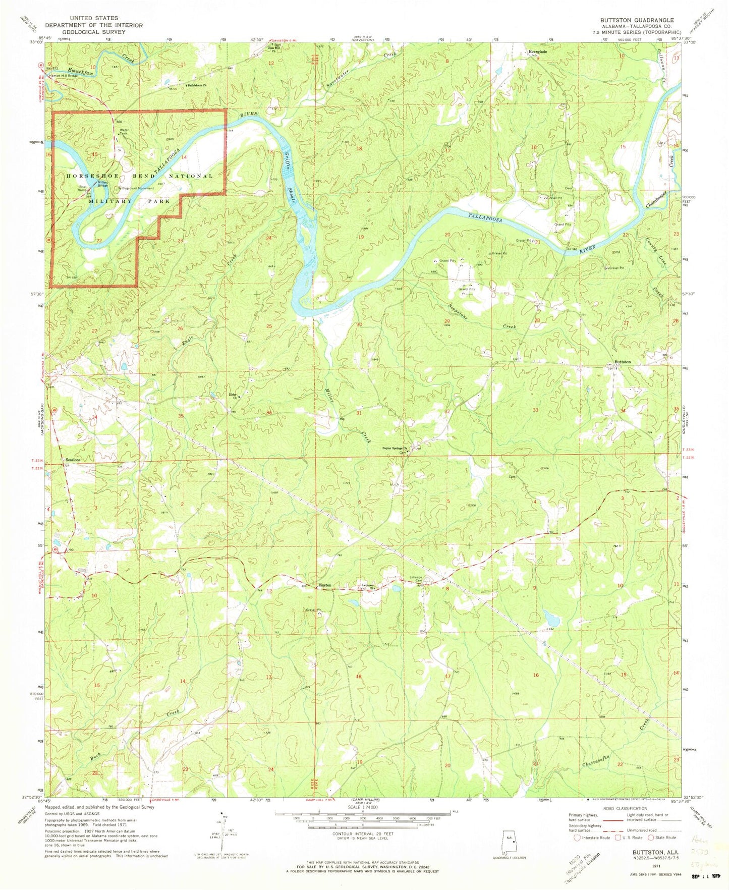
Classic USGS Buttston Alabama 7.5'x7.5' Topo Map
Couldn't load pickup availability
Historical USGS topographic quad map of Buttston in the state of Alabama. Map scale may vary for some years, but is generally around 1:24,000. Print size is approximately 24" x 27"
This quadrangle is in the following counties: Tallapoosa.
The map contains contour lines, roads, rivers, towns, and lakes. Printed on high-quality waterproof paper with UV fade-resistant inks, and shipped rolled.
Contains the following named places: Abernathy Prospects, Berry Mine, Bethlehem Church, Buttston, Buttston Baptist Church, Buttston Cemetery, Buttston School, Buttston Volunteer Fire Department, Carlton Mine, Chatahospee Creek, Cholocco Litabixee, County Line Creek, Eagle Creek, Easton, Elder Church, Elder School, Everglade, Everglade School, Galloway Creek, Germany Family Cemetery, Germany Ferry, Germanys Ferry Bridge, Gillam Cemetery, Griffin Ferry, Griffin Shoals, Hamlet, Hamlet Mill Bridge, Horseshoe Bend, Horseshoe Bend National Military Park, Howard Mine, Kidd Mine, Lake Howard, Lebanon Cemetery, Lebanon Church, Matilda, Matilda Ferry, Mica Hill Mine, Miller Creek, Millers Bridge, Millers Ferry, Niuyaka, Oakfuskee Council House, Oakfuskudshi, Poplar Springs Church, Popular Springs School, Punkin Hill Cemetery, Saunders Prospect, Schryer Dam, Sessions, Soapstone Creek, Sweetwater Creek, Swindall Dam, Swindall Lake, Vines Prospect, Washburne Prospect, Zion Hill Church, Zions Hill School