MyTopo
Classic USGS Caddo Alabama 7.5'x7.5' Topo Map
Couldn't load pickup availability
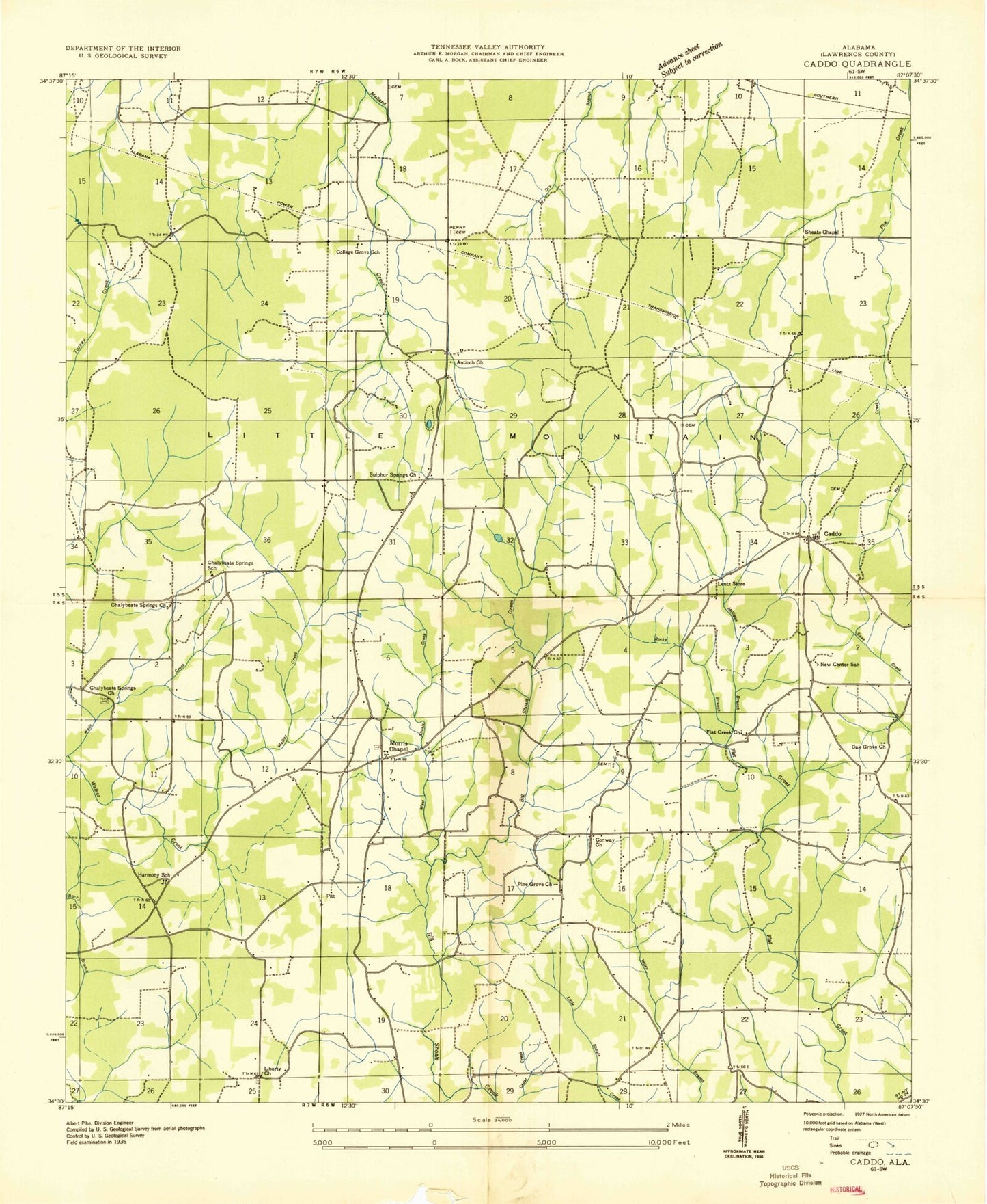
Historical USGS topographic quad map of Caddo in the state of Alabama. Map scale may vary for some years, but is generally around 1:24,000. Print size is approximately 24" x 27"
This quadrangle is in the following counties: Lawrence.
The map contains contour lines, roads, rivers, towns, and lakes. Printed on high-quality waterproof paper with UV fade-resistant inks, and shipped rolled.
Contains the following named places: Bald Knob, Bates Mountain, Black Bottom Branch, Blowing Spring, Blowing Spring Branch, Brown Hollow, Caddo, Caddo - Midway Fire and Rescue District, Cattail Pond, Chalybeate Fire and Rescue, Chalybeate Junior High School, Chalybeate Spring, Chalybeate Springs, Chalybeate Springs Church, Chicken Foot Mountain, College Grove Church, Conway Church, Deer Gap, Double Ponds, East Lawrence School, Flat Creek Church, Flat Rock, Goat Bluff, Hames - Clardy Cemetery, Harmony, Harmony Baptist Church, Holland Cemetery, Ivy Hollow, Kelly Cemetery, Liberty Church, Long Hollow, Midway, Midway School, Milligan Branch, Morris Chapel, Morris Chapel Division, Mount Olive School, Mount View Baptist Church, Naughan Creek, New Antioch Church of Christ, Oak Grove Church, Old Morris Chapel Cemetery, Penitentiary Hole, Penny Cemetery, Pine Grove Church, Pittsburg, Plainview School, Ready Spring, Resurrection Catholic Chapel Morris Chapel, Rocky Branch, Saltwell Bottom, Sheats Chapel, Sims Lake, Sims Lake Dam, Sivley Cemetery, Sulphur Spring, Sulphur Springs Church, Tanyard Hollow, Thrasher Cemetery, Union Hill Mountain, Union Hill School, United Church, Vaughan Cemetery, West Shoals Creek, Wiley Branch, ZIP Code: 35673