MyTopo
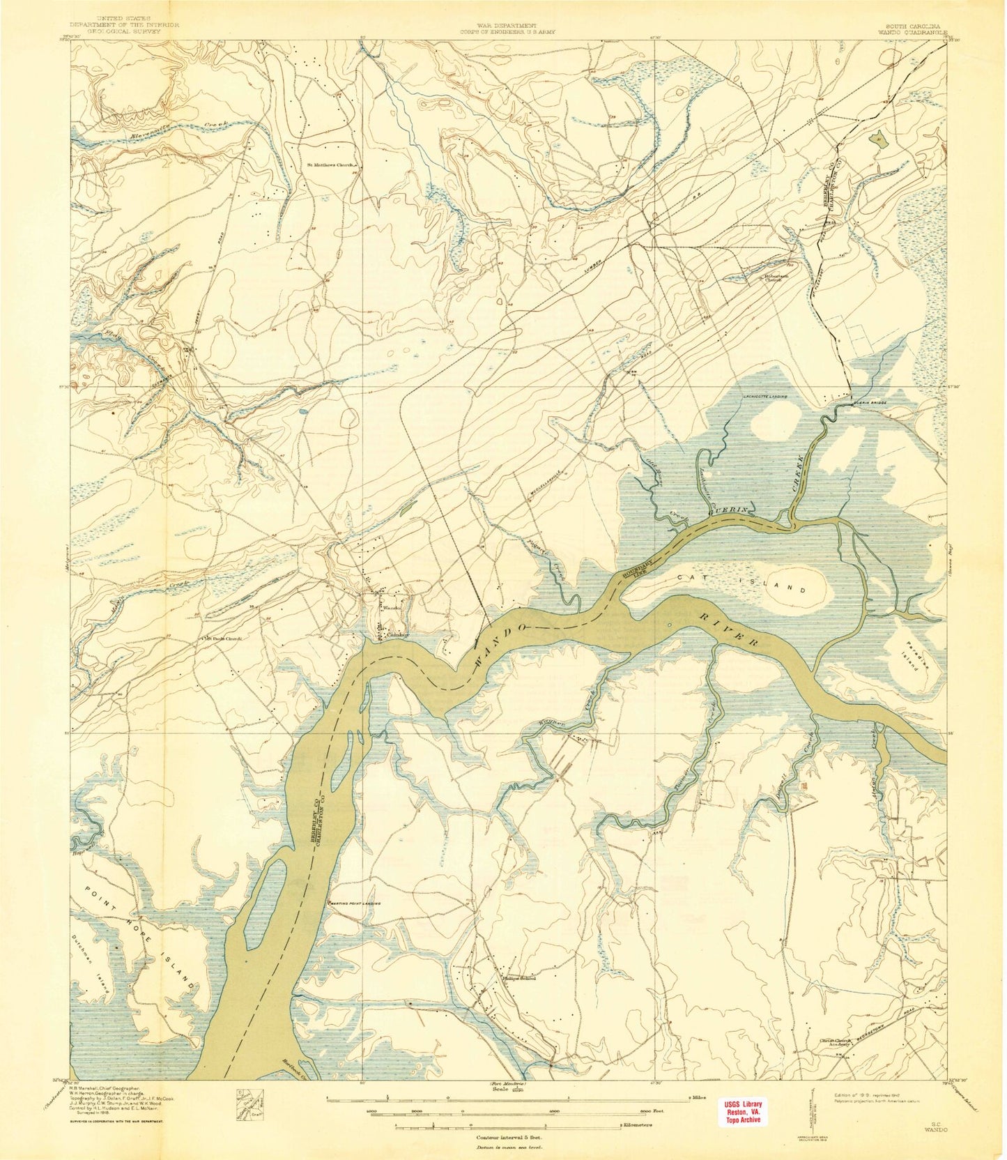
Classic USGS Cainhoy South Carolina 7.5'x7.5' Topo Map
Couldn't load pickup availability
Historical USGS topographic quad map of Cainhoy in the state of South Carolina. Map scale may vary for some years, but is generally around 1:24,000. Print size is approximately 24" x 27"
This quadrangle is in the following counties: Berkeley, Charleston.
The map contains contour lines, roads, rivers, towns, and lakes. Printed on high-quality waterproof paper with UV fade-resistant inks, and shipped rolled.
Contains the following named places: Alston Creek, Bethel Church, Brick Church Farm, Cainhoy, Cainhoy Rural Volunteer Fire Department Station 1, Cat Island, Charity Church, Charles Pinckney Elementary School, Darrell Creek, Darts Point, Deep Creek, Dutchman Island, Fogarty Creek, Goat Island, Gregorie School, Guerin Bridge, Guerin Creek, Horlbeck Creek, Huger Post Office, Johnfield Creek, Juba Island, Keith School, Lachicotte Creek, Laurel Hill Primary School, Little Johnson Creek, Martins Point Landing, McDowell Cemetery, Mill Creek, Mount Pleasant Fire Department Station 5, Mt Pleasant Regional Airport-Faison Field, Murphy Island, Nelliefield Creek Cemetery, O'Hare Point, Old House Creek, Old Vat, Paradise Island, Parker Island, Pepper Gully, Philip, Phillips School, Point Hope Island, Robertson Church, Saint Matthews Church, Saint Pauls Church, Saint Thomas Cemetery, Saint Thomas Church, Thomas C Cario Middle School, Three Log Bridge, Toomer Creek, Toomer Point, Trinity Church, Wagner Creek, Wagner Point, Wando, Wando Bridge, Wando Cemetery, Wando Division, Wando High School, Wando Lookout Tower, Wando Methodist Church, Wando Plantation, Wando School, White Point, ZIP Code: 29466