MyTopo
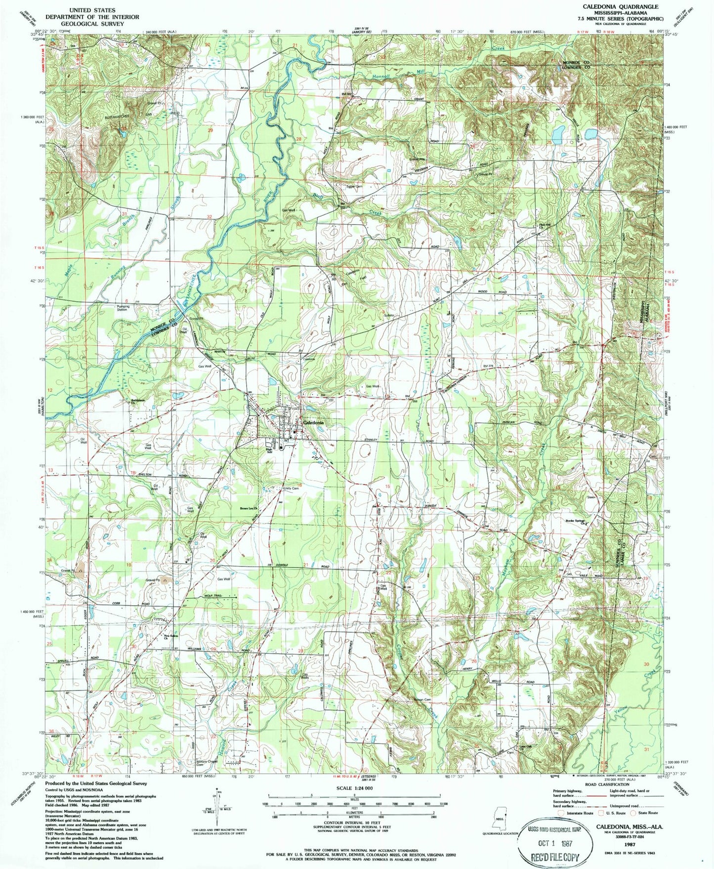
Classic USGS Caledonia Mississippi 7.5'x7.5' Topo Map
Couldn't load pickup availability
Historical USGS topographic quad map of Caledonia in the states of Mississippi, Alabama. Map scale may vary for some years, but is generally around 1:24,000. Print size is approximately 24" x 27"
This quadrangle is in the following counties: Lamar, Lowndes, Monroe.
The map contains contour lines, roads, rivers, towns, and lakes. Printed on high-quality waterproof paper with UV fade-resistant inks, and shipped rolled.
Contains the following named places: Ambrose Lake Dam, Baxters Store, Bethlehem Church, Bluff Creek, Border Springs, Border Springs Church, Brown Lee Church, Buttahatchee Gas Field, Caledonia, Caledonia Elementary School, Caledonia Gas Field, Caledonia High School, Caledonia Post Office, Cannons School, Cut Bank Creek, Dowdle School, Egger Cemetery, Flint Hill, Flint Hill Church, Gallagher Ferry, Honnoll Mill Creek, Kolbs Ferry, Liberty Church, Lone Oak Church, Lowndes County District 1 Volunteer Fire and Rescue Department Border Springs Station, Lowndes County District 1 Volunteer Fire and Rescue Department Caledonia Station, Mayhew Creek, New Salem Church, Rocky Valley School, Rowan Cemetery, Sturdivant Cemetery, Supervisor District 1, Swanzy, Town of Caledonia, Unity Cemetery, Washington County Court House, ZIP Code: 39740