MyTopo
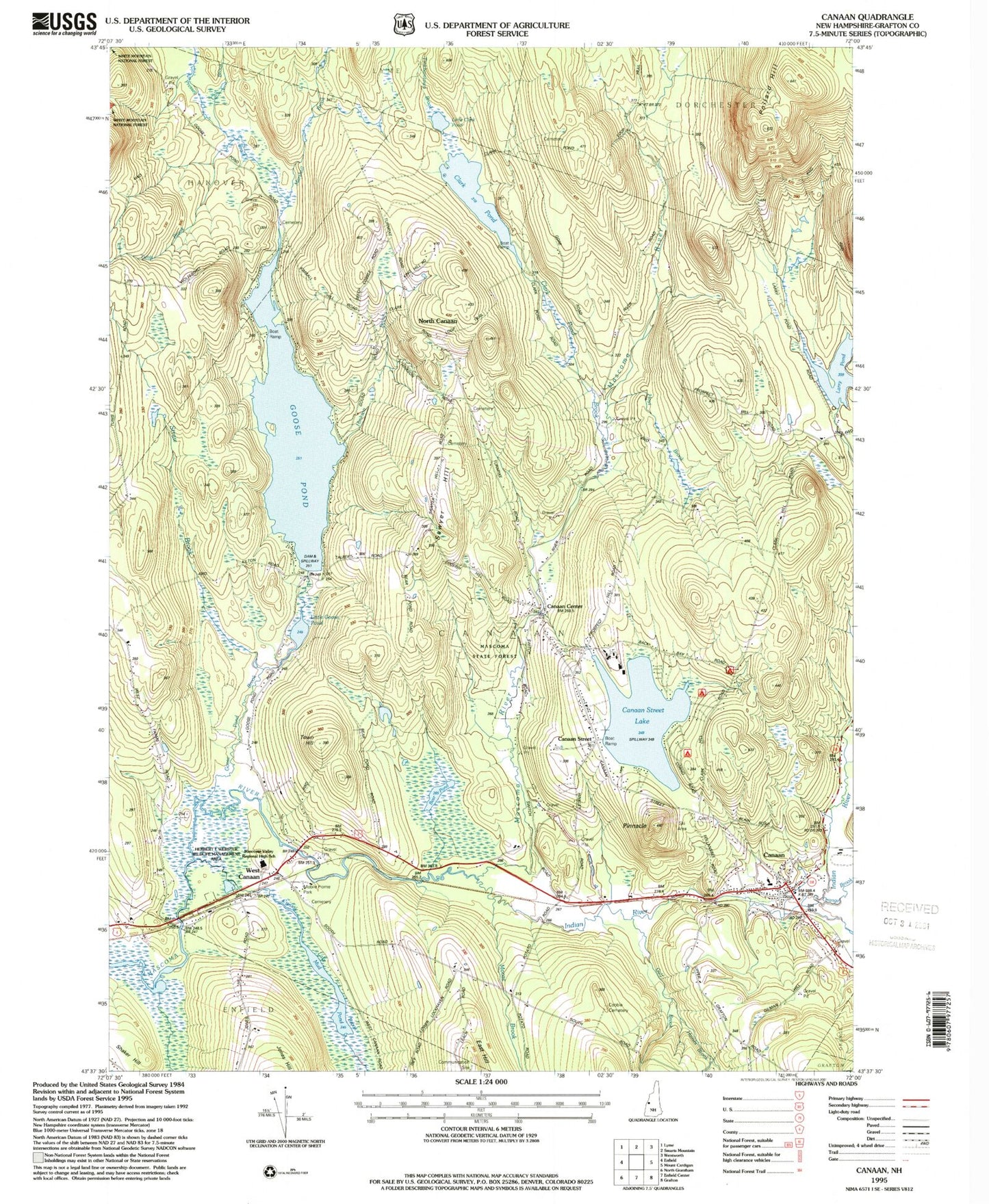
Classic USGS Canaan New Hampshire 7.5'x7.5' Topo Map
Couldn't load pickup availability
Historical USGS topographic quad map of Canaan in the state of New Hampshire. Typical map scale is 1:24,000, but may vary for certain years, if available. Print size: 24" x 27"
This quadrangle is in the following counties: Grafton.
The map contains contour lines, roads, rivers, towns, and lakes. Printed on high-quality waterproof paper with UV fade-resistant inks, and shipped rolled.
Contains the following named places: Bear Pond, Call Brook, Canaan, Canaan Center, Canaan Street, Canaan Street Lake, Clark Pond, Clark Pond Brook, Crystal Lake Brook, Goose Pond, Goose Pond Brook, Gulf Brook, Haines Brook, Halley School, Hinkson Brook, Hoyt Brook, Indian River, Lary Pond, Little Clark Pond, Little Goose Pond, Lovejoy Brook, Marshall Brook, Moose Brook, North Canaan School, Orange Brook, Pattee Station, Pollard Hill, Pressey Brook, Sawyer Hill, Straw Brook, Tinkhamtown Brook, Town Hill, Tunis Brook, Tunis School, West Canaan, West Farms School, Town of Canaan, Eastman Lake Dam, Eastman Pond, Goose Pond Dam, Canaan Elementary School, Canaan Post Office, Canaan Street Historic District, Canaan Town Library and Historical Museum, Canaan Union Academy (historical), Cardigan Mountain School, Williams Field, Moore Airfield, Canaan Christian School, Mascoma Valley Regional High School, Indian River School, Canaan Fire Department, Canaan Census Designated Place, Canaan First Aid Stabilization Team Squad, Canaan Police Dept