
MyTopo
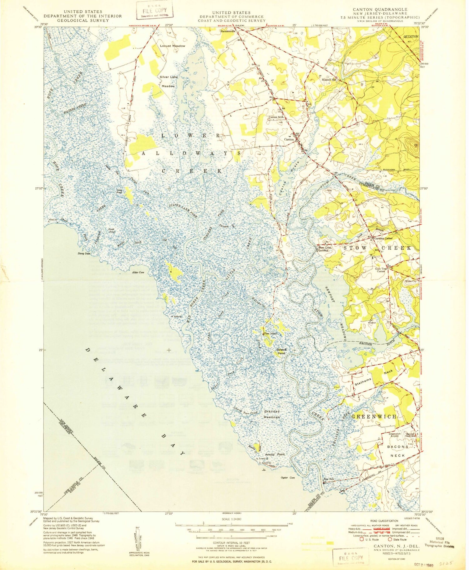
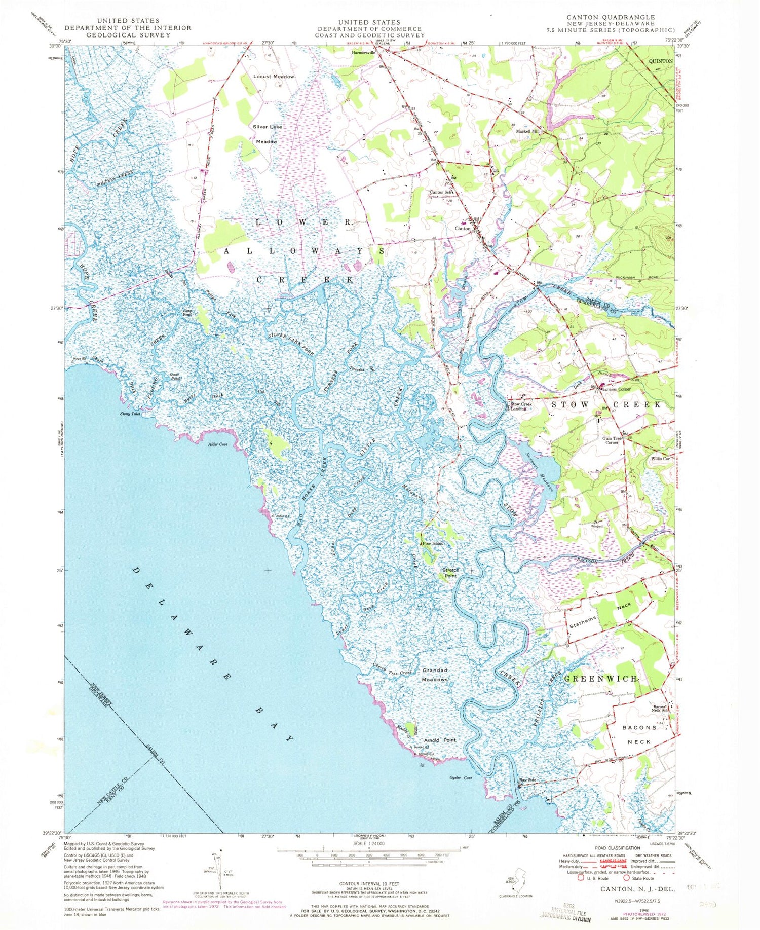
Classic USGS Canton New Jersey 7.5'x7.5' Topo Map
Couldn't load pickup availability
Historical USGS topographic quad map of Canton in the state of New Jersey. Map scale may vary for some years, but is generally around 1:24,000. Print size is approximately 24" x 27"
This quadrangle is in the following counties: Cumberland, Kent, New Castle, Salem.
The map contains contour lines, roads, rivers, towns, and lakes. Printed on high-quality waterproof paper with UV fade-resistant inks, and shipped rolled.
Contains the following named places: Alder Cove, Arnold Point, Bacons Neck, Bacons Neck School, Bay Side, Bucks Ditch, Canton, Canton Baptist Cemetery, Canton Drain, Canton School, Cat Gut, Cherry Tree Creek, Denn Branch, Devils Gut, Fishing Creek, Garrison Corner, Goose Pond, Grandad Meadows, Gum Tree Corner, Harmersville, Hidden Acres Farm Airport, Little Creek, Locust Meadow, Long Pond, Lower Alloways Creek Elementary School, Lower Alloways Creek Fire and Rescue Company Station 2, Lower Deep Creek, Mad Horse Creek, Mad Horse Creek Fish and Wildlife Management Area, Malapartis Creek, Maskells Mill, Maskells Millpond, Maskells Millpond Dam, Maskells Millpond Fish and Wildlife Management Area, Muddy Creek, Newport Meadows, Newport Meadows Seaplane Base, Oyster Cove, Pattys Fork, Phillips Creek, Pine Island, Raccoon Ditch, Shore Ditch, Silver Lake Fork, Silver Lake Meadow, Solters Creek, Stathems Neck, Stoe Creek Farm Airport, Stony Inlet, Stow Creek, Stow Creek Landing, Stretch Point, Taildragger Acres Airport, Terrapin Gut, Township of Lower Alloways Creek, Turner Fork, Upper Deep Creek, Willis Corner, ZIP Code: 08038


