
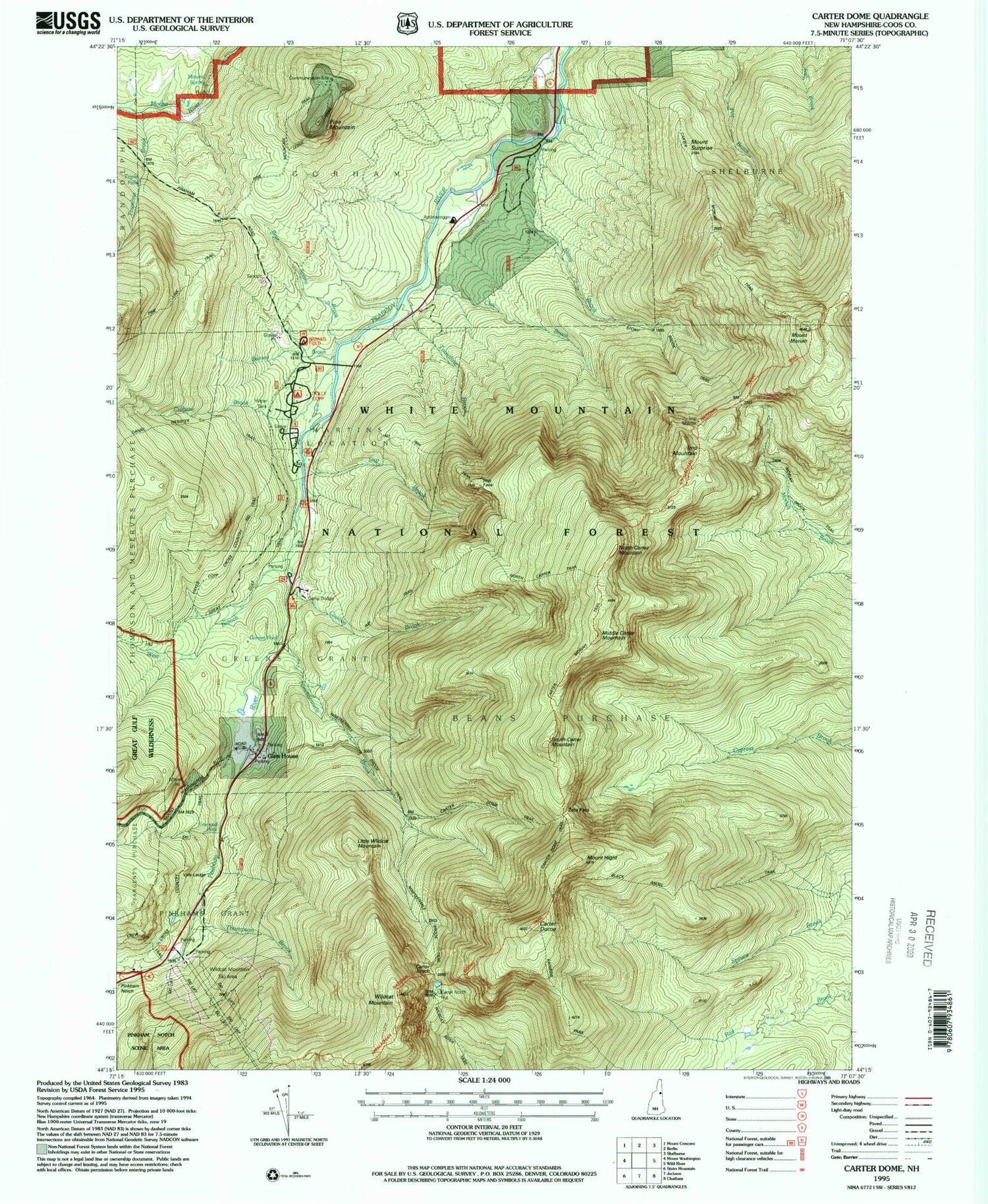
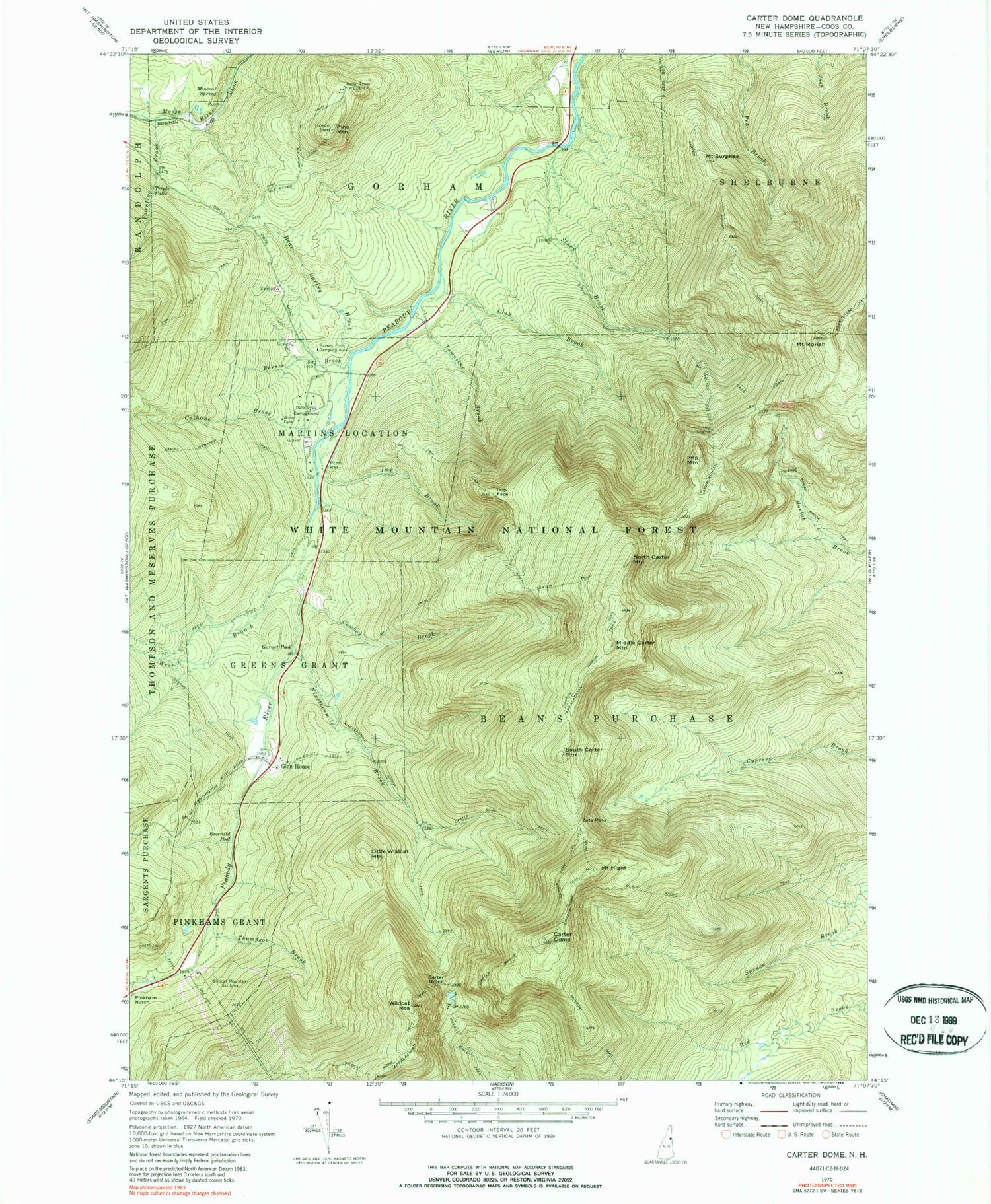
MyTopo
Classic USGS Carter Dome New Hampshire 7.5'x7.5' Topo Map
Couldn't load pickup availability
Historical USGS topographic quad map of Carter Dome in the state of New Hampshire. Typical map scale is 1:24,000, but may vary for certain years, if available. Print size: 24" x 27"
This quadrangle is in the following counties: Coos.
The map contains contour lines, roads, rivers, towns, and lakes. Printed on high-quality waterproof paper with UV fade-resistant inks, and shipped rolled.
Contains the following named places: Garnet Pool, Aqueduct Path, Barnes Brook, Bear Spring Brook, Black Angel Trail, Carter Dome, Carter Dome Trail, Carter Moriah Trail, Carter Notch, Clay Brook, Cowboy Brook, Crew Cut Trail, Culhane Brook, Daniel Webster Trail, Dolly Copp Campground, Emerald Pool, Glen House, Great Gulf Trail, Greens Grant, Mount Hight, Imp Brook, Imp Face, Imp Mountain, Imp Shelter, Imp Shelter Cut Off, Imp Trail, Little Wildcat Mountain, Martins Location, Middle Carter Mountain, Mount Moriah, Nineteen Brook, North Carter Mountain, North Carter Trail, Pine Link Trail, Pine Mountain, Pine Mountain Trail, Pinkhams Grant, Rainbow Trail, Restricted Ledge Trail, South Carter Mountain, Stony Brook, Stony Brook Trail, Mount Surprise, Thompson Brook, Townline Brook, Townline Brook, Triple Falls, West Branch Peabody River, Wildcat Mountain, Wildcat Ridge Trail, Wildcat River Trail, Zeta Pass, Vals Ledge, Barnes Field Camping Area, Nineteenmile Brook Trail, Peabody Field Picnic Area, Wildcat Mountain Ski Area, WEDB-TV (Berlin), Carter Notch Hut, RMC Brook Path, RMC Straight Path


