MyTopo
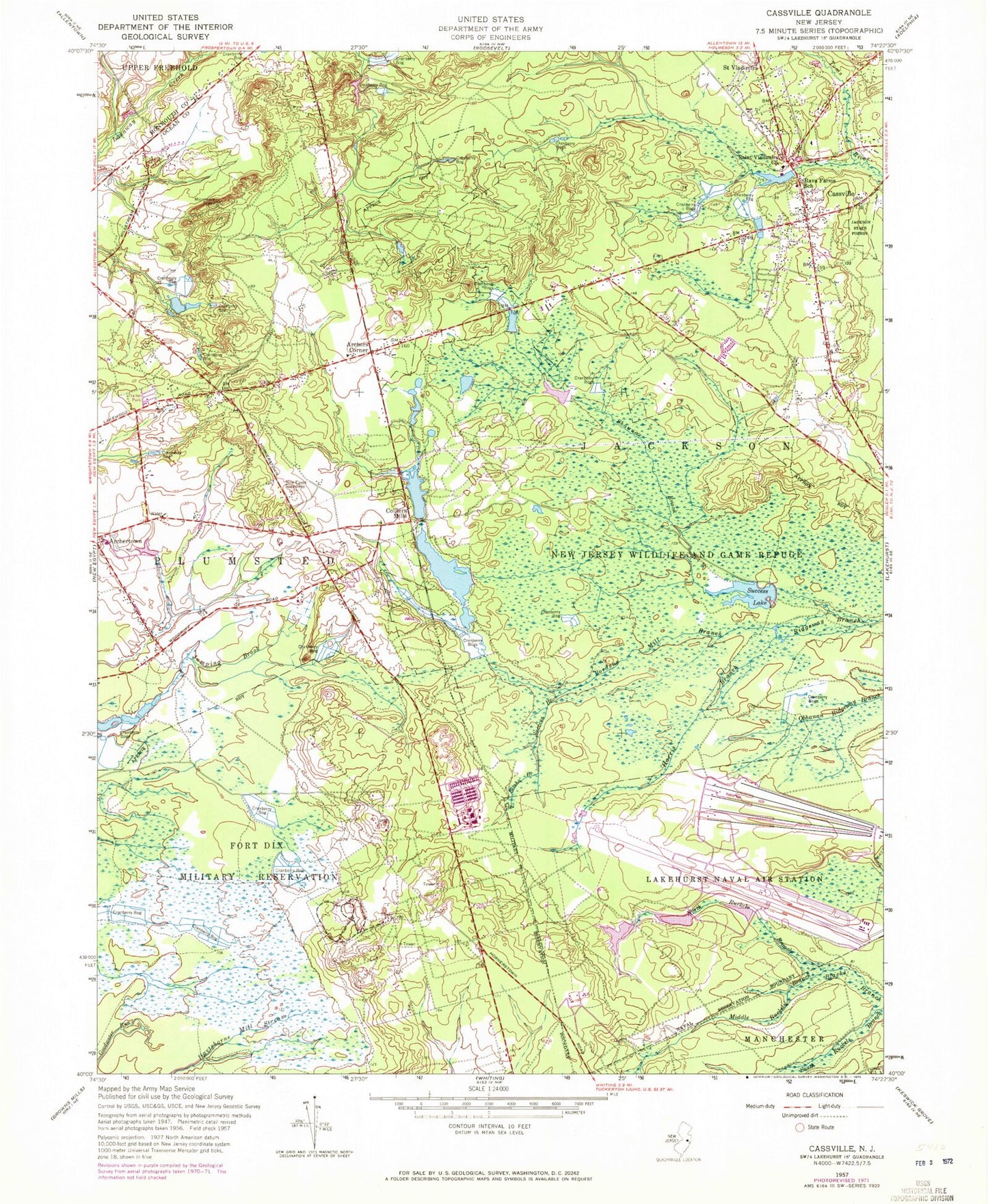
Classic USGS Cassville New Jersey 7.5'x7.5' Topo Map
Couldn't load pickup availability
Historical USGS topographic quad map of Cassville in the state of New Jersey. Typical map scale is 1:24,000, but may vary for certain years, if available. Print size: 24" x 27"
This quadrangle is in the following counties: Monmouth, Ocean.
The map contains contour lines, roads, rivers, towns, and lakes. Printed on high-quality waterproof paper with UV fade-resistant inks, and shipped rolled.
Contains the following named places: Archers Corner, Archertown, Bordens Mill Branch, Cassville, Colliers Mills, Elisha Branch, Harris Branch, Jackson State Forest, Middle Ruckels Branch, New Jersey Wildlife and Game Refuge, North Ruckels Branch, Rava Farms School, Saint Vladimirs, Saint Vladimir Memorial Church, Shannoc Brook, Success Branch, Success Lake, Township of Plumsted, Success, Woodruff, Midwood, Colliers Mills Wildlife Management Area, Woodair Estates, Colliers Lake, Colliers Mills Dam, Cassville Lake, Cassville Dam, Success Lake Dam, Colliers Mills Heliport, Cassville Crossroads Historic District, Gil Putnam Memorial Park, Cassville Volunteer Fire Company Station 56, Plumsted Pit