MyTopo
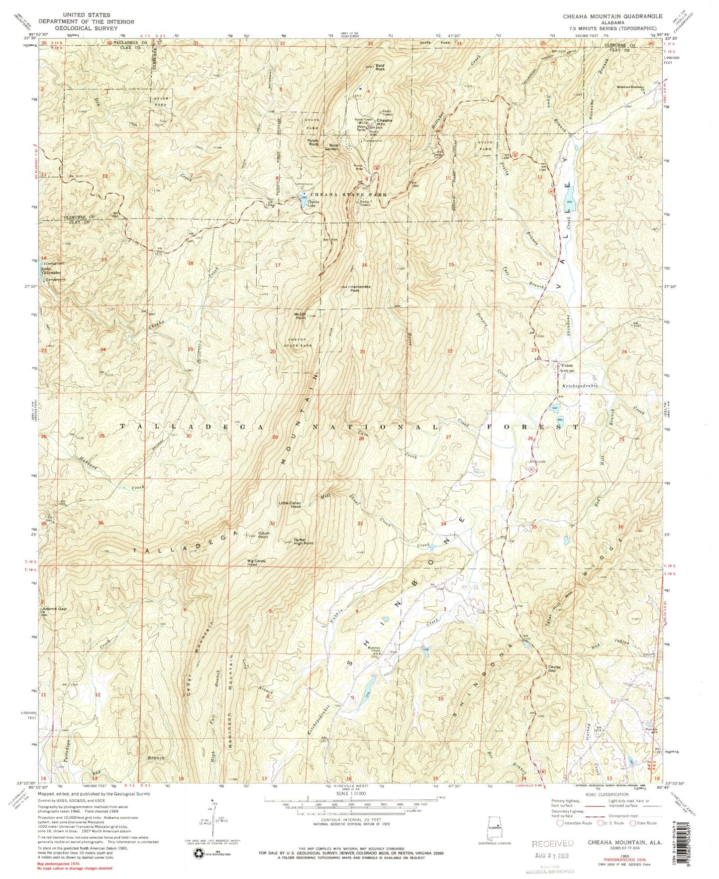
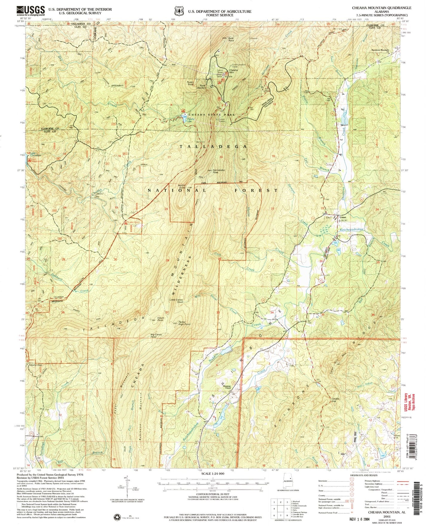
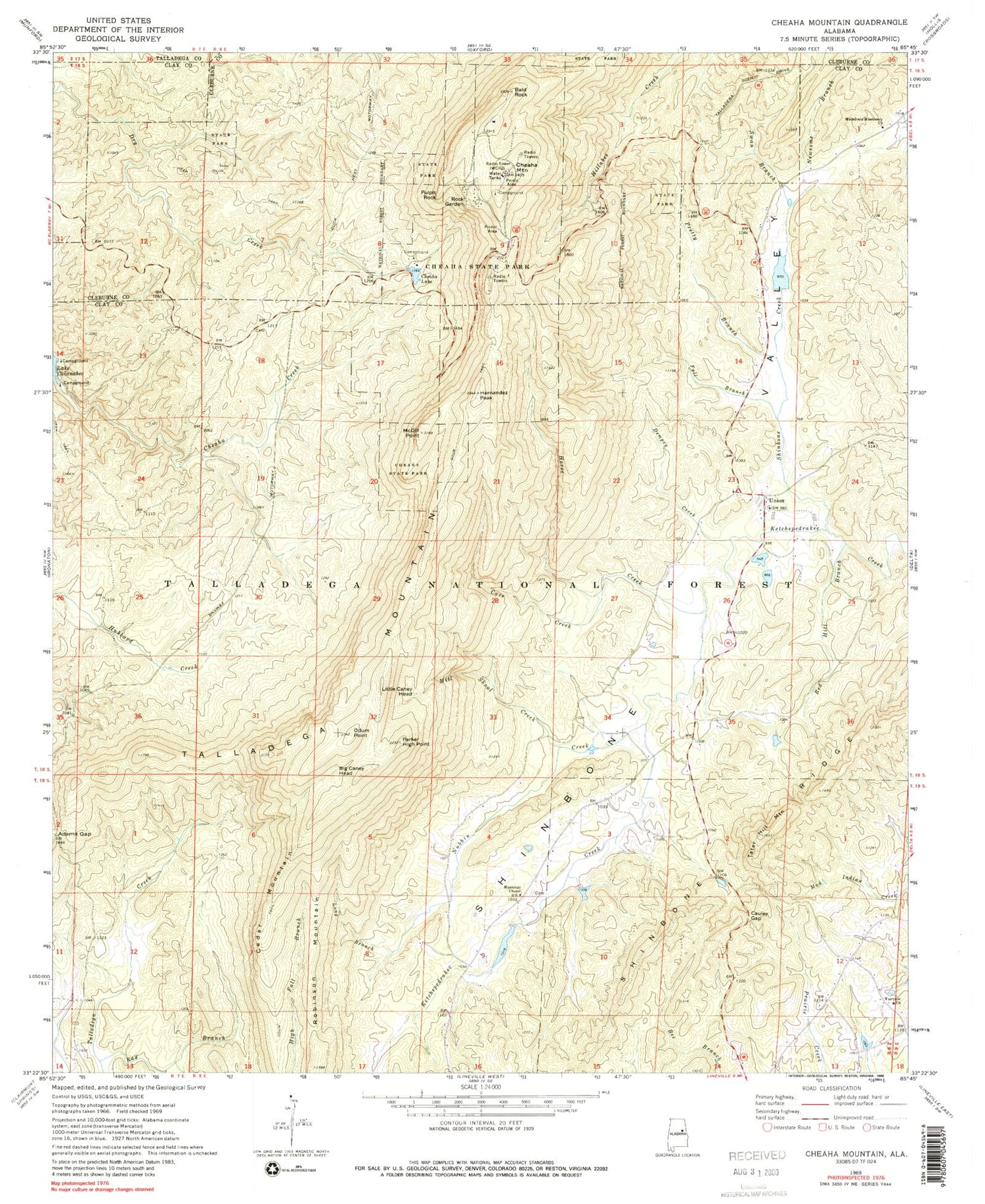
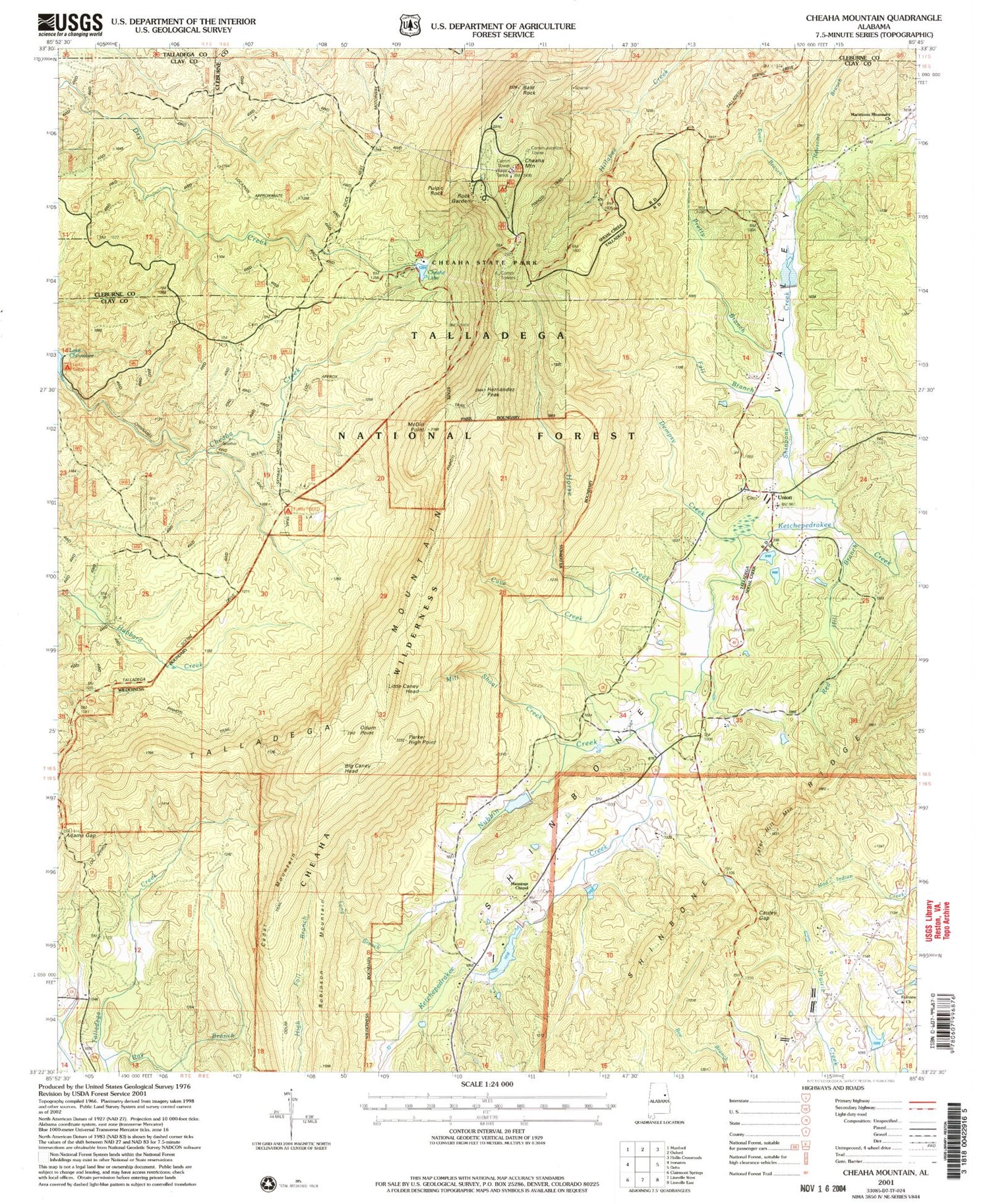
USGS Classic Cheaha Mountain Alabama 7.5'x7.5' Topo Map
Couldn't load pickup availability
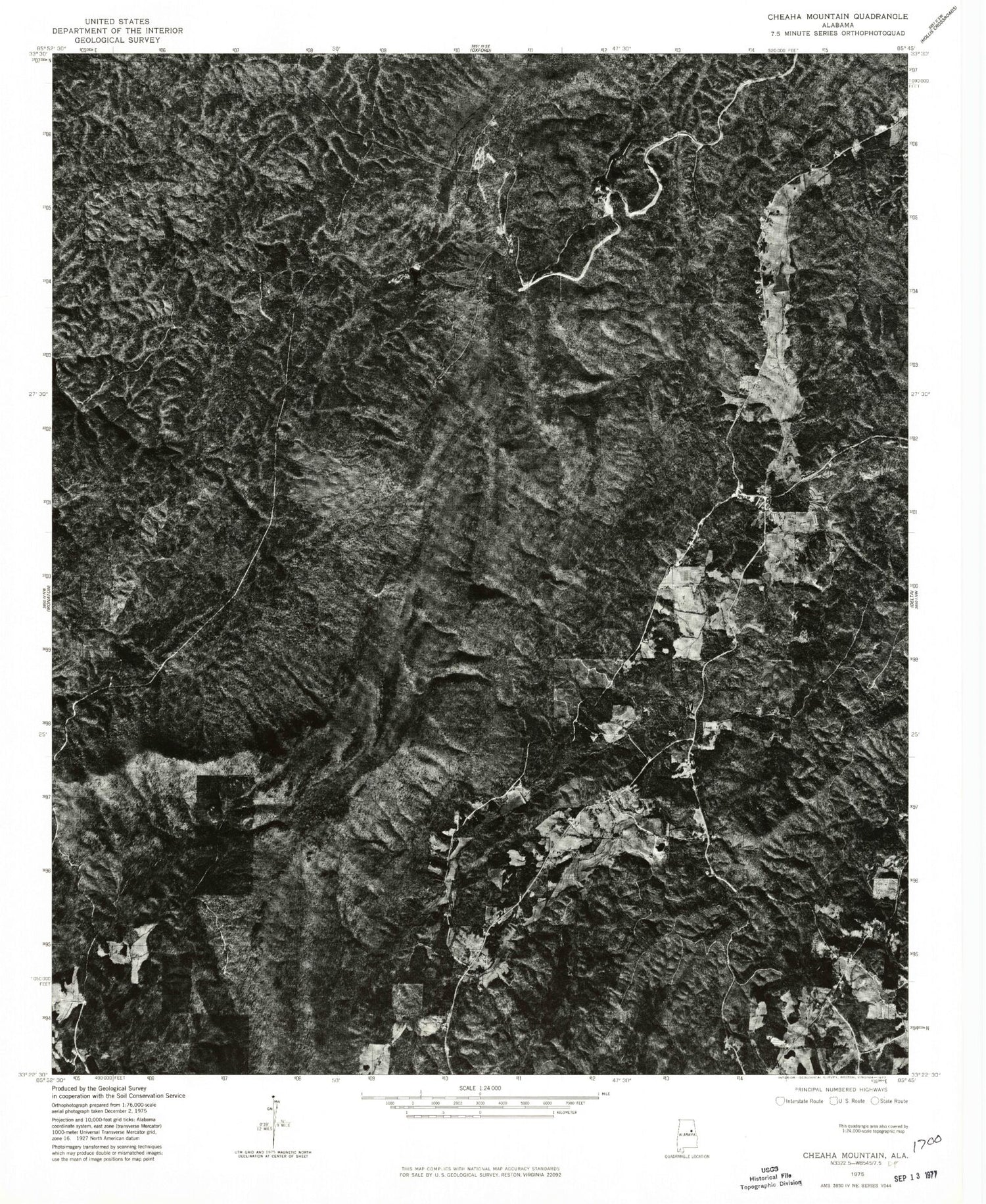
Historical USGS topographic quad map of Cheaha Mountainin the states of Alabama, Georgia. Scale: 1:24000. Print size: 24" x 27"
This quadrangle is in the following counties: Clay, Cleburne, Talladega.
The map contains contour lines, roads, rivers, towns, lakes, and grids including latitude / longitude and UTM / MGRS. Printed on high-quality waterproof paper with UV fade-resistant inks.
Contains the following named places: Barber Memorial School for Negro Girls (historical), Mount Zion Church, Dunlin Mine, Elder (historical), Dempsey Prospect, Dempsey Mine, Yates Mine, Ebenezer Church (historical), Adams Gap, Bald Rock, Big Caney Head, Cauley Gap, Cave Creek, Cedar Mountain, Cheaha Lake, Cheaha Mountain, Cheaha State Park, Dempsy Creek, Fairview Church, Fall Branch, Hernandez Peak, Horse Creek, Little Caney Head, Long Branch, Macedonia Missionary Church, Mannings Chapel, McDill Point, Mill Shoal Creek, Newsome Branch, Nubbin Creek, Odum Point, Odum Trail, Parker High Point, Pretty Branch, Pulpit Rock, Ray Branch, Red Hill Branch, Robinson Mountain, Rock Garden, Shinbone Creek, Shinbone Valley, Swan Branch, Tater Hill Mountain, Union, WCIQ-TV (Mount Cheaha), Bonner Lake, Burchfield Lake, Headricks Lake, Lake Henry, Center Hill School (historical), Dean (historical), Dowdy Chapel School (historical), Shinbone (historical), Shinbone Gin (historical), Smiths Mill (historical), Union Church, Emory Gap, Brown Prospect, Dye Prospect, Freeman Pit, M and G Mine, McNamara Mine, Smith Mine, M and G Number Two Mine, McKay Prospect, Liberty Mine, Cheaha Wilderness, Mannings Chapel Cemetery, Talladega National Forest, Lineville Division, Ebenezer Cemetery, Union Cemetery, Talladega Mountain, Shinbone Valley Volunteer Fire Department, Shinbone Ridge, Talladega National Forest