MyTopo
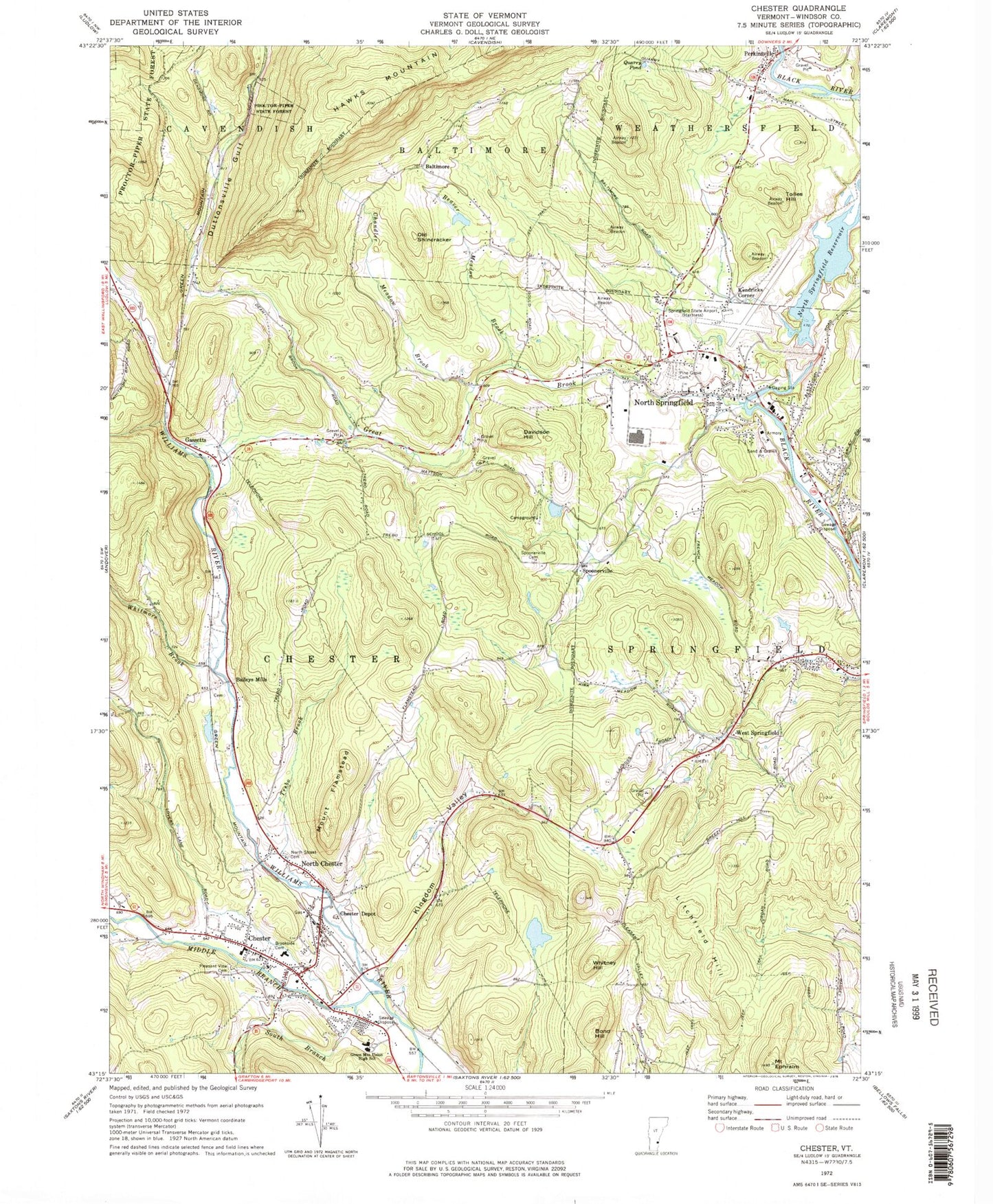
Classic USGS Chester Vermont 7.5'x7.5' Topo Map
Couldn't load pickup availability
Historical USGS topographic quad map of Chester in the state of Vermont. Typical map scale is 1:24,000, but may vary for certain years, if available. Print size: 24" x 27"
This quadrangle is in the following counties: Windsor.
The map contains contour lines, roads, rivers, towns, and lakes. Printed on high-quality waterproof paper with UV fade-resistant inks, and shipped rolled.
Contains the following named places: Baileys Mills, Baltimore, Beaver Meadow Brook, Bond Hill, Brookside Cemetery, Chandler Meadow Brook, Chester, Chester Depot, Davidson Hill, Duttonville Gulf, Mount Ephraim, Mount Flamstead, Gassetts, Great Brook, Green Mountain Union High School, Hawks Mountain, Kendricks Corner, Kingdom Valley, Litchfield Hill, Middle Branch Williams River, North Chester, North Springfield, North Springfield Reservoir, North Street Cemetery, Old Shincracker, Perkinsville, Pine Grove Cemetery, Pleasant View Cemetery, Proctorsville Gulf, Quarry Pond, South Branch Williams River, Spoonerville Cemetery, Tolles Hill, Trebo Brook, West Springfield, Whitmore Brook, Whitney Hill, Spoonerville, Hartness State Airport (Springfield), Town of Baltimore, Town of Chester, North Springfield Dam, Advent Christian Church, Baileys Mills Cemetery, Bailey Mills School (historical), Baltimore Cemetery, Baltimore School (historical), Chandler School (historical), Chester - Andover Elementary School, Chester Congregational Church, Chester Post Office, Chester Reservoir, Downers Covered Bridge, Field Number 1-Day Cemetery, Field Number 2 Cemetery, First Baptist Church, First Universalist Parish Church, Grout Cemetery, Hidden Valley Campground, North Springfield Baptist Church, North Springfield Bog, North Springfield Industrial Park, North Springfield Lake Recreation Area, North Springfield Post Office, Perkinsville Community Church, Saint Josephs Church, Saint Marys Cemetery, Springfield Art and Historical Society Library, Springfield Art and Historical Society Building, Springfield Art and Historical Society Museum, Springfield Nature Area, Trebo School (historical), Universalist Church, Weathersfield Elementary School, West Springfield School (historical), Pleasant Valley School (historical), Chester Fire Department, Chester Census Designated Place, Village of Perkinsville (historical), Windsor Southwest Supervisory Union, North Springfield Census Designated Place, Chester Police Department, Perkinsville Census Designated Place