MyTopo
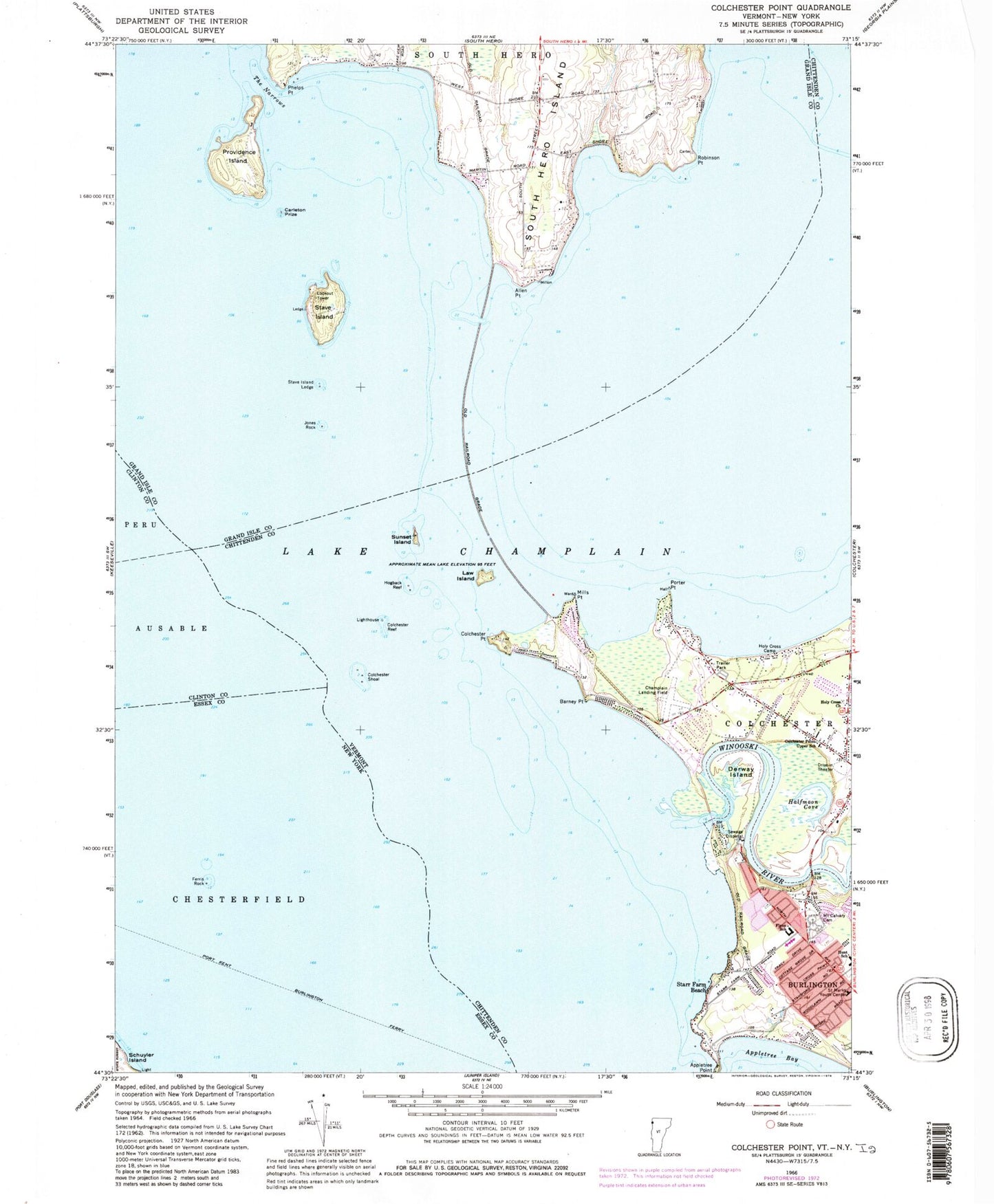
Classic USGS Colchester Point Vermont 7.5'x7.5' Topo Map
Couldn't load pickup availability
Historical USGS topographic quad map of Colchester Point in the states of Vermont, New York. Typical map scale is 1:24,000, but may vary for certain years, if available. Print size: 24" x 27"
This quadrangle is in the following counties: Chittenden, Clinton, Essex, Grand Isle.
The map contains contour lines, roads, rivers, towns, and lakes. Printed on high-quality waterproof paper with UV fade-resistant inks, and shipped rolled.
Contains the following named places: Lake Champlain, Allen Point, Barney Point, Colchester Point, Porters Point Elementary School, Colchester Reef, Colchester Shoal, Derway Island, John J Flynn Elementary School, Halfmoon Cove, Hogback Reef, Holy Cross Camp, Holy Cross Church, Jones Rock, Law Island, Mills Point, Mount Calvary Cemetery, Phelps Point, Porter Point, Providence Island, Robinson Point, Saint Marks Youth Center, Starr Farm Beach, Stave Island, Stave Island Ledge, Sunset Island, The Narrows, Winooski River, Camp Hochelaga, Camp Skyland, Thayer Beach, Mayes Boat Landing Ramp, Bernard J Leddy Park, Champlain Landing Field (historical), Allenholm Airport, Stave Island Seaplane Base, Carleton Prize, Camp Saint Joseph, Heineberg Bridge, Holy Cross Cemetery, Ohavi Zedek Cemetery, Malletts Bay Fire Department, Burlington Fire Department Station 4, Sunset Drive-In, Ferris Rock, Port Kent Burlington Ferry