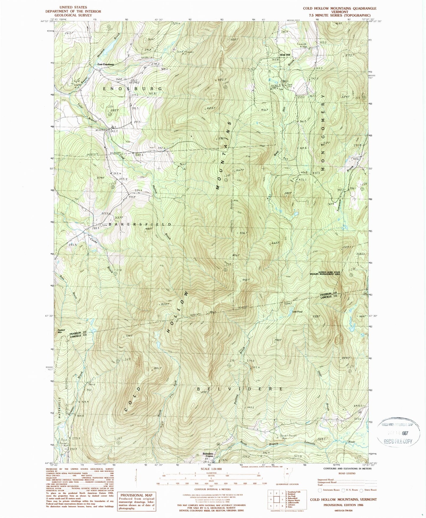
MyTopo
Classic USGS Cold Hollow Mountains Vermont 7.5'x7.5' Topo Map
Couldn't load pickup availability
Historical USGS topographic quad map of Cold Hollow Mountains in the state of Vermont. Map scale may vary for some years, but is generally around 1:24,000. Print size is approximately 24" x 27"
This quadrangle is in the following counties: Franklin, Lamoille.
The map contains contour lines, roads, rivers, towns, and lakes. Printed on high-quality waterproof paper with UV fade-resistant inks, and shipped rolled.
Contains the following named places: Beaver Meadow Brook, Belvidere Center, Chamberlain Cemetery, Clapp Cemetery, Cold Hollow Brook, Cold Hollow Mountains, Cook Cemetery, Cooks School, East Enosburg, Hodgkins-Lackey Hill, Lost Pond, Otter Brook, Peaked Mountain, Perkins Brook, Rattling Brook, Town of Belvidere, West Hill, West Hill Cemetery, West Hill Covered Bridge, ZIP Codes: 05441, 05442