
MyTopo
Classic USGS Columbus New Jersey 7.5'x7.5' Topo Map
Couldn't load pickup availability
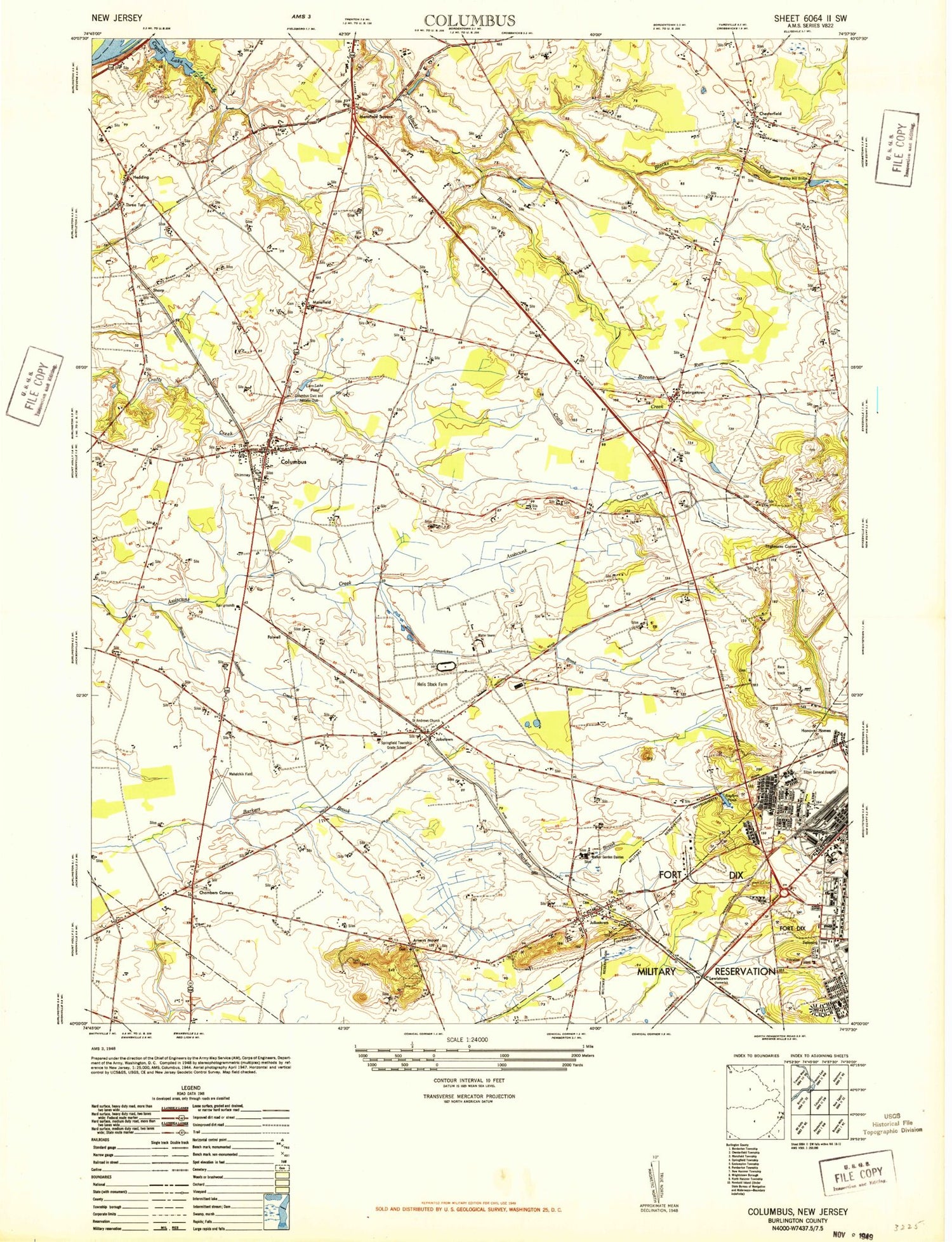
Historical USGS topographic quad map of Columbus in the state of New Jersey. Map scale may vary for some years, but is generally around 1:24,000. Print size is approximately 24" x 27"
This quadrangle is in the following counties: Burlington.
The map contains contour lines, roads, rivers, towns, and lakes. Printed on high-quality waterproof paper with UV fade-resistant inks, and shipped rolled.
Contains the following named places: Annaricken Brook, Arneys Mount, Assiscunk Branch, Bacons Run, Borough of Wrightstown, Carslake Pond, Chambers Corners, Chesterfield, Chesterfield Elementary School, Chesterfield Emergency Squad, Chesterfield Hose Company Station 262, Chesterfield Township Police Department, Colliers Pond, Columbus, Columbus Cemetery, Columbus Civic and Athletic Club, Columbus Post Office, Crystal Lake, Eastampton Emergency Squad, Eastampton Township Police Department, Fern Brook, Folwell, Fort Dix Post Office, Franklin Fire Company, Georgetown, Hampton Behavioral Health Center, Hedding, Jobstown, Jobstown Census Designated Place, Jobstown Post Office, John Hydock Elementary School, Juliustown, Juliustown Census Designated Place, Juliustown Post Office, Juliustown Volunteer Fire Company, Kuser Pond, Lewistown, Mansfield, Mansfield Ambulance, Mansfield Square, Mansfield Township Elementary School, Mansfield Township Police Department, Mount Holly Speedway, Mount Pisgah, Northern Burlington County Regional High School, Northern Burlington County Regional Middle School, Pine Lane, Redwing Airport, Saint Andrews Church, Saylors Pond, Sharp, Springfield, Springfield Township Elementary School, Springfield Township Emergency Medical Services, Springfield Township Fire Company, Springfield Township Police Department, State of New Jersey, Tilghmans Corner, Township of Chesterfield, Township of Mansfield, Township of Springfield, Wallace Mill, Wallace Mill Dam, Wallace Mill Pond, Wrightstown Volunteer Fire Company 1, ZIP Codes: 08022, 08041, 08042, 08505, 08515


