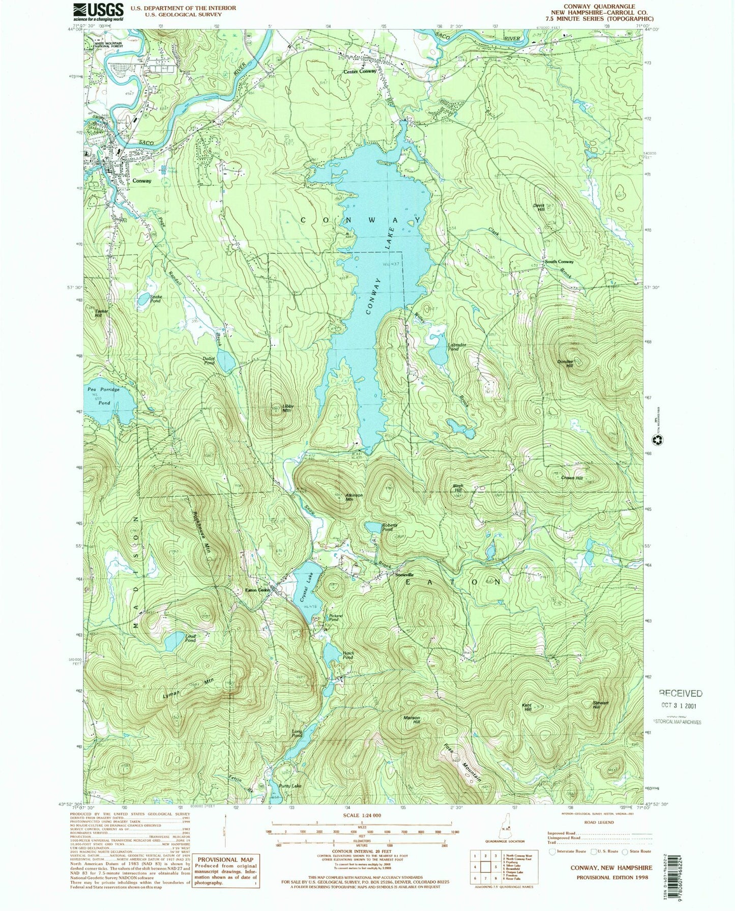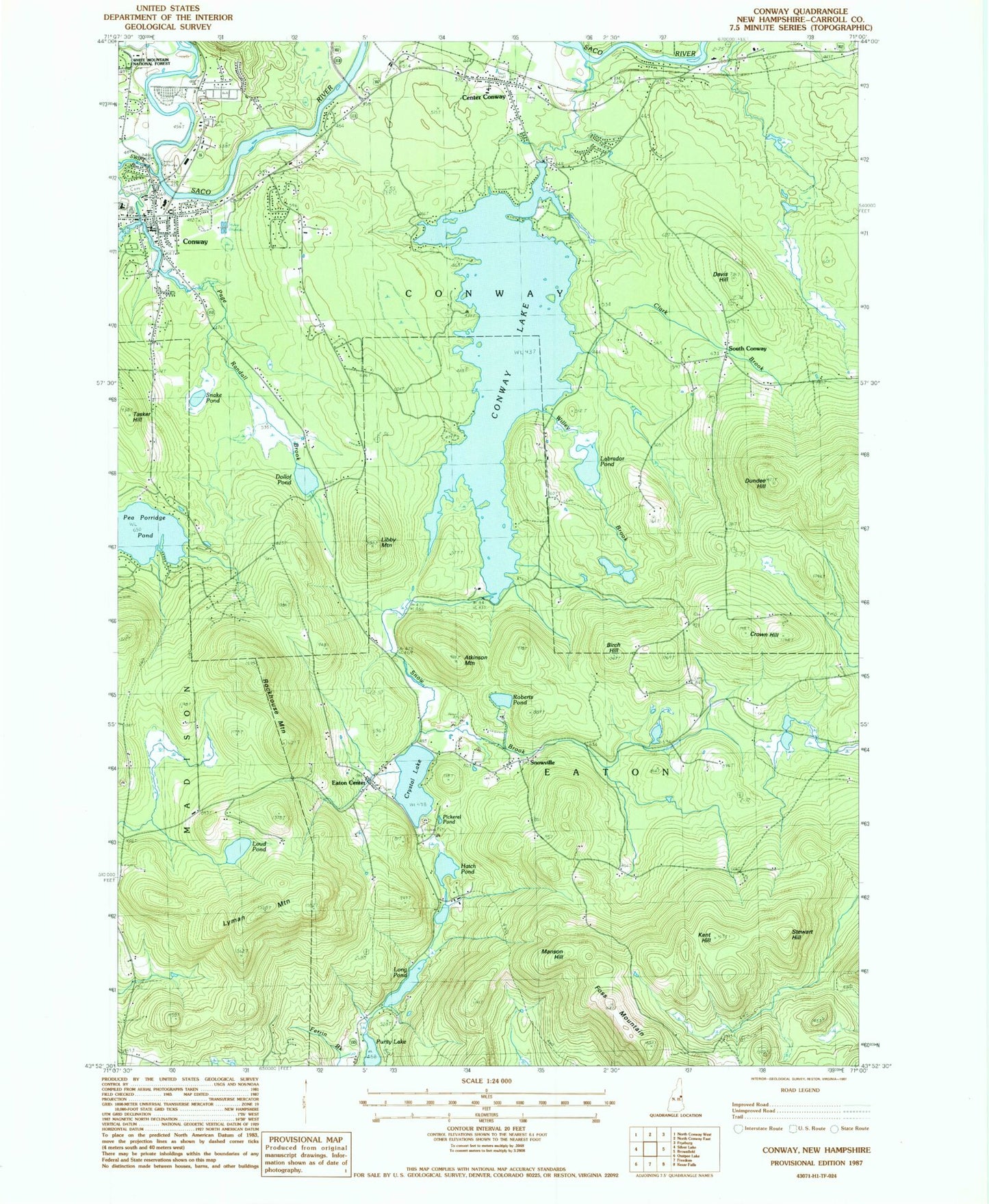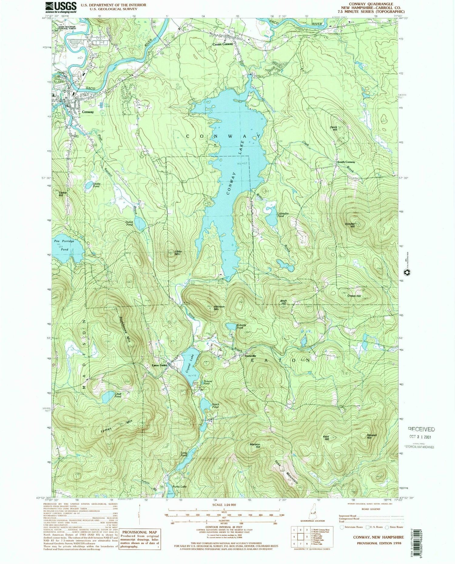

MyTopo
Classic USGS Conway New Hampshire 7.5'x7.5' Topo Map
Couldn't load pickup availability
Historical USGS topographic quad map of Conway in the state of New Hampshire. Typical map scale is 1:24,000, but may vary for certain years, if available. Print size: 24" x 27"
This quadrangle is in the following counties: Carroll.
The map contains contour lines, roads, rivers, towns, and lakes. Printed on high-quality waterproof paper with UV fade-resistant inks, and shipped rolled.
Contains the following named places: Atkinson Mountain, Birch Hill, Center Conway, Clark Brook, Conway, Conway Lake, Conway Village Cemetery, Crown Hill, Crystal Lake, Davis Hill, Dollof Pond, Dundee Hill, Eaton Center, Eaton School, Foss Mountain, Grove Brook, Hatch Pond, Kent Hill, Labrador Pond, Libby Mountain, Long Pond, Loud Pond, Lyman Mountain, Manson Hill, Page Randall Brook, Pea Porridge Pond, Pickerel Pond, Potter Cemetery, Roberts Pond, Rockhouse Mountain, Snake Pond, Snow Brook, Snowville, South Conway, Stewart Hill, Swift River, Tasker Hill, Willey Brook, WBNC-AM (Conway), WMLY-FM (Conway), Town of Eaton, Conway Lake Dam, Pequawket Power Company Dam, Center Conway Post Office, Conway Crossing Factory Stores Shopping Center, Conway Elementary School, Conway Public Library, Conway Village Congregational Church, Eaton Center Post Office, Pine Tree Elementary School, Saco River Covered Bridge, Saint Margaret Anglican Church, Snowvillage Ski Touring Center, Swift River Bridge, Valley Christian Church, Conway Census Designated Place, Conway Area Academic Center, Cady Memorial School, Conway Village Fire Department, Center Conway Fire Department, Hatches Orchard, Center Conway Cemetery