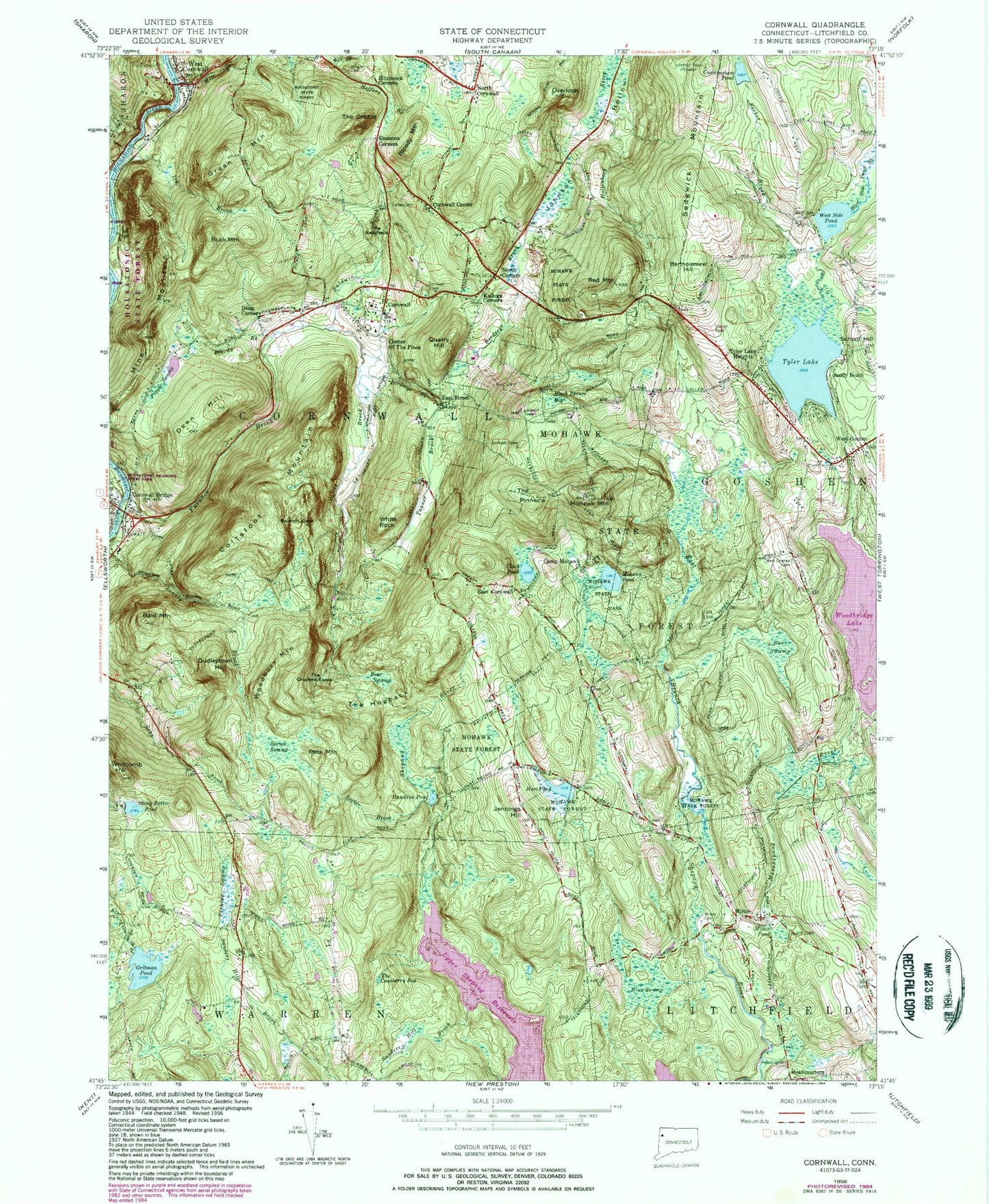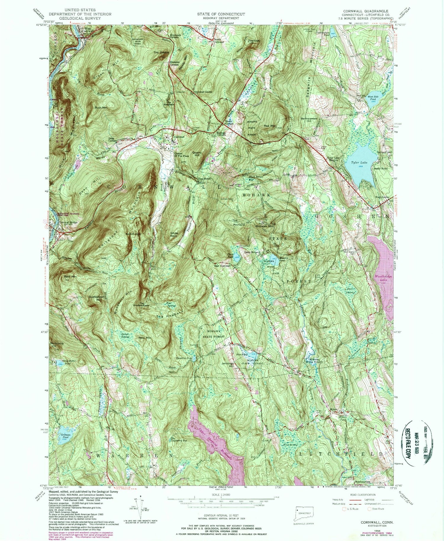
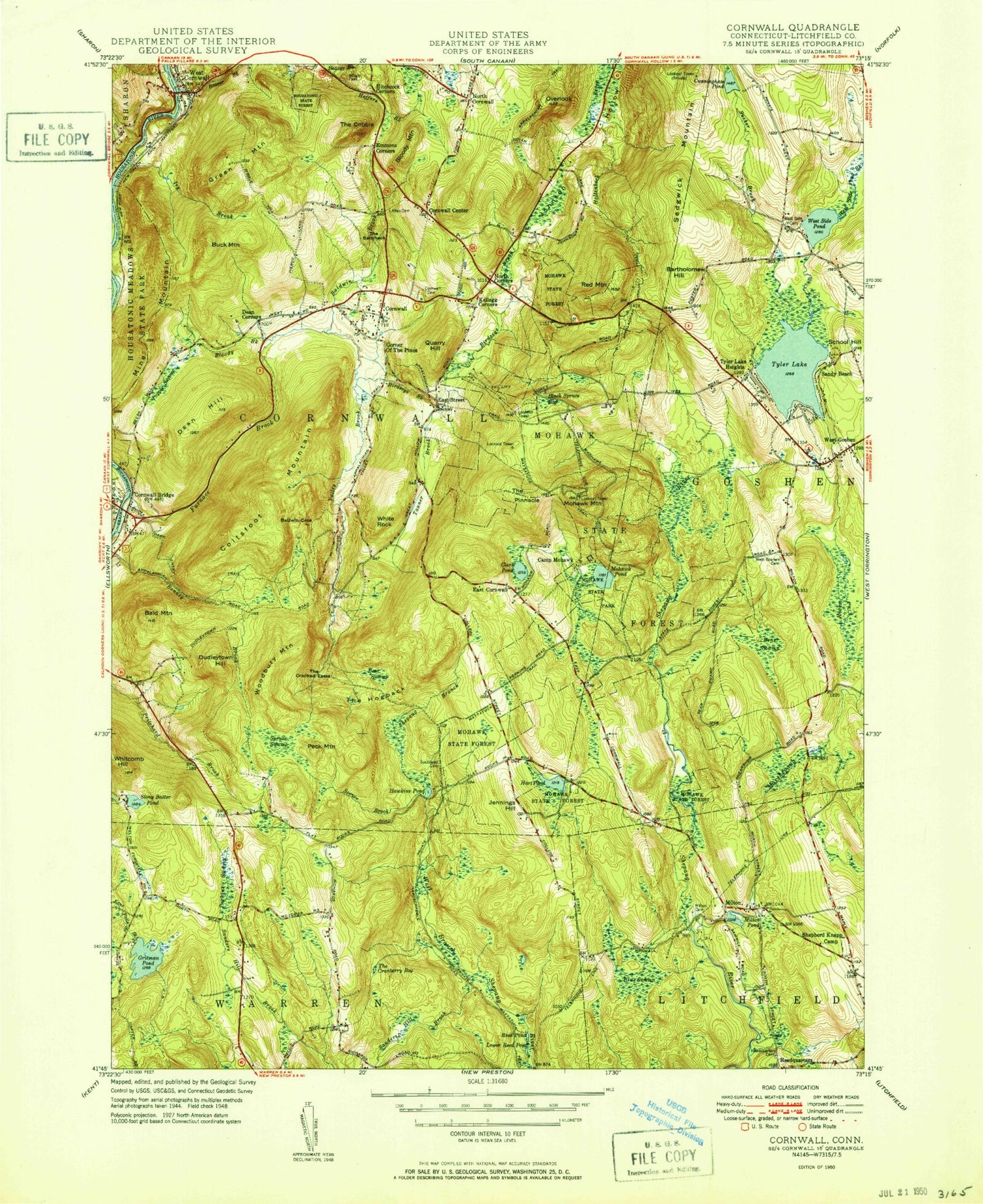
MyTopo
Classic USGS Cornwall Connecticut 7.5'x7.5' Topo Map
Couldn't load pickup availability
Historical USGS topographic quad map of Cornwall in the state of Connecticut. Typical map scale is 1:24,000, but may vary for certain years, if available. Print size: 24" x 27"
This quadrangle is in the following counties: Litchfield.
The map contains contour lines, roads, rivers, towns, and lakes. Printed on high-quality waterproof paper with UV fade-resistant inks, and shipped rolled.
Contains the following named places: Allen Cemetery, Bald Mountain, Baldwin Brook, Bartholomew Hill, Bear Swamp, Bear Swamp, Birdseye Brook, Black Spruce Bog, Bloody Brook, Bloody Mountain, Blue Swamp, Buck Mountain, Camp Mohawk, Carse Brook, Clark Pond, Coltsfoot Mountain, Cornwall, Cornwall Bridge, Cornwall Cemetery, Cornwall Center, Cunningham Pond, Dean Corners, Dean Hill, Dudleytown Hill, East Street, Emmons Corners, Furnace Brook, Green Mountain, Gritman Pond, Hart Pond, Hawkins Pond, Headquarters, Headquarters Cemetery, Heffers Brook, Hitchcock Corners, Housatonic Valley, Ivy Brook, Jennings Hill, Kellogg Corners, Marshepaug River, Mill Brook, Milton Cemetery, Milton Pond, Mine Mountain, Mohawk Mountain, Mohawk Pond, Mohawk State Forest, Mohawk State Park, North Corners, Overlook, Peck Mountain, Perkins Swamp, Pine Swamp Brook, Popple Swamp, Quarry Hill, Red Mountain, Sanders Hill Brook, Sandy Beach, School Hill, Sedgwick Mountain, Southeast Cemetery, Spruce Brook, Spruce Swamp, Stony Batter Pond, Sucker Brook, Tanner Brook, The Ballyhack, The Cobble, The Cranberry Bog, The Crooked Esses, The Hogback, The Pinnacle, Tyler Lake Heights, Upper Shepaug Reservoir, Valley Brook, West Cornwall, West Goshen, West Goshen Cemetery, West Side Cemetery, West Side Pond, West Side Pond Brook, White Rock, Woodridge Lake, Woodbury Mountain, Wright Cemetery, Corner of the Pines, East Cornwall, Milton, Tyler Lake, Wings Ago Airstrip, Ripley Field Airport (historical), North Cornwall, Town of Cornwall, Tyler Lake Dam, Woodridge Lake Dam, Gritman Pond Dam, Nash Pond Dam, Nash Pond, Goose Pond, Base Lodge, Black Spruce Bog, Brick Schoolhouse, Calhaoun Memorial Library, Cornwall Bridge Post Office, Cornwall Bridge Pottery, Cornwall Post Office, Cornwall Town Hall, Foreign Mission School (historical), Housatonic Boy Scout Reservation, Marvelwood School, Milton Center Historic District, Milton Hill, Mohawk Mountain Ski Area, Mohawk Tower, North Cornwall Meeting House, Pine Lodge, Red Mountain Shelter (historical), Cornwall Volunteer Fire Department Cornwall Bridge Firehouse, Cornwall Census Designated Place, West Cornwall Census Designated Place