MyTopo
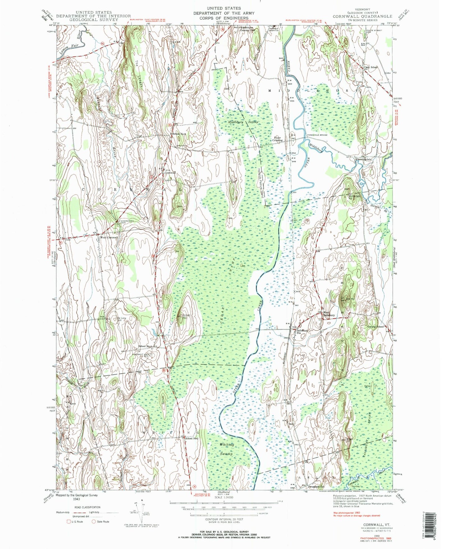
Classic USGS Cornwall Vermont 7.5'x7.5' Topo Map
Couldn't load pickup availability
Historical USGS topographic quad map of Cornwall in the state of Vermont. Map scale may vary for some years, but is generally around 1:24,000. Print size is approximately 24" x 27"
This quadrangle is in the following counties: Addison.
The map contains contour lines, roads, rivers, towns, and lakes. Printed on high-quality waterproof paper with UV fade-resistant inks, and shipped rolled.
Contains the following named places: Beaver Brook, Bingham Memorial School, Bond Island, Cady School, Cedar Swamp, Central Cemetery, Central School, Cornwall, Cornwall Congregational Church, Cornwall Fire Department - West Station, Cornwall Swamp Wildlife Management Area, Cornwall Volunteer Fire Department, De Long Hill, Dyer Hill, Evergreen Cemetery, Farmingdale, Foote Street Cemetery, Halnon Brook, Helen Porter Healthcare and Rehabilitation Center, Hollands Pasture Island, Huntley Island, Jerusalem School, Middlebury Country Club, Middlebury River, Middlebury Swamp, Middlebury Union Middle School, Old South Cemetery, Piper Crossing, Pleasant View Cemetery, Porter Medical Center, Porter Medical Center Medical Library and Information Service, Salisbury Station, Salisbury Swamp, School Number 1, School Number 2, School Number 4, Scove Hill, Seeley Cemetery, Seymour Brook, Station Covered Bridge, The Ledge, Threemile Bridge, Town of Cornwall, Wainwright Hill, West Cemetery, West Cornwall, West Salisbury, West Salisbury Cemetery, WFAD-AM (Middlebury), Whiting Swamp, ZIP Codes: 05753, 05778