MyTopo
Classic USGS Cowen Hill New Hampshire 7.5'x7.5' Topo Map
Couldn't load pickup availability
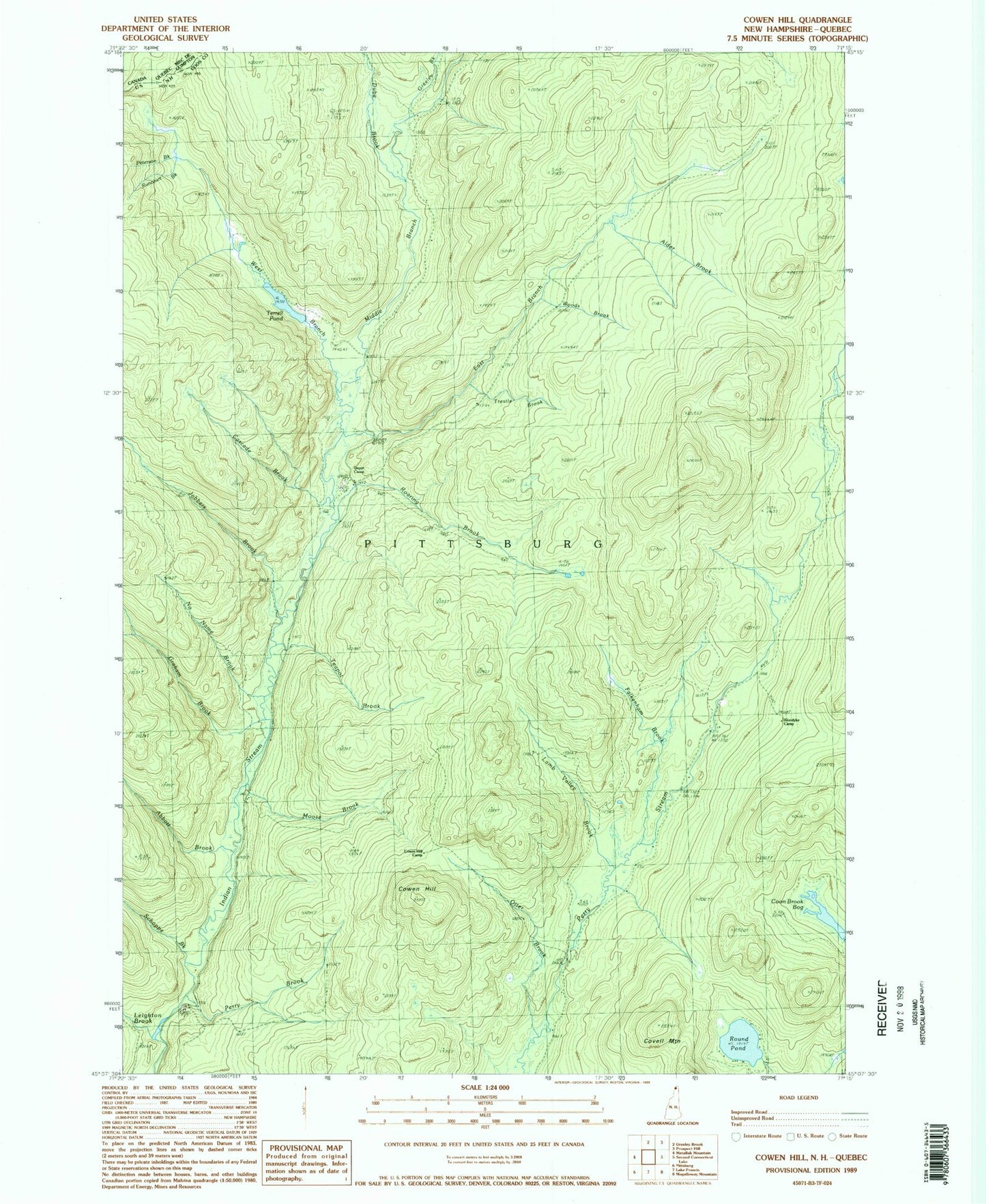
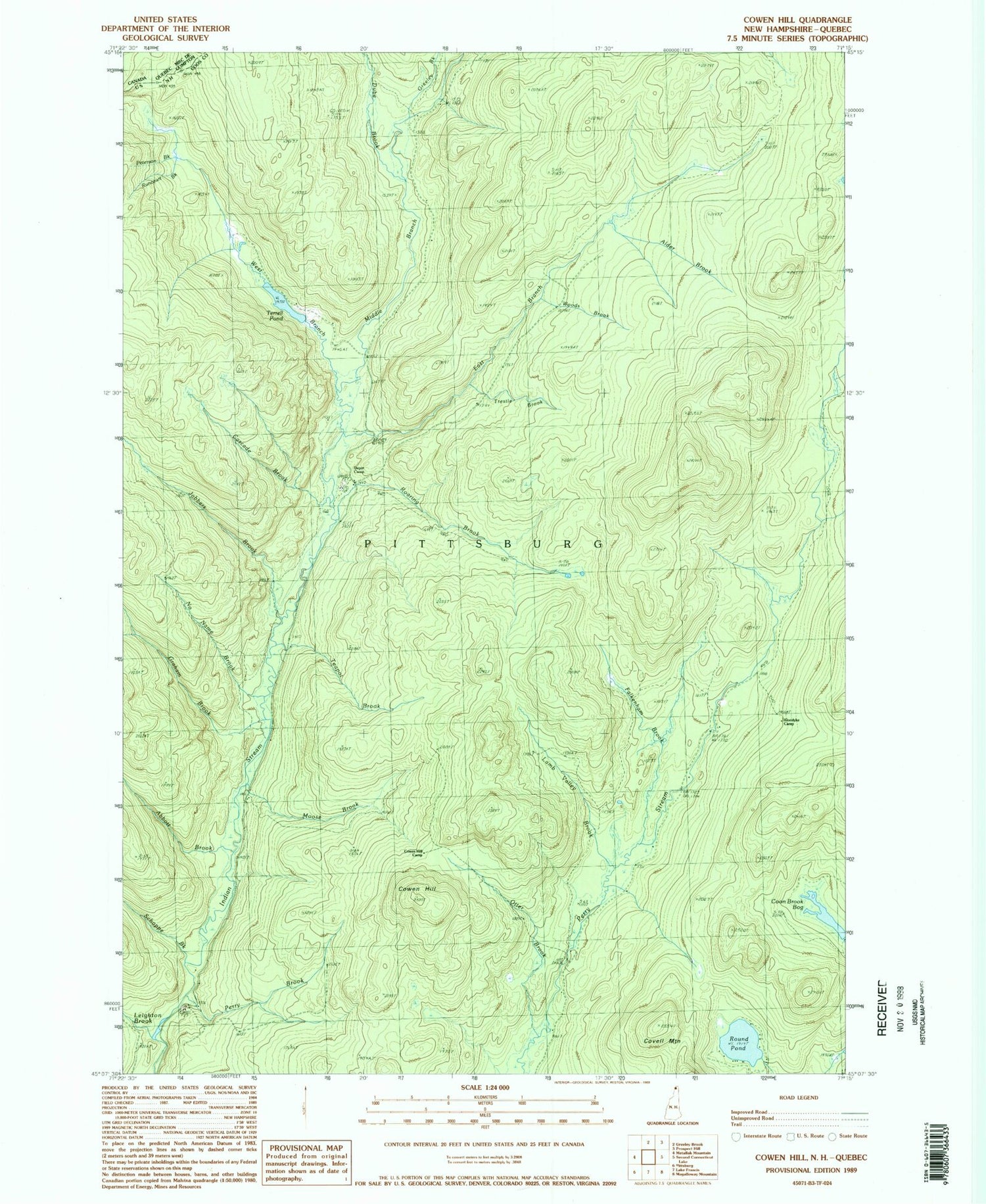
Historical USGS topographic quad map of Cowen Hill in the state of New Hampshire. Typical map scale is 1:24,000, but may vary for certain years, if available. Print size: 24" x 27"
This quadrangle is in the following counties: Coos.
The map contains contour lines, roads, rivers, towns, and lakes. Printed on high-quality waterproof paper with UV fade-resistant inks, and shipped rolled.
Contains the following named places: Abbott Brook, Alder Brook, Cascade Brook, Cowen Hill, Cowen Hill Camp, Day Brook, Depot Camp, Dube Brook, East Branch Indian Stream, Graham Brook, Greeley Brook, Holden Camp, Jobbers Brook, Lamb Valley, Leighton Brook, Middle Branch Indian Stream, Moose Brook, Otter Brook, Perry Brook, Roaring Brook, Round Pond, Schoppe Brook, Teapot Brook, Trestle Brook, West Branch Indian Stream, Covell Mountain, Coon Brook Bog, Lamb Valley Brook, Falkenham Brook, No Name Brook, Woods Brook, Terrell Pond, Runcourt Brook, Peterson Brook, Town of Pittsburg, Falkenham Camp (historical), Klondyke Camp (historical), Varney Camp (historical), Coon Brook Bog, Pearley Terrill Dam, West Branch of Indian Stream Reservoir