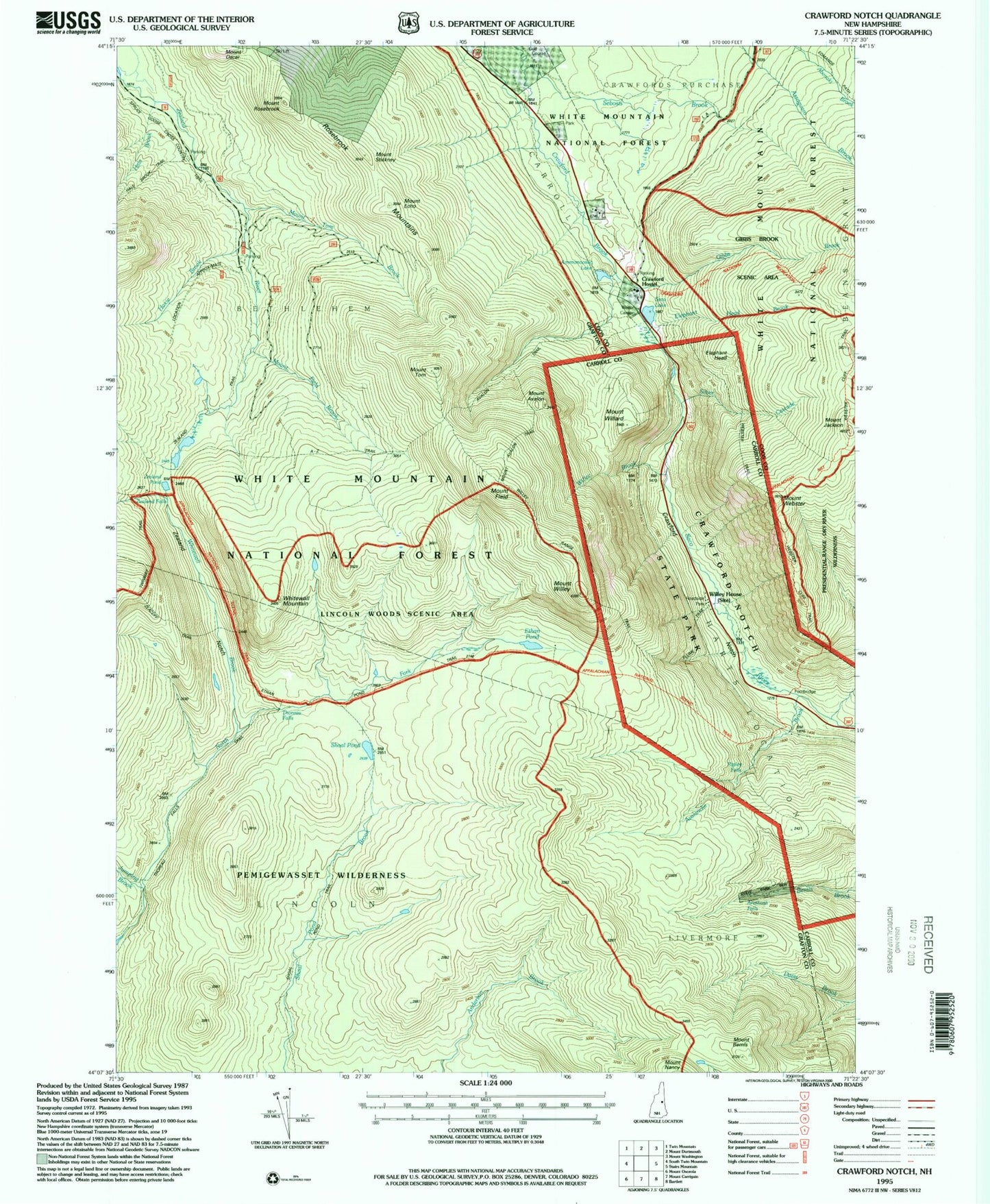
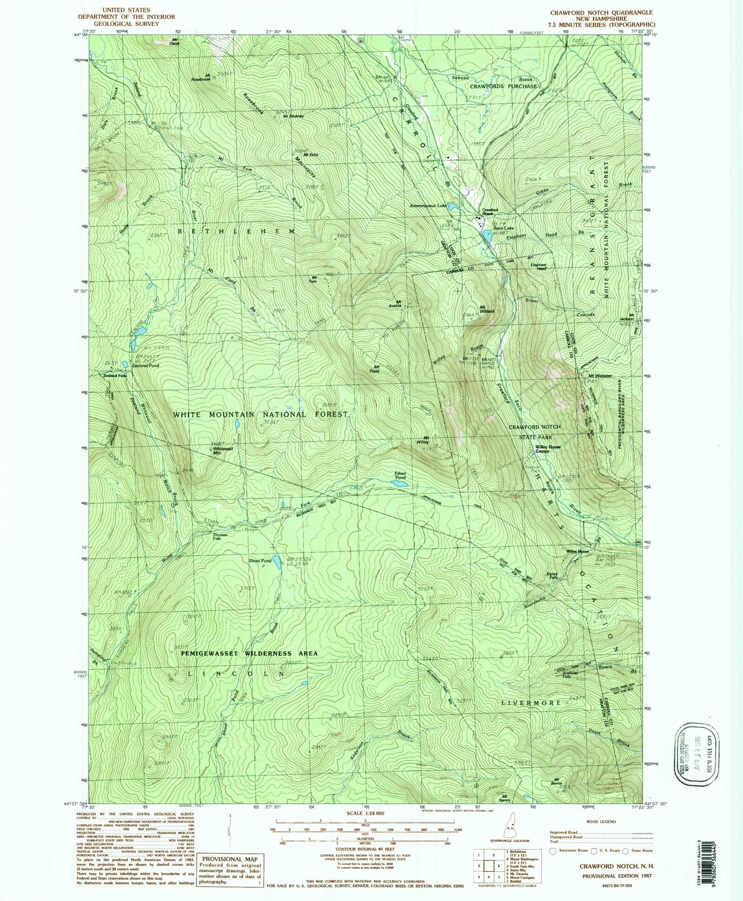
MyTopo
Classic USGS Crawford Notch New Hampshire 7.5'x7.5' Topo Map
Couldn't load pickup availability
Historical USGS topographic quad map of Crawford Notch in the state of New Hampshire. Typical map scale is 1:24,000, but may vary for certain years, if available. Print size: 24" x 27"
This quadrangle is in the following counties: Carroll, Coos, Grafton.
The map contains contour lines, roads, rivers, towns, and lakes. Printed on high-quality waterproof paper with UV fade-resistant inks, and shipped rolled.
Contains the following named places: A-Z Trail, Ammonoosuc Lake, Arethusa Falls, Avalanche Brook, Mount Avalon, Beans Grant, Mount Bemis, Crawford Brook, Crawford House, Crawford Notch, Crawford Notch State Reservation, Mount Echo, Elephant Head, Elephant Head Brook, Ethan Pond, Ethan Pond Trail, Flume Cascade, Gibbs Brook, Hale Brook, Havie Brook, Mount Jackson, Jumping Brook, Kedron Brook, Mount Avalon Trail, Mount Field Brook, Mount Rosebrook Trail, Mount Tom Brook, Mount Webster Trail, Ripley Falls, Rosebrook Mountains, Mount Rosebrook, Saco Lake, Shoal Pond, Shoal Pond Trail, Silver Cascade, Mount Stickney, Stillwater By-Pass, Thoreau Falls, Thoreau Falls Trail, Tisdale Spring, Mount Tom, Webster Brook, Webster Cliff Trail, Mount Webster, Whitewall Brook, Whitewall Mount, Wiley Range Trail, Mount Willard, Willey House, Willey House Camps, Mount Willey, Zealand Falls, Zealand Notch, Zealand Trail, Zealand Valley Trail, Gibbs Brook Scenic Area, Zealand Pond, Mount Field, Zeacliff Trail, Willey Brook, Webster Trail, Ethan Pond Shelter, Lincoln Woods Scenic Area, Avalon Trail, White Mountain National Forest