
MyTopo
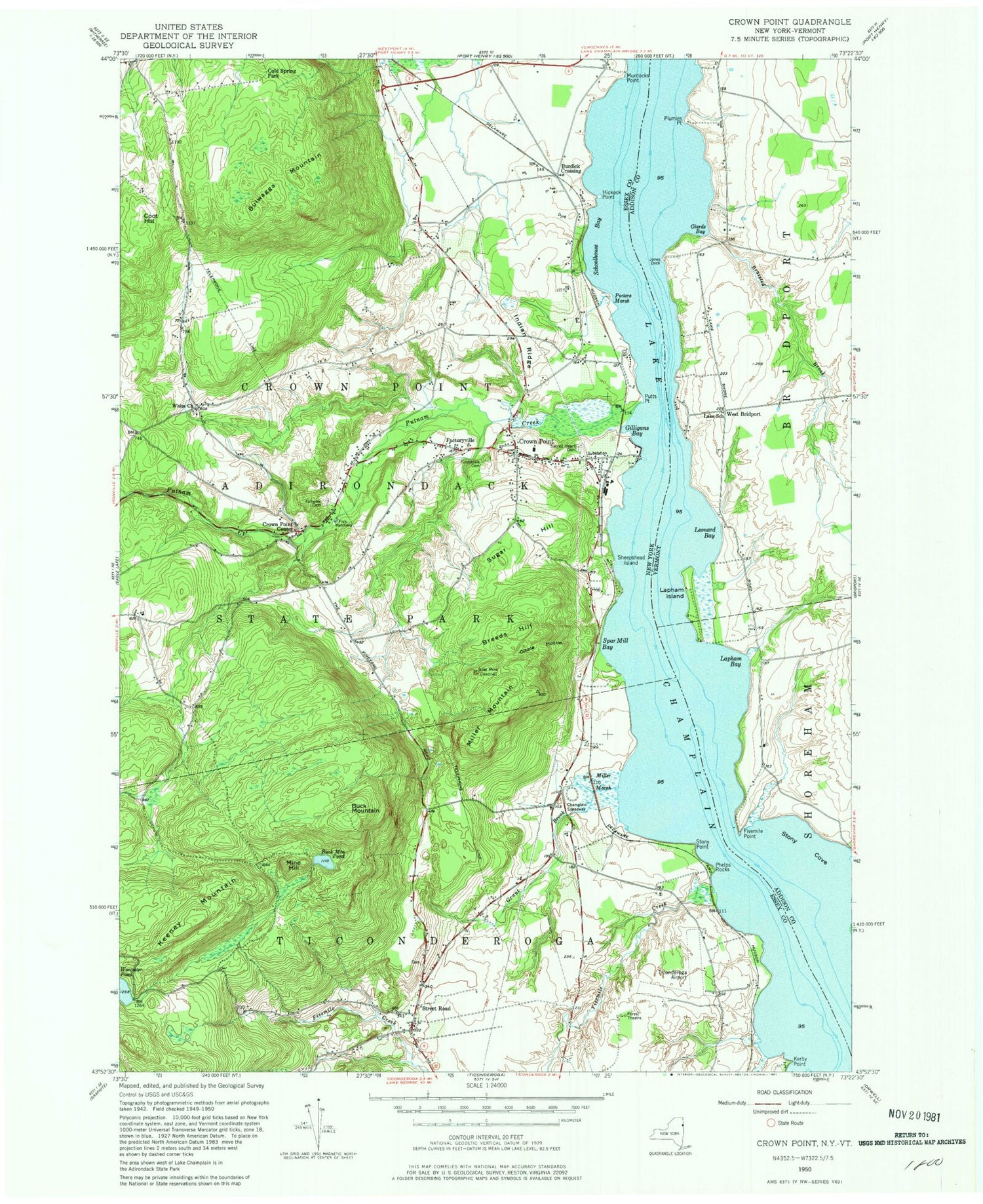
Classic USGS Crown Point New York 7.5'x7.5' Topo Map
Couldn't load pickup availability
Historical USGS topographic quad map of Crown Point in the states of New York, Vermont. Map scale may vary for some years, but is generally around 1:24,000. Print size is approximately 24" x 27"
This quadrangle is in the following counties: Addison, Essex.
The map contains contour lines, roads, rivers, towns, and lakes. Printed on high-quality waterproof paper with UV fade-resistant inks, and shipped rolled.
Contains the following named places: Bliss Cemetery, Braisted Brook, Breeds Hill, Buck Mountain, Buck Mountain Pond, Bulwagga Mountain, Burdick Crossing, Champlain Speedway, Cold Spring Park, Coot Hill, Crown Point, Crown Point Bible Church, Crown Point Center, Crown Point Central School, Crown Point Fire Department, Crown Point Post Office, Dibble Hollow, Factoryville, Fairview Cemetery, First Congregational Church, Fivemile Creek, Fivemile Point, Fivemile Point Light, Forestdale Cemetery, Giards Bay, Gilligans Bay, Grant Brook, Hammond Library of Crown Point, Hickock Point, Indian Ridge, Jones Dock, Keeney Mountain, Kerby Point, Lake School, Lapham Bay, Lapham Island, Leonard Bay, Manning Personal Airstrip, Miller Marsh, Miller Mountain, Mine Hill, Moniter Bay Park, Murdocks Point, Phelps Brook, Phelps Rocks, Plumies Point, Porters Marsh, Putnam Creek, Putts Point, Russell Cemetery, Sacred Heart Cemetery, Sacred Heart Church, Schoolhouse Bay, Sheepshead Island, Skyline Drive-In, Spar Mill Bay, Spar Mine, Stony Cove, Stony Point, Street Road, Sugar Hill, Ticonderoga Municipal Airport, Wells Cemetery, West Bridport, White Church, Worcester Pond


