MyTopo
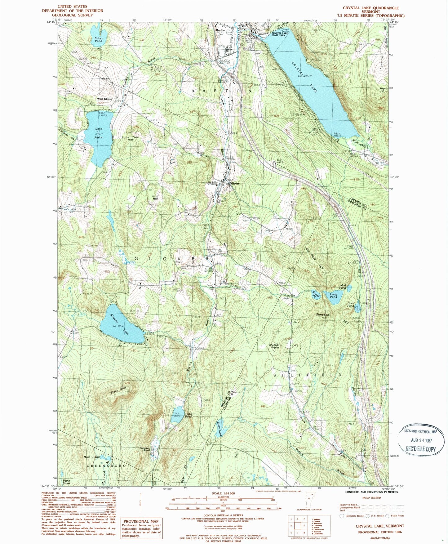
Classic USGS Crystal Lake Vermont 7.5'x7.5' Topo Map
Couldn't load pickup availability
Historical USGS topographic quad map of Crystal Lake in the state of Vermont. Typical map scale is 1:24,000, but may vary for certain years, if available. Print size: 24" x 27"
This quadrangle is in the following counties: Caledonia, Orleans.
The map contains contour lines, roads, rivers, towns, and lakes. Printed on high-quality waterproof paper with UV fade-resistant inks, and shipped rolled.
Contains the following named places: Willoughby Brook, Baker Pond, Barton, Bickford School, Big Rock Hill, Black Hills, Bruce Pond, Clarks Pond, Crystal Lake, Duck Pond, Glover, Heights School, Lone Tree Hill, Long Pond, May Hill, May Pond Brook, Mud Pond, Mud Pond, Nation Brook, Parish School, Lake Parker, Roaring Brook, Round Pond, Runaway Pond, Shadow Lake, Sheffield Heights, Simpson Hill, Stevens Brook, Still Hill, Trout Brook, West Glover, West Look Cemetery, Town of Glover, Town of Sheffield, Crystal Lake Dam, Shadow Lake Dam, Sheffield Heights - Cass Cemetery, Cemetery Hill, Crystal Lake State Park, Dexter Hill, Federated Church, French Cemetery, Glover Community School, Glover Post Office, Glover Public Library, Roaring Brook Park, Solid Rock Assembly of God Church, South Barton - Willoughby Cemetery, Welcome O Brown Cemetery, West Glover Cemetery, West Glover Post Office, Barton Academy (historical), Barton Baptist Church, Barton Graded School, Barton Public Library, Bread and Puppet Museum, Glover Volunteer Fire Department, Barton Fire Department Station 2, Village of Barton, Saint Pauls Catholic School, Glover Ambulance, Glover Census Designated Place