
MyTopo
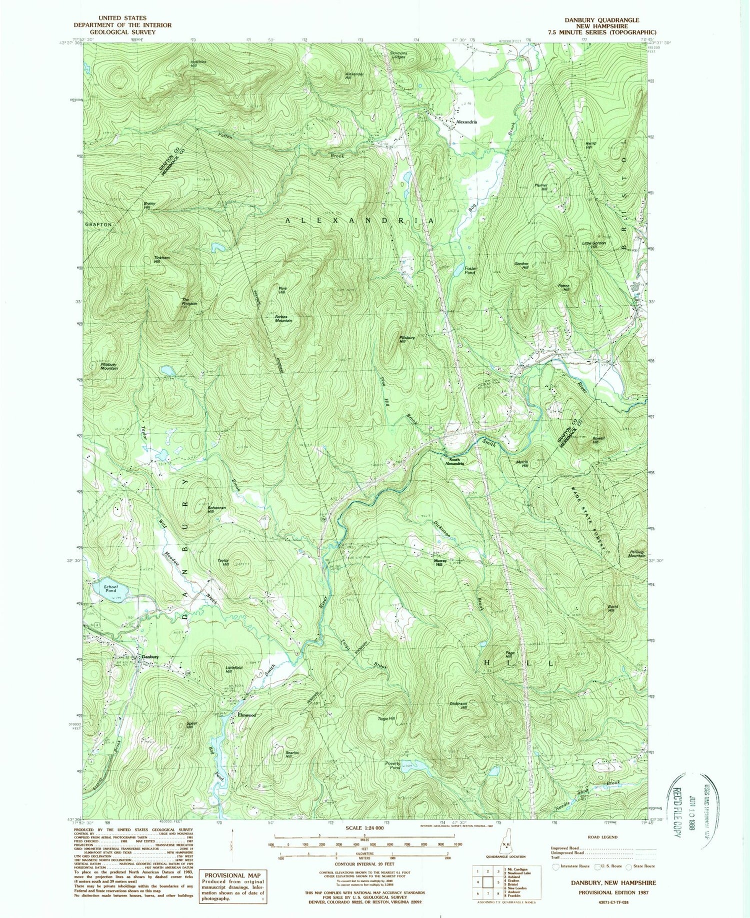
Classic USGS Danbury New Hampshire 7.5'x7.5' Topo Map
Couldn't load pickup availability
Historical USGS topographic quad map of Danbury in the state of New Hampshire. Typical map scale is 1:24,000, but may vary for certain years, if available. Print size: 24" x 27"
This quadrangle is in the following counties: Grafton, Merrimack.
The map contains contour lines, roads, rivers, towns, and lakes. Printed on high-quality waterproof paper with UV fade-resistant inks, and shipped rolled.
Contains the following named places: Alexander Hill, Alexandria Mica Mine, Bog Pond, Bohannan Hill, Braley Hill, Burns Hill Cemetery, Burnt Hill, Center School, Crawford Cemetery, Danbury, Dickinson Brook, Dickinson Hill, Elmwood, Elmwood School, Forbes Mountain, Foster Pond, Fowler River, Gordon Hill, Hemp Hill, Hutchins Hill, Little Gordon Hill, Littlefield Hill, Merrill Hill, Murray Hill, Page Hill, Pattee Hill, Patten Brook, Pillsbury Hill, Pillsbury Mountain, Pine Hill, Pine Hill Brook, Plumer Hill, Poverty Pond, Riverside Cemetery, Rowell Hill, Saint Pauls School Camp, School Pond, Searles Hill, Simmons Ledges, Spear Hill, Taylor Brook, Taylor Hill, The Pinnacle, Tinkham Hill, Tioga Brook, Tioga Hill, Alexandria Village School, Wild Meadow Brook, Willow School, South Alexandria, Newfound Valley Airport, Town of Alexandria, Town of Danbury, Town of Hill, Bog Pond Dam, Benton Pond Hydro Dam, Benton Pond, Cardigan Camp, Danbury Bog Wildlife Management Area, Danbury Christian Church, Danbury Elementary School, Danbury Post Office, Murray Hill Summer Home District, Wade State Forest, Alexandria, Alexandria Volunteer Fire Department, Danbury Volunteer Fire Department, Cardigan Mountain Orchard, Alexandria Police Department, Danbury Police Dept


