
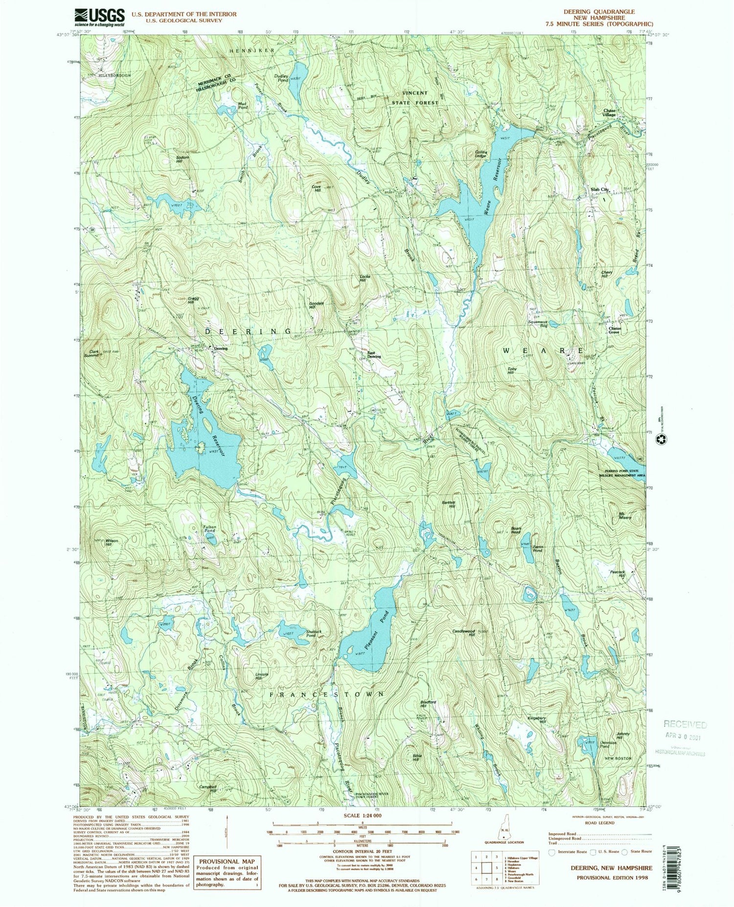
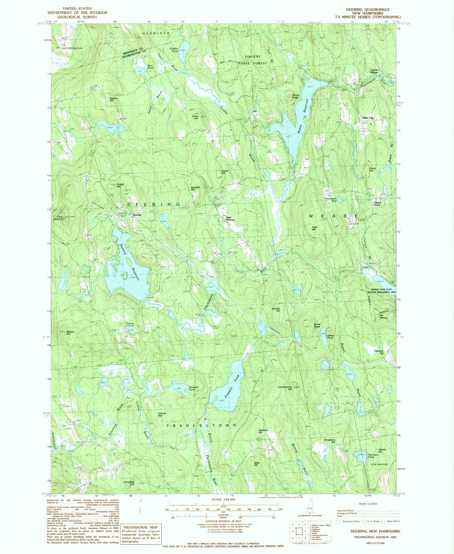
MyTopo
Classic USGS Deering New Hampshire 7.5'x7.5' Topo Map
Couldn't load pickup availability
Historical USGS topographic quad map of Deering in the state of New Hampshire. Typical map scale is 1:24,000, but may vary for certain years, if available. Print size: 24" x 27"
This quadrangle is in the following counties: Hillsborough, Merrimack.
The map contains contour lines, roads, rivers, towns, and lakes. Printed on high-quality waterproof paper with UV fade-resistant inks, and shipped rolled.
Contains the following named places: Bartlett Cemetery, Bartlett Hill, Bible Hill, Boars Head, Bradford Hill, Campbell Hill, Candlewood Hill, Chase Village, Chevy Hill, Clark Summit, Clinton Grove, Collins Brook, Collins Ledge, Corliss Cemetery, Cove Hill, Deering, Deering Community Center, Deering Reservoir, Dennison Pond, Dinsmore Brook, Dow Cemetery, Dudley Brook, Dudley Pond, East Deering, Fulton Pond, Goodale Cemetery, Goodale Hill, Gregg Hill, Johnny Hill, Kingsbury Hill, Lincoln Hill, Locke Hill, Mount Misery, Mud Pond, Patten Brook, Peacock Hill, Pleasant Pond, Shattuck Pond, Slab City, Smith Brook, Sodom Hill, South Quaker Cemetery, Squamscot Bog, Toby Hill, Vincent State Forest, Weare Reservoir, Wilson Hill, Town of Deering, Weare Reservoir Dam, Pleasant Pond Dam, Deering Reservoir Dam, Dudley Pond Dam, All Seasons Campground, Deering Community Church, Deering Reserve, Ferrin Pond, Perkins Pond State Wildlife Management Area, Weare Congregational Church, Deering Fire and Rescue Donovan Station, Charmingfare Farm, Deering Police Department


