MyTopo
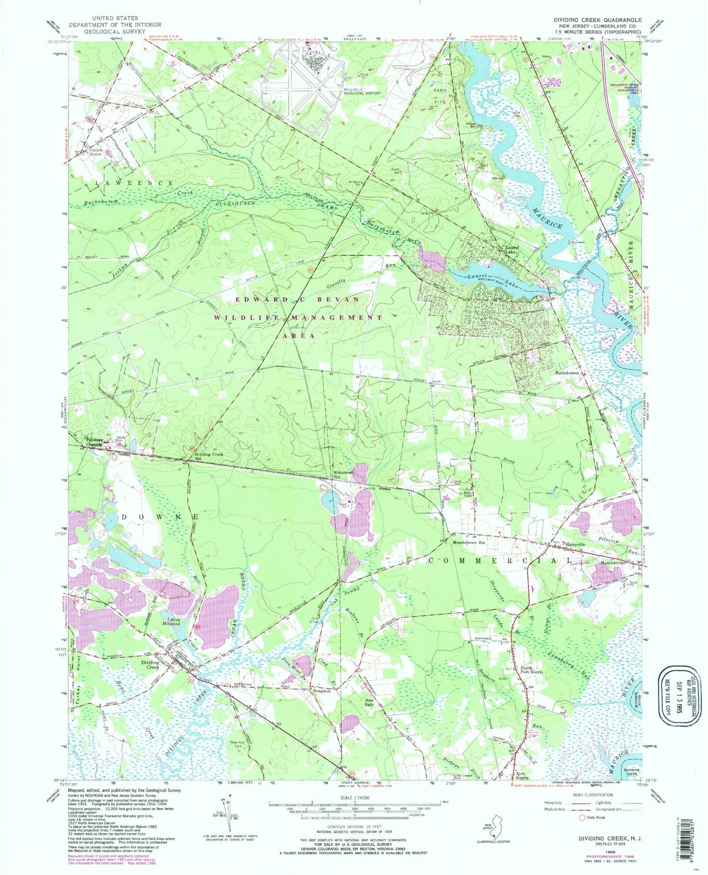
Classic USGS Dividing Creek New Jersey 7.5'x7.5' Topo Map
Couldn't load pickup availability
Historical USGS topographic quad map of Dividing Creek in the state of New Jersey. Map scale may vary for some years, but is generally around 1:24,000. Print size is approximately 24" x 27"
This quadrangle is in the following counties: Cumberland.
The map contains contour lines, roads, rivers, towns, and lakes. Printed on high-quality waterproof paper with UV fade-resistant inks, and shipped rolled.
Contains the following named places: Baileytown, Beaver Dam, Beaver Lake, Buckshutem, Buckshutem Creek, Buckshutem Swamp, Cedar Creek, Centre Grove, Clarks Mill, Clay Branch, Cranberry Gut, Creative Achievement Academy Downe Academy, Cub Swamp, Dividing Creek, Dividing Creek Census Designated Place, Dividing Creek Fire Company, Dividing Creek Post Office, Dividing Creek Station, Dragston, Edward G Bevan Fish and Wildlife Management Area, Gravelly Run, Haleys Branch, Haleyville, Haleyville Mauricetown Elementary School, Iron Mine Branch, Joshua Branch, Ladow Millpond, Lands Branch, Laurel Lake, Laurel Lake Census Designated Place, Laurel Lake Dam, Laurel Lake Volunteer Fire Company, Laurel Lakes Volunteer Rescue Squad, Lores Mill, Maple Creek, Mauricetown Census Designated Place, Mauricetown Station, Menantico Creek, Menantico Ponds Fish and Wildlife Management Area, Mill Creek, Millville Army Air Field, Millville Municipal Airport, New Italy, New Jersey State Police Troop A Port Norris Station, North Port Norris, Owls Nest Field, Paynters Crossing, Pine Branch, Port Norris Census Designated Place, Reubens Branch, Sheppards Branch, Steep Run, Toms Bridge, Township of Commercial, Whitehead Station, ZIP Codes: 08329, 08349