MyTopo
Classic USGS Dover East New Hampshire 7.5'x7.5' Topo Map
Couldn't load pickup availability
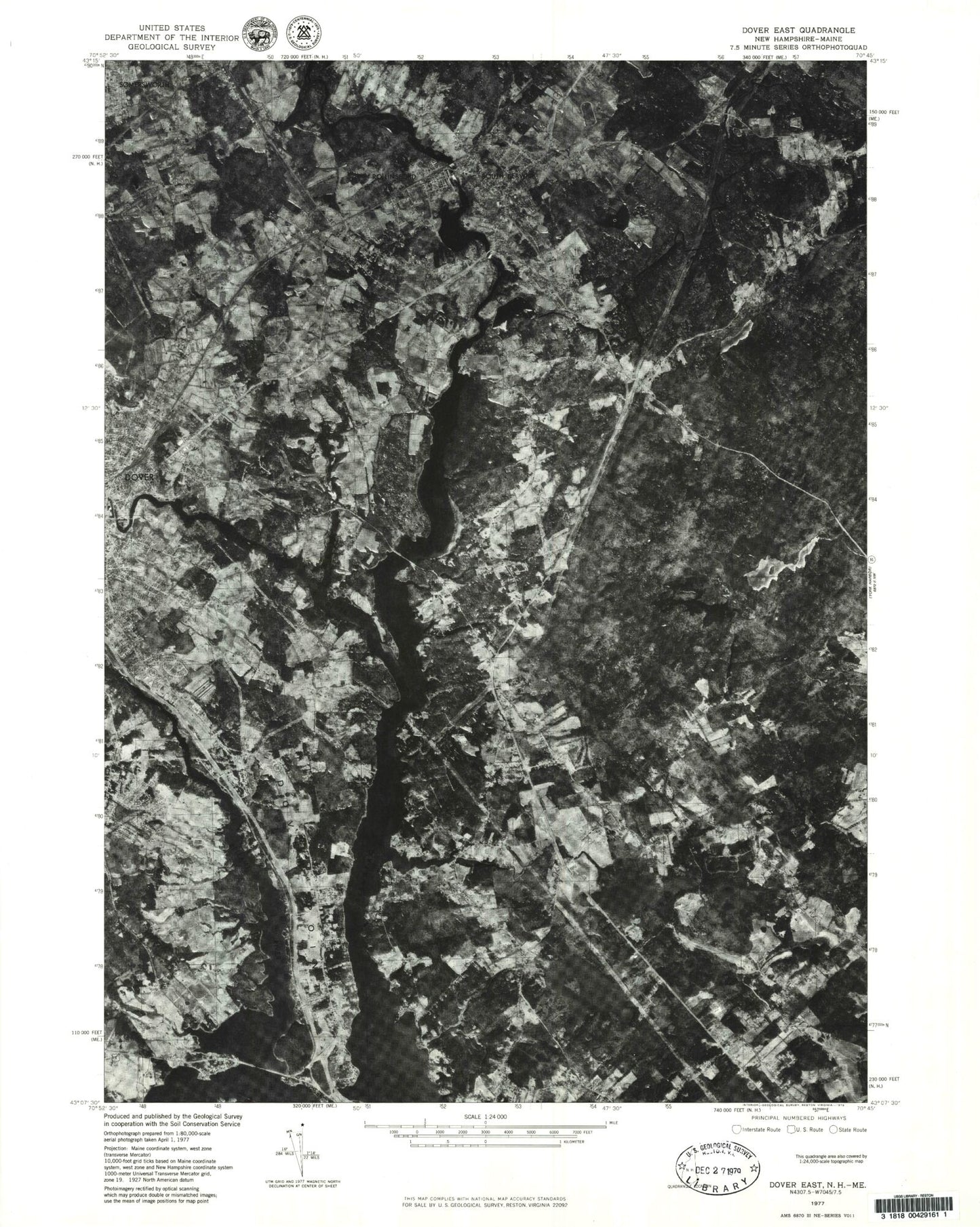
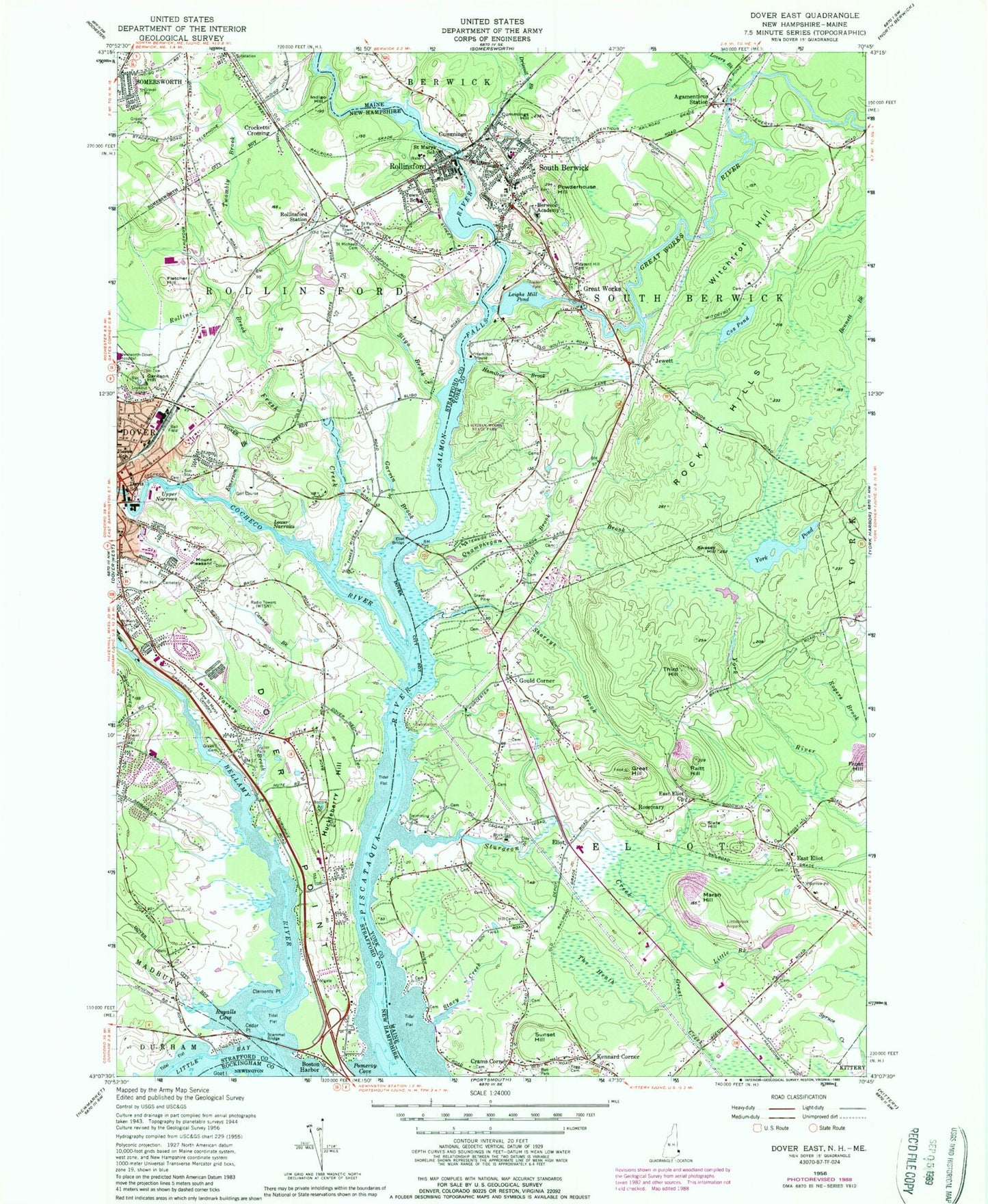
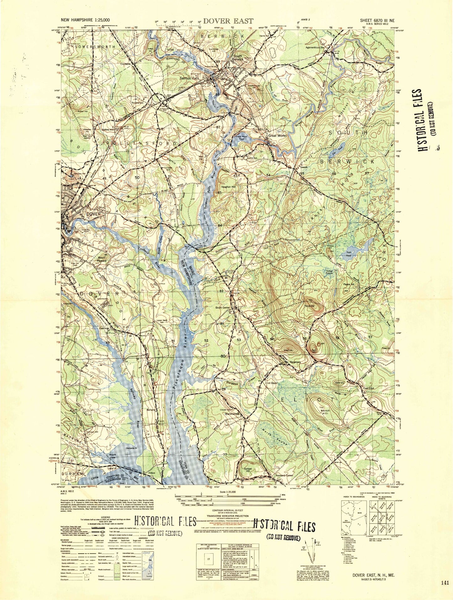
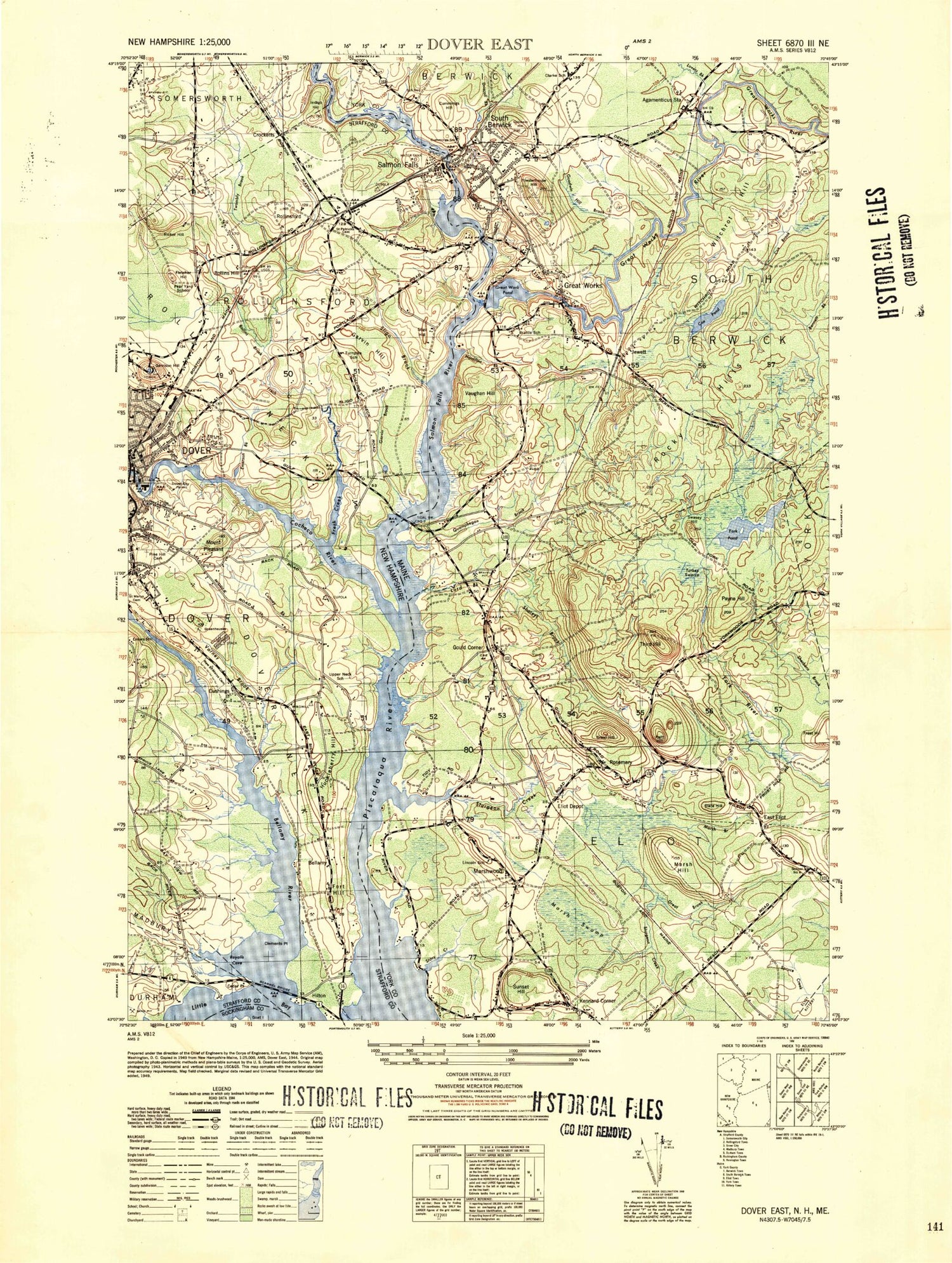
Historical USGS topographic quad map of Dover East in the states of New Hampshire, Maine. Typical map scale is 1:24,000, but may vary for certain years, if available. Print size: 24" x 27"
This quadrangle is in the following counties: Rockingham, Strafford, York.
The map contains contour lines, roads, rivers, towns, and lakes. Printed on high-quality waterproof paper with UV fade-resistant inks, and shipped rolled.
Contains the following named places: Bellamy River, Boston Harbor, Canney Brook, Cedar Point, Clements Point, Cocheco River, Crocketts Crossing, Davis School, Dover, Dover Point, Eliot Bridge, Emerson Brook, Fletcher Hill, Fresh Creek, Garrison Hill, Garvin Brook, Greek Cemetery, Huckleberry Hill, Indigo Hill, Lower Narrows, New Saint Marys Cemetery, New Town Cemetery, Old Town Cemetery, Pierce School, Pine Hill Cemetery, Mount Pleasant, Pomeroy Cove, Rollins Brook, Rollinsford, Rollinsford Station, Royalls Cove, Saint Marys Cemetery, Saint Marys School, Saint Michaels Cemetery, Saint Patrick Cemetery, Salmon Falls River, Scammel Bridge, Sligo Brook, Rollinsford Grade School, Twombly Brook, Upper Narrows, Varney Brook, Wentworth - Douglass Hospital, Wentworth-Douglass Heliport, WTSN-AM (Dover), WOKQ-FM (Dover), Town of Rollinsford, Salmon Falls Dam, Salmon Falls River Reservoir, Rollinsford Dam, Salmon Falls River Reservoir, Cocheco River Number 2 Dam, Cocheco River Reservoir, Bellamy Preserve, Bellamy River Access Wildlife Preserve, Butterfield Gymnasium, Cochecho Country Club, Cochecho River Walk and Canoe Launch, Cocheco Burying Ground, Dame Hill Cemetery, Dover Point Cemetery, Fish Ladder Park, Garrison Hill Park, Garrison Hill Tower, Garrison School, Guppey Park, Guppey Pool, Henry Law Park, Heritage Baptist Church, Immigrant Park, Janetos Shopping Plaza Shopping Center, Maglaras Park, Quaker Burying Ground, Rollinsford Post Office, Rollinsford School Library, Saint Josephs Parish Church, Saint Mary Academy, Saint Thomas Aquinas High School, Salmon Falls Mill Historic District, Society of Friends Meeting House, Sunningdale Country Club, Woodman Institute, Portsmouth Christian Academy, Dover Fire and Rescue Department Central Station, Rollinsford Fire Department, Thornwood Orchard, Rollinsford Town Police Department, Odiorne Cemetery, Agamenticus Station, Berwick Academy, Central School, Cox Pond, Crams Corner, Cummings, Cummings Hill, Driscoll Brook, East Eliot Church, Eliot, Fogg Cemetery, Gould Corner, Great Creek, Great Hill, Great Works, Great Works River, Hamilton Brook, Hamilton House, Hill Cemetery, Jewett, Kennard Corner, Leighs Mill Pond, Little Brook, Lord Brook, Lovers Brook, Marsh Hill, Pleasant Hill Cemetery, Portland Station Cemetery, Powderhouse Hill, Quamphegan Brook, Raitt Hill, Rocky Hills, Shoreys Brook, Slate Hill, South Berwick, Sturgeon Creek, Sunset Hill, Swasey Hill, The Heath, Third Hill, Witchtrot Hill, Woodlawn Cemetery, York Pond, Shapleigh Old Mill Pond, East Eliot, Rosemary, Littlebrook Air Park, WSHK-FM (Kittery), Town of Eliot, Great Works Pond Dam, Mill Dam, Stoney Brook, Great Works Dam, Great Works River Reservoir, Little Brook Dam, Little Brook, Eliot Baptist Church, Eliot Commons Shopping Center, Eliot Post Office, Eliot Town Hall, First Congregational Church, Free Baptist Church, Frost Tufts Park and Ballpark, Marshwood High School, Marshwood Middle School, Oldfields, Oldfields Cemetery, Sarah Orne Jewett Memorial, South Berwick Post Office, South Berwick Bible Speaks Church, Vaughan Woods State Park, William Fogg Library, John F Hill Grange, South Eliot Census Designated Place, South Berwick Fire Department, York Ambulance Association - South Berwick Station, South Berwick Police Department, Fernald - Libbey - Remick Lot, Free Baptist Church Cemetery, Goodwin Family Cemetery, Joseph Preble Lot, Shorey Plot, Tombs Lot, Tidewater School, Marshwood Great Works School, Marshwood Middle School, South Berwick Public Library, South Berwick Census Designated Place, Bellamy River, Boston Harbor, Canney Brook, Cedar Point, Clements Point, Cocheco River, Crocketts Crossing, Davis School, Dover, Dover Point, Eliot Bridge, Emerson Brook, Fletcher Hill, Fresh Creek, Garrison Hill, Garvin Brook, Greek Cemetery, Huckleberry Hill, Indigo Hill, Lower Narrows, New Saint Marys Cemetery, New Town Cemetery, Old Town Cemetery, Pierce School, Pine Hill Cemetery, Mount Pleasant, Pomeroy Cove, Rollins Brook, Rollinsford, Rollinsford Station, Royalls Cove, Saint Marys Cemetery, Saint Marys School, Saint Michaels Cemetery, Saint Patrick Cemetery, Salmon Falls River, Scammel Bridge, Sligo Brook, Rollinsford Grade School, Twombly Brook, Upper Narrows, Varney Brook, Wentworth - Douglass Hospital, Wentworth-Douglass Heliport, WTSN-AM (Dover), WOKQ-FM (Dover), Town of Rollinsford, Salmon Falls Dam, Salmon Falls River Reservoir, Rollinsford Dam, Salmon Falls River Reservoir, Cocheco River Number 2 Dam, Cocheco River Reservoir, Bellamy Preserve, Bellamy River Access Wildlife Preserve, Butterfield Gymnasium, Cochecho Country Club, Cochecho River Walk and Canoe Launch, Cocheco Burying Ground, Dame Hill Cemetery