
MyTopo
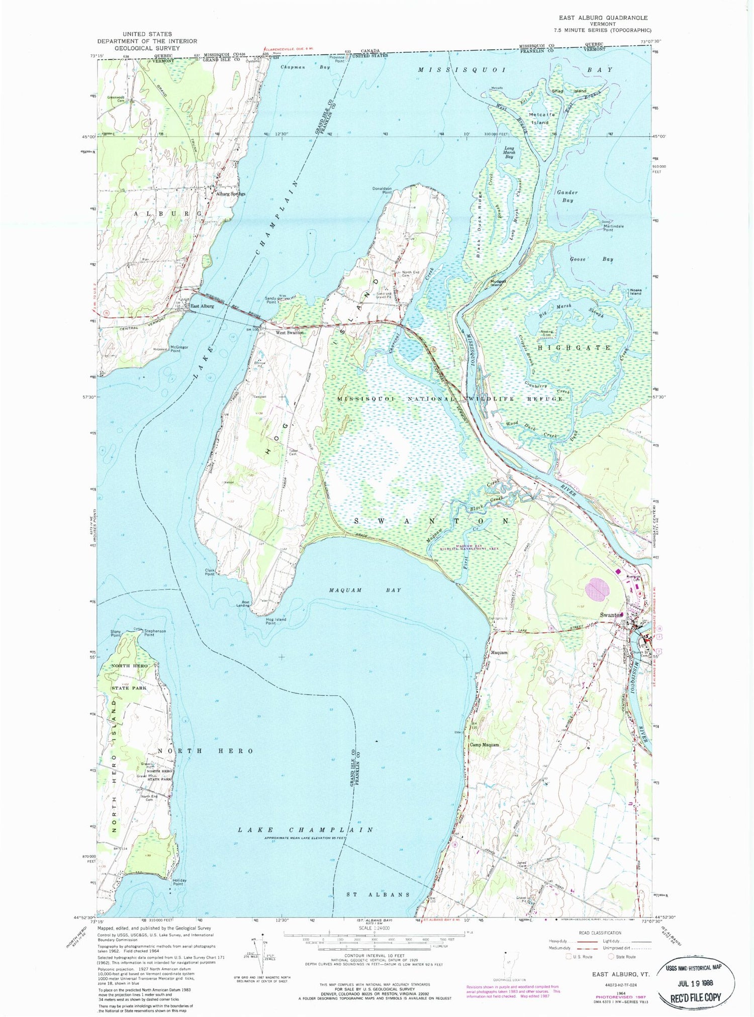
Classic USGS East Alburg Vermont 7.5'x7.5' Topo Map
Couldn't load pickup availability
Historical USGS topographic quad map of East Alburg in the state of Vermont. Map scale may vary for some years, but is generally around 1:24,000. Print size is approximately 24" x 27"
This quadrangle is in the following counties: Franklin, Grand Isle.
The map contains contour lines, roads, rivers, towns, and lakes. Printed on high-quality waterproof paper with UV fade-resistant inks, and shipped rolled.
Contains the following named places: Alburg Springs, Alburg Travel Trailer Park, Alburg-Swanton Ferry, Allens Bay, Big Marsh Slough, Black Creek, Black Duck Ridge, Brush Creek, Camp Maquam, Campbells Bay Campground, Champlain Valley Campground, Charcoal Creek, Clark Point, Cranberry Creek, Cripple Brush Creek, Dead Creek, Donaldson Point, East Alburg, First Creek, Gander Bay, Goose Bay, Hog Island, Hog Island Point, Holiday Point, Janes Cemetery, Lakewood Campground, Long Marsh Bay, Long Marsh Channel, Maquam, Maquam Bay, Maquam Bay Wildlife Management Area, Maquam Creek, Martindale Point, McGregor Point, Missisquoi Bay Bridge, Missisquoi National Wildlife Refuge, Missisquoi River, Mudgett Island, Noaks Island, North End Cemetery, North Hero State Park, Reynolds Cemetery, Riverside Cemetery, Sandy Point, Stephenson Point, Stony Point, Swanton Chamber of Commerce, Swanton Covered Bridge, Swanton Dam, Tabor Cemetery, Town of Swanton, West Swanton, Wood Duck Creek, ZIP Code: 05488


